Category:1926 maps of the United States
Jump to navigation
Jump to search
Other areas: Hawaii
States of the United States: Georgia · Hawaii · Illinois · Massachusetts · Michigan · North Carolina · North Dakota · Pennsylvania · Texas · Wisconsin
Subcategories
This category has the following 12 subcategories, out of 12 total.
G
H
- 1926 maps of Hawaii (5 F)
I
M
- 1926 maps of Massachusetts (5 F)
N
- 1926 maps of North Carolina (empty)
P
T
- 1926 maps of Texas (2 F)
W
Media in category "1926 maps of the United States"
The following 7 files are in this category, out of 7 total.
-
 1926 Canada-Alaska 1903 boundary-map.jpg 448 × 432; 55 KB
-
 1926 Canada-Alaska 1903 boundary-map.png 429 × 418; 433 KB
-
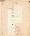 1926 fire insurance map of Henderson, Alabama.jpg 806 × 977; 106 KB
-
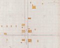 1926 fire insurance map of Whitney, Alabama.jpg 954 × 775; 97 KB
-

-
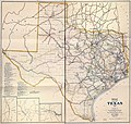 Railroad map of Texas, 1926 LOC 2004629147.jpg 13,189 × 12,582; 27.65 MB
-
 The Commonwealth of Connecticut (20112486154).jpg 2,000 × 1,578; 3.64 MB


_(2).jpg)

.jpg)