Category:1933-1935, boulevard Gouin Est
Jump to navigation
Jump to search
This category is for a Properties in the Répertoire du patrimoine culturel du Québec, with site identifier 108949 |
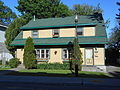
Français : 1933-1935, boulevard Gouin Est
| Object location | | View all coordinates using: OpenStreetMap |
|---|
Media in category "1933-1935, boulevard Gouin Est"
The following 2 files are in this category, out of 2 total.
-
 1933-1935, boulevard Gouin Est - 01.jpg 5,152 × 3,864; 4.23 MB
-
 1933-1935, boulevard Gouin Est - 02.jpg 5,152 × 3,864; 4.28 MB

