Category:1945 maps of the United Kingdom
Jump to navigation
Jump to search
Media in category "1945 maps of the United Kingdom"
The following 13 files are in this category, out of 13 total.
-

-
 20th Century Boyton Map.PNG 538 × 459; 475 KB
-
 A 20th Century map of Lower Hardres.png 473 × 683; 724 KB
-
 Admiralty Chart No 1945 Scotland - west coast - Sanda Island, published 1849.jpg 7,989 × 5,426; 8.55 MB
-
 Canterbury Orchards 1945 OS Map 171 detail.jpg 2,890 × 1,996; 2.7 MB
-
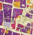 City of London Bomb Damage Map Wood Street and Milk Street.jpg 550 × 587; 368 KB
-
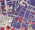 Noble Street and surrounding area Bombing, mapped in 1945.png 2,038 × 1,739; 7.09 MB
-
 Ordnance Survey Map from the 20th century of Ashleyhay, Derbyshire.png 1,102 × 648; 1.44 MB
-
 Ordnance Survey One-Inch Sheet 170 London SW, Published 1945.jpg 8,187 × 9,560; 13.79 MB
-
 Ordnance Survey One-Inch Sheet 173 East Kent, Published 1945.jpg 10,987 × 12,763; 14.79 MB
-
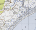
 Ordnance Survey One-Inch Sheet 180 The Solent, Published 1945.jpg 8,163 × 9,570; 10.68 MB
-
 Proposed inner ring road for London shown in 1945.png 624 × 473; 259 KB
-
 Stirlingmap1945.png 1,734 × 1,308; 5.88 MB


