Category:1950 maps
Jump to navigation
Jump to search
| ← · 1950 · 1951 · 1952 · 1953 · 1954 · 1955 · 1956 · 1957 · 1958 · 1959 · → |
Deutsch: Karten mit Bezug zum Jahr 1950
English: Maps related to the year 1950
Español: Mapas relativos al año 1950
Français : Cartes concernant l’an 1950
Русский: Карты 1950 года
Subcategories
This category has the following 8 subcategories, out of 8 total.
Media in category "1950 maps"
The following 43 files are in this category, out of 43 total.
-
 0529121005168j0jg5b4jylwj5snftmefj.jpg 418 × 389; 22 KB
-
 052912100531u4znhzkqf4qzc.jpg 561 × 730; 71 KB
-
 1950 M.T.A. Boston map.jpg 5,398 × 8,928; 87.06 MB
-
 Akershus amt nr 105- Instrument Approach Chart ICAO, 1950.jpg 2,474 × 3,208; 1.2 MB
-
 Messtischblatt 4509 Bochum 193x.jpg 10,336 × 7,960; 15.75 MB
-

-
 Czechoslovakia - DPLA - 5d463bc6cbfd3391b2ae3d58fb6a0797.jpg 4,664 × 3,946; 1.82 MB
-
 Czechoslovakia - DPLA - d2c3a5afef121ad359036a3462ff15a9.jpg 4,648 × 3,952; 1.83 MB
-

-
 Great Smoky Mountains National Park and vicinity. LOC 99446153.jpg 10,664 × 8,510; 17.04 MB
-
 HolyokeWaterPowerMap circa 1950.jpg 5,844 × 4,400; 20.69 MB
-
 Island and anchorages in the Southern Ocean - Maquarie Island - 1950 nautical chart.jpg 5,000 × 7,328; 17.12 MB
-
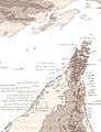
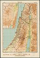
 Israel (FL147408385 3369819).jpg 2,986 × 3,944; 11.65 MB
-
 Mammoth Cave National Park, Kentucky LOC 79691611.jpg 12,811 × 7,167; 13.82 MB
-
 Mammoth Cave National Park, Kentucky LOC 79691611.tif 12,811 × 7,167; 262.69 MB
-
 Maryland and Delaware shaded relief. LOC 76695238.jpg 10,409 × 6,779; 8.4 MB
-
 Maryland and Delaware shaded relief. LOC 76695238.tif 10,409 × 6,779; 201.88 MB
-
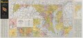 Maryland State Highway Map - 1950.pdf 6,085 × 2,814, 2 pages; 13.09 MB
-
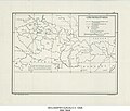
 North Korean Supply Pattern - DPLA - 2792564d66ba9a1b9bfb73cbf4b3ece3.jpg 7,931 × 5,755; 4.99 MB
-
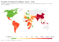 Number of reported smallpox cases, OWID.svg 850 × 600; 140 KB
-

-
 States of Maryland and Delaware - base map with highways and shaded relief LOC map52000758.jpg 10,232 × 6,600; 7.79 MB
-
 States of Maryland and Delaware - base map with highways and shaded relief LOC map52000758.tif 10,232 × 6,600; 193.21 MB
-
 Survey of Israel, Israel (FL37465294 2366881).jpg 11,392 × 14,779; 206.21 MB
-
 Survey of Israel, Israel (FL44250466 2367744).jpg 9,844 × 23,226; 348.5 MB
-
 Survey of Israel, Israel (FL44254733 2367798).jpg 9,974 × 23,046; 348.46 MB
-
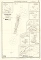
 Survey of Israel, Israel guide map 01 (FL155340665 3585533).jpg 10,259 × 14,796; 170.46 MB
-
 Survey of Israel, Israel guide map 02 (FL155340666 3585533).jpg 14,764 × 10,268; 166.03 MB
-
 Survey of Israel, Motor map (FL44254723 2367912).jpg 11,100 × 15,258; 236.07 MB
-
 Survey of Israel, Tel-Aviv (FL25553465 2367009).jpg 18,776 × 20,508; 518.86 MB
-
 Survey of Israel, Tourist motor map (FL155729540 3793747).jpg 10,004 × 14,446; 176.7 MB
-
 Survey of Israel, ג'מסין אל ערבי, ג'רישה. נפת יפו (FL62986114 4094803).jpg 12,602 × 13,500; 171.62 MB
-
 Survey of Israel, ישראל (FL147391529 2367198).jpg 11,791 × 14,535; 159.54 MB
-
 Survey of Israel, ישראל (FL147392241 2367944).jpg 10,218 × 14,818; 165.53 MB
-
 Survey of Israel, ישראל (FL147555966 2369343).jpg 3,217 × 5,663; 19.35 MB
-
 Survey of Israel, ישראל. גליון דרומי (FL147558654 3938334).jpg 3,470 × 5,445; 17.03 MB
-
 Survey of Israel, סקיה, תל ליטוינסקי. נפת יפו (FL62985922 4094774).jpg 14,960 × 17,760; 261.85 MB
-
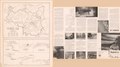
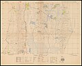 Surveys Departmen of Israel, Es Salihiya (FL50290437 4052606).jpg 19,299 × 15,546; 389.4 MB
-
 Surveys Departmen of Israel, Metulla (FL50290432 4052604).jpg 18,690 × 15,739; 378.88 MB
-
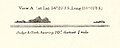 View of Judge and Clerk Islands from 1950 nautical chart (cropped).jpg 1,841 × 733; 187 KB
-
 Washington, D.C., as seen by new Air Force horizon to horizon camera. LOC 87693353.jpg 2,783 × 6,014; 2.06 MB
-
 Washington, D.C., as seen by new Air Force horizon to horizon camera. LOC 87693353.tif 2,783 × 6,014; 47.89 MB
-
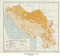 Yugoslavia Agricultural Land Use - DPLA - 4a3f31778d1ef95afe91d843e3e07211.jpg 5,351 × 5,002; 4.05 MB


.svg)


,_Germany_administrative_boundaries_(FL167468818_2569413).jpg)


.jpg)


.jpg)
.jpg)
.jpg)
.jpg)
.jpg)
.jpg)
.jpg)
.jpg)
.jpg)
.jpg)
.jpg)
.jpg)
.jpg)
.jpg)
.jpg)
.jpg)


.jpg)