Category:1950s maps of London
Jump to navigation
Jump to search
Media in category "1950s maps of London"
The following 7 files are in this category, out of 7 total.
-
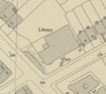 Finchley Road Library, Ordnance Survey, 1953 (TQ2685SW).png 736 × 651; 852 KB
-
 Land Registry map of Kingsway Telephone Exchange, 1 of 3.png 2,000 × 2,800; 3.44 MB
-
 Land Registry map of Kingsway Telephone Exchange, 2 of 3.png 2,000 × 2,800; 3.21 MB
-
 Land Registry map of Kingsway Telephone Exchange, 3 of 3.png 1,252 × 2,800; 1.25 MB
-
 London S.W. OS One-Inch 7th 170.jpg 8,216 × 9,951; 29.06 MB
-
 New Fresh Wharf map 1950s.jpg 797 × 611; 157 KB
-
 Ordnance Survey One-Inch Sheet 161 London NE, Published 1958.jpg 8,337 × 9,958; 11.5 MB
.png)


