Category:1960s maps of Pennsylvania
Jump to navigation
Jump to search
States of the United States: Alabama · Alaska · Arizona · California · Colorado · Delaware · Florida · Georgia · Hawaii · Illinois · Louisiana · Massachusetts · Michigan · Mississippi · Nebraska · New Hampshire · New Jersey · New York · Ohio · Oklahoma · Pennsylvania · Tennessee · Utah · Virginia · West Virginia – Washington, D.C.
Puerto Rico
Puerto Rico
Subcategories
This category has the following 7 subcategories, out of 7 total.
- 1960 maps of Pennsylvania (1 F)
- 1961 maps of Pennsylvania (1 F)
- 1962 maps of Pennsylvania (1 F)
- 1963 maps of Pennsylvania (2 F)
- 1965 maps of Pennsylvania (2 F)
- 1969 maps of Pennsylvania (2 F)
P
- 1960s maps of Philadelphia (6 F)
Media in category "1960s maps of Pennsylvania"
The following 4 files are in this category, out of 4 total.
-
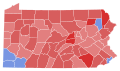 1962 Pennsylvania gubernatorial election results map by county.svg 744 × 443; 288 KB
-
 1966 Pennsylvania gubernatorial election results map by county.svg 810 × 471; 50 KB
-
 Pennsylvania Presidential Election Results 1964.svg 810 × 471; 50 KB
-
 Pennsylvania Presidential Election Results by County, 1964.svg 209 × 122; 40 KB


