Category:1979 maps of Georgia (U.S. state)
Jump to navigation
Jump to search
States of the United States: Delaware · Florida · Georgia · Maine · Maryland · Massachusetts · Mississippi · North Carolina · Ohio · Pennsylvania · South Carolina · Tennessee · Texas · Vermont · Virginia · West Virginia · Wyoming
| 1970 1971 1972 1975 1976 1977 1978 1979 → |
Media in category "1979 maps of Georgia (U.S. state)"
The following 10 files are in this category, out of 10 total.
-

-

-

-
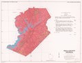
 Hall County, Georgia - soil interpretive map of limitations for shallow excavations LOC 82696071.tif 7,082 × 5,425; 109.92 MB
-

-
-

-
 Hall County, Georgia - soil interpretive map of suitability for crops and pasture LOC 82696070.tif 7,068 × 5,419; 109.58 MB
-

-


