Category:1989 maps of Alabama
Jump to navigation
Jump to search
States of the United States: Alabama · California · Delaware · Georgia · Maine · Ohio · Pennsylvania · South Carolina · Texas · Virginia – Washington, D.C.
| 1980 1981 1984 1985 1986 1987 1989 → |
Media in category "1989 maps of Alabama"
The following 3 files are in this category, out of 3 total.
-
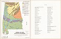 General soil map, state of Alabama LOC 90684182.jpg 5,164 × 3,335; 1.61 MB
-
 General soil map, state of Alabama LOC 90684182.tif 5,164 × 3,335; 49.27 MB
-
 National forests in Alabama LOC 89697203.jpg 10,272 × 6,927; 6.87 MB

