Category:1991 maps
Jump to navigation
Jump to search
| ← · 1990 · 1991 · 1992 · 1993 · 1994 · 1995 · 1996 · 1997 · 1998 · 1999 · → |
Deutsch: Karten mit Bezug zum Jahr 1991
English: Maps related to the year 1991
Español: Mapas relativos al año 1991
Français : Cartes concernant l’an 1991
Русский: Карты 1991 года
Subcategories
This category has the following 8 subcategories, out of 8 total.
Media in category "1991 maps"
The following 200 files are in this category, out of 206 total.
(previous page) (next page)-

-
-
 1984 classified Landsat Thematic Mapper Satellite, Louisiana LOC 92682945.jpg 4,979 × 3,266; 2.26 MB
-
 1991 Republic of Soviet Union (30849143016).jpg 1,212 × 953; 448 KB
-
 Area 4, Oklahoma LOC 92684500.jpg 5,894 × 6,518; 5.17 MB
-
 Area 4, Oklahoma LOC 92684500.tif 5,894 × 6,518; 109.91 MB
-
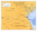
 Bahrain. LOC 91682452.jpg 3,320 × 4,298; 1.42 MB
-
 Bahrain. LOC 91682452.tif 3,320 × 4,298; 40.83 MB
-
 Big South Fork National River and Recreation Area, Kentucky-Tennessee LOC 91684876.jpg 10,017 × 7,062; 9.67 MB
-
 Big South Fork National River and Recreation Area, Kentucky-Tennessee LOC 91684876.tif 10,017 × 7,062; 202.39 MB
-
 Blackwater National Wildlife Refuge, Cambridge, Maryland LOC 95685525.jpg 11,235 × 2,749; 3.87 MB
-
 Blackwater National Wildlife Refuge, Cambridge, Maryland LOC 95685525.tif 11,235 × 2,749; 88.36 MB
-
 Blue Marsh Lake hiking trails LOC 93685460.jpg 4,218 × 5,142; 2.2 MB
-
 Blue Marsh Lake hiking trails LOC 93685460.tif 4,218 × 5,142; 62.05 MB
-
 Brcko - Etnicki sastav po naseljima 1991.gif 3,700 × 2,592; 273 KB
-
 Brotschgrotte topomod.jpg 1,854 × 1,205; 502 KB
-
 Buffalo National River - official map and guide LOC 91684723.jpg 10,039 × 4,744; 6.76 MB
-
 Buffalo National River - official map and guide LOC 91684723.tif 10,039 × 4,744; 136.26 MB
-

-

-
 Burma (Myanma). LOC 91684818.tif 2,009 × 2,801; 16.1 MB
-
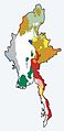 Burma ethnolinguistic map.jpg 209 × 430; 22 KB
-
 C 1991.png 615 × 355; 23 KB
-

-
-

-

-
 Circum-Pacific seismic potential, 1989-1999 LOC 92682192.jpg 10,204 × 7,230; 7.6 MB
-
 Circum-Pacific seismic potential, 1989-1999 LOC 92682192.tif 10,204 × 7,230; 211.07 MB
-
 Clara Barton National Historic Site, Maryland LOC 2012585024.jpg 5,064 × 4,724; 3.03 MB
-
 Clara Barton National Historic Site, Maryland LOC 2012585024.tif 5,064 × 4,724; 68.44 MB
-
 Clara Barton National Historic Site, Maryland LOC 96687605.jpg 5,042 × 4,718; 2.93 MB
-
 Clara Barton National Historic Site, Maryland LOC 96687605.tif 5,042 × 4,718; 68.06 MB
-
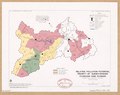
 Cooperative extension districts, Virginia LOC 92681541.tif 4,190 × 3,195; 38.3 MB
-
 Cordell Hull Lake LOC 91684892.jpg 14,452 × 5,412; 9.62 MB
-
 Cordell Hull Lake LOC 91684892.tif 14,452 × 5,412; 223.77 MB
-
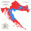
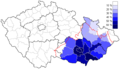
 Croatia-Language-1991.png 1,000 × 990; 517 KB
-
 Croatia-Religion-1991.png 1,000 × 990; 408 KB
-
 Cumberland Island National Seashore, Georgia - official map and guide LOC 92683100.jpg 5,116 × 7,078; 6.41 MB
-
 Cumberland Island National Seashore, Georgia - official map and guide LOC 92683100.tif 5,116 × 7,078; 103.6 MB
-
 Dale Hollow Lake LOC 91684802.jpg 14,321 × 5,448; 12.93 MB
-
 Dale Hollow Lake LOC 91684802.tif 14,321 × 5,448; 223.22 MB
-
 East Branch Clarion River Lake LOC 93686532.jpg 9,692 × 5,500; 4.9 MB
-
 East Branch Clarion River Lake LOC 93686532.tif 9,692 × 5,500; 152.51 MB
-
 Ethnic Groups in the Soviet Union - DPLA - d7a6475bd436c74e2b67e621a6b2afad.jpg 2,558 × 3,276; 3.45 MB
-
 Flowpath, Fishing Creek watershed, Frederick County, Maryland LOC 92683639.jpg 6,768 × 4,956; 2.49 MB
-
 Flowpath, Fishing Creek watershed, Frederick County, Maryland LOC 92683639.tif 6,768 × 4,956; 95.97 MB
-
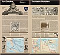 Fort Caroline National Memorial, Florida LOC 2005628140.jpg 5,099 × 4,701; 5.26 MB
-
 Fort Caroline National Memorial, Florida LOC 2005628140.tif 5,099 × 4,701; 68.58 MB
-
 Fort Donelson National Battlefield, Tennessee LOC 91684877.jpg 5,011 × 4,708; 4.03 MB
-
 Fort Donelson National Battlefield, Tennessee LOC 91684877.tif 5,011 × 4,708; 67.5 MB
-
 Fort Jefferson National Monument, Florida LOC 91685098.jpg 10,000 × 4,708; 7.97 MB
-
 Fort Jefferson National Monument, Florida LOC 91685098.tif 10,000 × 4,708; 134.7 MB
-
 Fort Pulaski National Monument, Georgia LOC 91685092.jpg 10,121 × 4,810; 8.48 MB
-
 Fort Pulaski National Monument, Georgia LOC 91685092.tif 10,121 × 4,810; 139.28 MB
-
 Fort Smith LOC 93684433.jpg 5,587 × 5,077; 4.36 MB
-
 Fort Smith LOC 93684433.tif 5,587 × 5,077; 81.15 MB
-
 Fort Washington, Fort Washington Park, Maryland, official map and guide LOC 92683643.jpg 10,052 × 3,558; 5.69 MB
-
 Fort Washington, Fort Washington Park, Maryland, official map and guide LOC 92683643.tif 10,052 × 3,558; 102.32 MB
-
 Fredericksburg and Spotsylvania National Military Park, Virginia LOC 94686130.jpg 13,488 × 6,426; 14.59 MB
-
 Fredericksburg and Spotsylvania National Military Park, Virginia LOC 94686130.tif 13,488 × 6,426; 247.98 MB
-
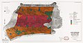
 General soil map, Anderson County, Texas LOC 92682949.tif 7,707 × 11,588; 255.51 MB
-

-

-
 General soil map, Fannin County, Georgia LOC 2012588218.jpg 5,376 × 3,268; 1.87 MB
-
 General soil map, Fannin County, Georgia LOC 2012588218.tif 5,376 × 3,268; 50.26 MB
-
 General soil map, Hardin County, Texas LOC 92682951.tif 7,720 × 11,702; 258.46 MB
-
 General soil map, Lynn County, Texas LOC 92682540.jpg 5,810 × 6,723; 2.74 MB
-
 General soil map, Lynn County, Texas LOC 92682540.tif 5,810 × 6,723; 111.75 MB
-

-
-
 George Washington Birthplace National Monument, Virginia LOC 96680000.jpg 13,457 × 6,392; 14.47 MB
-
 George Washington Birthplace National Monument, Virginia LOC 96680000.tif 13,457 × 6,392; 246.1 MB
-

-
 George Washington Memorial Parkway, Virginia, Maryland, District of Columbia LOC 99464072.tif 6,934 × 9,615; 190.75 MB
-
 Grand Canyon National Park, Arizona LOC 91682960.jpg 6,935 × 4,951; 9.24 MB
-
 Grand Canyon National Park, Arizona LOC 91682960.tif 6,935 × 4,951; 98.23 MB
-
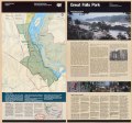
 Great Falls Park, Virginia LOC 95682636.jpg 6,871 × 6,421; 10.57 MB
-
 Great Falls Park, Virginia LOC 95682636.tif 6,871 × 6,421; 126.22 MB
-
 Great Smoky Mountains National Park, North Carolina-Tennessee LOC 93681891.jpg 4,741 × 2,525; 2.97 MB
-
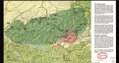 Great Smoky Mountains National Park, North Carolina-Tennessee LOC 93681891.tif 4,741 × 2,525; 34.25 MB
-
 Great Smoky Mountains National Park, North Carolina-Tennessee, trail map LOC 96683865.jpg 7,214 × 10,124; 9.93 MB
-
 Great Smoky Mountains National Park, North Carolina-Tennessee, trail map LOC 96683865.tif 7,214 × 10,124; 208.95 MB
-
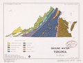 Ground water, Virginia LOC 92681542.tif 3,136 × 2,413; 21.65 MB
-
 Guadalupe Mountains - official map and guide LOC 92682521.jpg 5,196 × 9,559; 7.8 MB
-
 Guadalupe Mountains - official map and guide LOC 92682521.tif 5,196 × 9,559; 142.1 MB
-
 Guilford Courthouse National Military Park, North Carolina LOC 2005631799.jpg 5,076 × 9,480; 7.08 MB
-
 Guilford Courthouse National Military Park, North Carolina LOC 2005631799.tif 5,076 × 9,480; 137.67 MB
-
 Gulf Islands LOC 91682382.jpg 10,086 × 4,753; 8.28 MB
-
 Gulf Islands LOC 91682382.tif 10,086 × 4,753; 137.15 MB
-
 Historic route, Santa Fe National Historic Trail LOC 97682418.jpg 8,563 × 3,466; 2.4 MB
-
 Historic route, Santa Fe National Historic Trail LOC 97682418.tif 8,563 × 3,466; 84.91 MB
-
 Holly Springs and Tombigbee National forests, Mississippi LOC 95681014.jpg 14,437 × 8,056; 17.19 MB
-
 Holly Springs and Tombigbee National forests, Mississippi LOC 95681014.tif 14,437 × 8,056; 332.75 MB
-
 Hot Springs National Park, Arkansas LOC 91684627.jpg 10,500 × 5,046; 8.51 MB
-
 Hot Springs National Park, Arkansas LOC 91684627.tif 10,500 × 5,046; 151.59 MB
-
 Hydrologic soils, Fishing Creek watershed, Frederick County, Maryland LOC 92683638.jpg 6,721 × 4,950; 3.66 MB
-
 Hydrologic soils, Fishing Creek watershed, Frederick County, Maryland LOC 92683638.tif 6,721 × 4,950; 95.18 MB
-
 Hydrologic unit map, South Carolina LOC 97683355.jpg 3,334 × 2,574; 1.22 MB
-
 Hydrologic unit map, South Carolina LOC 97683355.tif 3,334 × 2,574; 24.55 MB
-
 Hydrologic unit map, South Carolina LOC 97683356.jpg 6,372 × 5,146; 4.73 MB
-
 Hydrologic unit map, South Carolina LOC 97683356.tif 6,372 × 5,146; 93.81 MB
-
 Identified surface water resource problem areas, Virginia LOC 92681545.jpg 3,239 × 2,459; 880 KB
-
 Identified surface water resource problem areas, Virginia LOC 92681545.tif 3,239 × 2,459; 22.79 MB
-

-

-
 Independenta1991.png 5,000 × 6,146; 2.21 MB
-
-

-
 M 1991.png 615 × 355; 23 KB
-
 Marsh land water change, 1956-1978, Louisiana LOC 92682946.jpg 5,026 × 3,264; 2.1 MB
-
 Marsh land water change, 1956-1978, Louisiana LOC 92682946.tif 5,026 × 3,264; 46.93 MB
-
 Martin Luther King, Jr., National Historic Site, Georgia LOC 91685219.jpg 10,051 × 4,728; 7.76 MB
-
 Mississippi River recreation areas LOC 91686935.tif 4,302 × 5,232; 64.4 MB
-
 Mississippi River recreation areas. LOC 2001627467.jpg 6,453 × 5,160; 2.7 MB
-
 Mississippi River recreation areas. LOC 2001627467.tif 6,453 × 5,160; 95.27 MB
-
 Moravané 1991.png 615 × 355; 25 KB
-
 Moravska narodnost 1991.PNG 819 × 608; 32 KB
-
 Morristown National Historical Park, New Jersey, official map and guide LOC 91684449.jpg 10,212 × 4,838; 6.19 MB
-
 Morristown National Historical Park, New Jersey, official map and guide LOC 91684449.tif 10,212 × 4,838; 141.35 MB
-
 Navarro Mills Lake LOC 91684806.tif 7,424 × 11,069; 235.11 MB
-
 New River Gorge, West Virginia LOC 93681894.jpg 5,298 × 7,168; 6.79 MB
-
 New River Gorge, West Virginia LOC 93681894.tif 5,298 × 7,168; 108.65 MB
-
 Ocmulgee - Ocmulgee National Monument, Georgia LOC 93683112.jpg 5,004 × 7,046; 5.3 MB
-
 Ocmulgee - Ocmulgee National Monument, Georgia LOC 93683112.tif 5,004 × 7,046; 100.87 MB
-

-

-
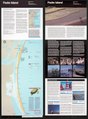
 Padre Island National Seashore, Texas - official map and guide LOC 91684626.jpg 5,296 × 7,194; 5.86 MB
-
 Padre Island National Seashore, Texas - official map and guide LOC 91684626.tif 5,296 × 7,194; 109 MB
-
 Pea Ridge National Military Park, Arkansas - official map and guide LOC 91684722.jpg 5,012 × 4,695; 4.06 MB
-
 Pea Ridge National Military Park, Arkansas - official map and guide LOC 91684722.tif 5,012 × 4,695; 67.32 MB
-
 Pennsylvania, U.S.D.A. Soil Conservation Service administrative areas LOC 92683611.jpg 3,287 × 2,542; 1.08 MB
-
 Pennsylvania, U.S.D.A. Soil Conservation Service administrative areas LOC 92683611.tif 3,287 × 2,542; 23.91 MB
-
 Pennsylvania, U.S.D.A. Soil Conservation Service administrative areas LOC 92683612.jpg 3,274 × 2,492; 1.14 MB
-
 Pennsylvania, U.S.D.A. Soil Conservation Service administrative areas LOC 92683612.tif 3,274 × 2,492; 23.34 MB
-
-
-

-
 Planning Districts Commission, Virginia LOC 92681533.jpg 4,342 × 3,299; 1.08 MB
-
 Planning Districts Commission, Virginia LOC 92681533.tif 4,342 × 3,299; 40.98 MB
-

-
 Plant materials, Minnesota, North Dakota, and South Dakota - October 1990 LOC 97680884.tif 3,216 × 2,428; 22.34 MB
-
 Prime Hook National Wildlife Refuge, Delaware LOC 93686709.jpg 9,090 × 2,738; 3.23 MB
-
 Prime Hook National Wildlife Refuge, Delaware LOC 93686709.tif 9,090 × 2,738; 71.21 MB
-

-
 Project map, Chunky River Watershed, Neshoba and Newton counties, Mississippi LOC 92682704.tif 3,277 × 5,960; 55.88 MB
-
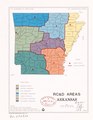
 RC&D areas, Arkansas LOC 92682933.jpg 2,520 × 3,261; 870 KB
-
 RC&D areas, Arkansas LOC 92682933.tif 2,520 × 3,261; 23.51 MB
-

-
-
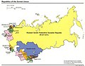
 Republics of the Soviet Union. LOC 2005626536.jpg 2,461 × 3,275; 374 KB
-
 Republics of the Soviet Union. LOC 2005626536.tif 2,461 × 3,275; 23.06 MB
-
 Resource conservation and development project areas, Kentucky LOC 92682932.tif 3,285 × 2,529; 23.77 MB
-
 River basins of the United States-The Delaware LOC 00557437.jpg 6,198 × 5,788; 4.32 MB
-
 River basins of the United States-The Delaware LOC 00557437.tif 6,198 × 5,788; 102.64 MB
-
 River basins of the United States-The Potomac LOC 00557436.jpg 6,126 × 5,762; 4.43 MB
-
 River basins of the United States-The Potomac LOC 00557436.tif 6,126 × 5,762; 100.99 MB
-
 Rock Creek Park, Washington, D.C. - 100 years, 1890-1990 LOC 91686298.jpg 5,150 × 7,202; 5.78 MB
-
 Rock Creek Park, Washington, D.C. - 100 years, 1890-1990 LOC 91686298.tif 5,150 × 7,202; 106.12 MB
-
 Roma in B&H.PNG 1,792 × 1,704; 84 KB
-
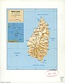 Saint Lucia. LOC 2005631605.jpg 2,521 × 3,259; 659 KB
-
 Saint Lucia. LOC 2005631605.tif 2,521 × 3,259; 23.51 MB
-
 Salem Maritime National Historic Site, Massachusetts LOC 91685080.jpg 10,038 × 7,062; 12.05 MB
-
 Salem Maritime National Historic Site, Massachusetts LOC 91685080.tif 10,038 × 7,062; 202.81 MB
-
 Sarajevo - Etnicki sastav po naseljima 1991 1.gif 2,806 × 3,252; 232 KB
-
 Sarajevo - Udeo Muslimana po naseljima 1991.gif 2,806 × 3,252; 249 KB
-
 Sarajevo - Udeo Srba po naseljima 1991.gif 2,806 × 3,252; 249 KB
-
 Shiloh National Military Park, Tennessee LOC 91682379.jpg 5,006 × 4,685; 4.32 MB
-
 Shiloh National Military Park, Tennessee LOC 91682379.tif 5,006 × 4,685; 67.1 MB
-
 Soviet Union Republics, September 1991 - DPLA - e968bcde0c9fb13dfa1d8700d0d3bc05.jpg 3,276 × 2,552; 1.16 MB
-
 Status of watershed projects, Georgia - October 1991 LOC 98684798.jpg 3,467 × 6,129; 2.19 MB
-
 Status of watershed projects, Georgia - October 1991 LOC 98684798.tif 3,467 × 6,129; 60.79 MB
-
 Stonewall Jackson Lake LOC 99443772.jpg 7,823 × 4,380; 3.86 MB
-
 Stonewall Jackson Lake LOC 99443772.tif 7,823 × 4,380; 98.03 MB
-
 Stonewall Jackson Lake LOC 99443792.jpg 9,668 × 5,580; 7.45 MB
-
 Stonewall Jackson Lake LOC 99443792.tif 9,668 × 5,580; 154.35 MB
-
 Território de Macau, escala 1-20 000 = (Ao-men ti chʻü, pi li) 1-20 000. LOC 92684636.jpg 6,258 × 8,663; 5.17 MB
-
 Território de Macau, escala 1-20 000 = (Ao-men ti chʻü, pi li) 1-20 000. LOC 92684636.tif 6,258 × 8,663; 155.11 MB
-
 The Civil War at a glance LOC 91685463.jpg 13,541 × 9,656; 17.42 MB
-
 The Civil War at a glance LOC 91685463.tif 13,541 × 9,656; 374.08 MB
-

-

-
 The White House 1792-1992 LOC 2006625228.jpg 10,193 × 4,956; 8.7 MB
-
 The White House 1792-1992 LOC 2006625228.tif 10,193 × 4,956; 144.53 MB
-

-

-
-

-
 U.S. Department of Agriculture, National Arboretum, Washington, D.C. - 1991 LOC 91683020.jpg 4,876 × 5,644; 4.44 MB
-
 U.S. Department of Agriculture, National Arboretum, Washington, D.C. - 1991 LOC 91683020.tif 4,876 × 5,644; 78.74 MB
-
 Ukraine presidential elections 1991 Vote (Lukyanenko).png 2,000 × 1,371; 341 KB
-
 Ukraine presidential elections 1991-de.svg 1,032 × 693; 1.55 MB
-
 Ukraine presidential elections 1991.png 1,179 × 773; 38 KB
-
 Valley Forge National Historical Park, Pennsylvania LOC 92680010.jpg 10,148 × 4,773; 7.02 MB
-
 Valley Forge National Historical Park, Pennsylvania LOC 92680010.tif 10,148 × 4,773; 138.58 MB
-

-
-
 Vicksburg National Military Park, Mississippi LOC 91684875.jpg 5,048 × 7,047; 6.88 MB
-
 Vicksburg National Military Park, Mississippi LOC 91684875.tif 5,048 × 7,047; 101.78 MB
-
 Věřící - sčítání 1991.png 615 × 355; 25 KB
._LOC_91682276.jpg)

.jpg)


_United_States_-_projected_agreeable_to_the_direction_of_the_President_of_the_United_States,_in_pursuance_of_an_act_of_LOC_91684074.jpg)
_United_States_-_projected_agreeable_to_the_direction_of_the_President_of_the_United_States,_in_pursuance_of_an_act_of_LOC_97683585.jpg)


_1-20_000._LOC_92684636.jpg)

_LOC_91684381.jpg)

,_Oxford,_and_York_counties_-_February_1991_LOC_92683216.jpg)


.png)


