Category:1991 maps of Ohio
Jump to navigation
Jump to search
States of the United States: Florida · Georgia · Kentucky · Louisiana · Maine · Maryland · Massachusetts · Mississippi · North Carolina · Ohio · Pennsylvania · Texas · Virginia
| ← 1991 1992 1995 1997 |
Media in category "1991 maps of Ohio"
The following 14 files are in this category, out of 14 total.
-

-

-

-
-
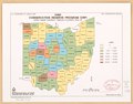
 Ohio, Conservation Reserve Program (CRP) - cropland acres eligible LOC 93681127.jpg 3,420 × 2,677; 907 KB
-
 Ohio, Conservation Reserve Program (CRP) - cropland acres eligible LOC 93681127.tif 3,420 × 2,677; 26.19 MB
-
 Ohio, Conservation Reserve Program (CRP) - cropland acres eligible LOC 93681128.jpg 3,444 × 2,664; 940 KB
-
 Ohio, Conservation Reserve Program (CRP) - cropland acres eligible LOC 93681128.tif 3,444 × 2,664; 26.25 MB
-
 Plant hardiness zones, Ohio LOC 95681997.jpg 3,427 × 2,665; 838 KB
-
 Plant hardiness zones, Ohio LOC 95681997.tif 3,427 × 2,665; 26.13 MB
-
 Resource conservation and development, Ohio LOC 92681229.jpg 2,679 × 3,427; 1.06 MB
-
 Resource conservation and development, Ohio LOC 92681229.tif 2,679 × 3,427; 26.27 MB
-
 Status of soil surveys, Ohio - October 1991 LOC 97681543.jpg 3,444 × 2,701; 903 KB
-
 Status of soil surveys, Ohio - October 1991 LOC 97681543.tif 3,444 × 2,701; 26.61 MB
_-_acres_under_contract_through_eleventh_sign_up_LOC_93681125.jpg)
_-_acres_under_contract_through_eleventh_sign_up_LOC_93681126.jpg)
_-_cropland_acres_eligible_LOC_93681127.jpg)
_-_cropland_acres_eligible_LOC_93681128.jpg)


