Category:19th-century architecture in Oxfordshire
Jump to navigation
Jump to search
Ceremonial counties of England: Bedfordshire · Berkshire · Buckinghamshire · Cambridgeshire · Cheshire · Cornwall · Cumbria · Derbyshire · Devon · Dorset · Durham · East Riding of Yorkshire · East Sussex · Essex · Gloucestershire · Greater London · Greater Manchester · Hampshire · Herefordshire · Hertfordshire · Kent · Lancashire · Leicestershire · Lincolnshire · Merseyside · Norfolk · North Yorkshire · Northamptonshire · Northumberland · Nottinghamshire · Oxfordshire · Rutland · Shropshire · Somerset · South Yorkshire · Staffordshire · Suffolk · Surrey · Tyne and Wear · Warwickshire · West Midlands · West Sussex · West Yorkshire · Wiltshire · Worcestershire
City-counties: Bristol ·
Former historic counties: Huntingdonshire · Sussex · West Riding of Yorkshire · Yorkshire
Other former counties:
City-counties: Bristol ·
Former historic counties: Huntingdonshire · Sussex · West Riding of Yorkshire · Yorkshire
Other former counties:
Subcategories
This category has the following 82 subcategories, out of 82 total.
*
2
- 23 Cornhill, Banbury (3 F)
- 24 Cornhill, Banbury (5 F)
A
- St John's Hospital, Abingdon (2 F)
- Ardington Marsh Lock (27 F)
- Ardington Top Lock (17 F)
- Aston and Cote School (5 F)
B
- Corn Exchange, Banbury (6 F)
- Banbury Cross (54 F)
- 33–34 Bridge Street, Banbury (19 F)
- Old Court House, Bicester (2 F)
- Bliss Mill (32 F)
- Bloxham Windmill (3 F)
- Brightwell Village Hall (8 F)
C
- Charlbury Fountain (2 F)
- Charlbury railway station (33 F)
- Chipping Norton Town Hall (21 F)
- Culham railway station (43 F)
D
- Deddington Library (2 F)
- Deddington Town Hall (15 F)
- Dew Drop Inn, Summertown (5 F)
E
- Lower Mill, East Hanney (3 F)
F
- Fawler Railway Bridge (5 F)
- The Fox and Goat, Tiddington (9 F)
- Main Road milestone, Fyfield (2 F)
G
- Goring Library (1 F)
- Grafton Lock (6 F)
- Greys Court Keep (4 F)
- Tulwick milestone, Grove (4 F)
- Grove Bottom Lock (11 F)
- Grove Common Lock (11 F)
- Grove Top Lock (3 F)
- Limekiln Lock (2 F)
H
- Henley Obelisk (19 F)
- Heyford Bridge (5 F)
I
K
- Kiddington School (2 F)
L
- Leafield Cross (6 F)
- Lock Up, Wheatley (11 F)
- Lower Heyford Old School (4 F)
M
- Moulsford Railway Bridge (49 F)
N
- North Leigh Windmill (3 F)
O
- Old Man's Bridge (3 F)
- The Old Red Lion, Tetsworth (4 F)
- Tirah Monument, Oxford (13 F)
- Oxford Post Office (23 F)
P
- Pinkhill Lock (12 F)
R
- The Railway, Wheatley (6 F)
- Roving Bridge (9 F)
S
- Smallmarsh Lock (7 F)
- St Edburg's Hall (4 F)
- Maharajah's Well, Stoke Row (20 F)
T
- Thame Museum (2 F)
- Thame Town Hall (30 F)
U
- Upper Heyford Old School (2 F)
V
- Venn Mill (24 F)
W
- Wallingford Corn Exchange (13 F)
- Wardington School (3 F)
- St Peter's Church, Wilcote (15 F)
Media in category "19th-century architecture in Oxfordshire"
The following 138 files are in this category, out of 138 total.
-
 10 and 11 Upper High Street, Thame, December 2023.jpg 4,032 × 3,024; 4.18 MB
-
 10 High Street, Thame, December 2023.jpg 4,032 × 3,024; 3.29 MB
-
 108 High Street, Thame, December 2023.jpg 3,024 × 4,032; 4 MB
-
 109 High Street, Thame, December 2023.jpg 3,024 × 4,032; 4.78 MB
-
 11 and 12 High Street, Thame, December 2023.jpg 4,032 × 3,024; 3.24 MB
-
 112 High Street, Thame, December 2023.jpg 3,024 × 4,032; 3.27 MB
-
 19 Buttermarket, Thame, December 2023.jpg 3,024 × 4,032; 4.11 MB
-
 9 and 10 Buttermarket, Thame, December 2023.jpg 4,032 × 3,024; 4.08 MB
-
 9 Buttermarket, Thame, December 2023.jpg 3,024 × 4,032; 3.4 MB
-
 Abingdon HighSt 23.jpg 914 × 1,280; 626 KB
-
 Abingdon MarketSquare17–21.jpg 1,024 × 614; 313 KB
-
 Abingdon OckStreet 37–41.jpg 1,280 × 659; 531 KB
-
 Alvescot StPeter ChancelS.jpg 1,280 × 853; 831 KB
-
 Alvescot StPeter east.jpg 1,150 × 1,280; 1.1 MB
-

-
 Ashbury VillageHall.JPG 2,680 × 1,880; 2.44 MB
-
 Vestry at the back - geograph.org.uk - 990522.jpg 640 × 426; 96 KB
-
 The Centre of Bampton - geograph.org.uk - 471628.jpg 640 × 480; 97 KB
-
 Bampton Youth Centre - geograph.org.uk - 1542248.jpg 640 × 427; 71 KB
-

-
 Lower Cherwell Street looking north - geograph.org.uk - 1474182.jpg 495 × 640; 108 KB
-
 Lower Cherwell Street looking south - geograph.org.uk - 1474187.jpg 640 × 435; 93 KB
-
 Scania AlexanderDennis Enviro300 YM15 FPL Banbury.jpg 1,280 × 854; 561 KB
-
 Banbury JTs - geograph.org.uk - 1659897.jpg 640 × 480; 79 KB
-
 Baulking Bridge - geograph.org.uk - 1539476.jpg 640 × 452; 58 KB
-
 Begbroke StMichael NaveNorth.jpg 2,925 × 1,950; 2.65 MB
-
 Bicester SheepSt 27.jpg 1,024 × 731; 317 KB
-
 Bletchingdon Road bridge in Islip - geograph.org.uk - 1502998.jpg 640 × 427; 109 KB
-
-
 Caversfield StLaurence RainwaterHead.jpg 853 × 1,280; 768 KB
-
 Chesterton StMary StairTurret plaque.jpg 1,280 × 854; 949 KB
-
 Chesterton StMary StairTurret.jpg 853 × 1,280; 785 KB
-

-
 All Saints' Church, Chilton, Porch - geograph.org.uk - 1320448.jpg 480 × 640; 90 KB
-

-
 Claydon StJamesGt font.jpg 915 × 1,280; 607 KB
-

-
 Cornwell Village centre and Village Hall - geograph.org.uk - 253357.jpg 480 × 640; 135 KB
-
 Cottage by the barn - geograph.org.uk - 1725808.jpg 1,024 × 683; 159 KB
-
 Across the courtyard - geograph.org.uk - 1338437.jpg 640 × 426; 79 KB
-
 Back of the transport - geograph.org.uk - 1340245.jpg 640 × 426; 63 KB
-
 Neat and tidy - geograph.org.uk - 1338369.jpg 640 × 480; 79 KB
-
 Culham Tandoori - geograph.org.uk - 1300075.jpg 640 × 405; 57 KB
-

-
 Drayton Lock - geograph.org.uk - 290071.jpg 640 × 480; 185 KB
-
 Drayton StPeter transept.jpg 1,024 × 768; 412 KB
-
 Duns Tew village hall, 6th April 2008 - geograph.org.uk - 949511.jpg 640 × 480; 102 KB
-
 Elsfield StThomasC NW 02.JPG 3,000 × 2,000; 1.04 MB
-
 Old Milestone by London Street, Faringdon (geograph 5364061).jpg 1,009 × 1,405; 457 KB
-

-
 Road Bridge, Finstock Rail Station - geograph.org.uk - 1439922.jpg 640 × 480; 126 KB
-
 Former fountain on Walton Well Road - geograph.org.uk - 1760230.jpg 1,000 × 1,500; 250 KB
-
 Gothic porch - geograph.org.uk - 1266617.jpg 400 × 600; 83 KB
-
 Garsington OldSchool.jpg 2,975 × 1,785; 2.27 MB
-
 Garsington StMary GargoylesSE.jpg 1,940 × 2,910; 2.1 MB
-
 Garsington StMary GargoylesSW.jpg 1,980 × 2,640; 2.38 MB
-
 Garsington StMary NorthDoor 2.jpg 961 × 1,280; 1.01 MB
-
 Garsington StMary NorthDoor.jpg 1,970 × 2,955; 2.44 MB
-
 Goosey AllSaints BellTurret NE.jpg 614 × 1,024; 315 KB
-
 Goosey AllSaints cross NE.jpg 768 × 768; 287 KB
-
 Graffiti in the bridge - geograph.org.uk - 1564624.jpg 640 × 480; 90 KB
-
 Growth on the roof - geograph.org.uk - 1568661.jpg 480 × 640; 124 KB
-
 Rail bridge on the track - geograph.org.uk - 1564524.jpg 640 × 480; 117 KB
-
 Goring side of the bridge - geograph.org.uk - 1564610.jpg 640 × 480; 96 KB
-
 Mill Road - geograph.org.uk - 1278161.jpg 640 × 480; 102 KB
-
 GreatTew School.JPG 3,000 × 2,000; 711 KB
-
 Greys Court, Henley-on-Thames (6227998844).jpg 4,272 × 2,848; 9 MB
-
 Canal through the bridge - geograph.org.uk - 1201881.jpg 640 × 426; 117 KB
-
 Bridge at top lock - geograph.org.uk - 1204948.jpg 640 × 426; 89 KB
-
 Chamber remains - geograph.org.uk - 1201909.jpg 640 × 426; 131 KB
-
 Eroded walls - geograph.org.uk - 1204958.jpg 640 × 426; 106 KB
-
 Over the bridge - geograph.org.uk - 1206239.jpg 400 × 600; 96 KB
-
 HenleyOnThames DukeSt47–49.jpg 2,850 × 1,900; 2.33 MB
-
 Old school by the road - geograph.org.uk - 1470867.jpg 640 × 427; 117 KB
-
 HintonWaldrist FormerSchool.jpg 1,280 × 853; 744 KB
-
 Holton Village Hall - geograph.org.uk - 1173204.jpg 640 × 480; 65 KB
-

-

-
 Horspath CuddesdonRdBridge.JPG 3,000 × 2,000; 2.76 MB
-
 The Isis at Iffley - geograph.org.uk - 1253556.jpg 640 × 414; 92 KB
-
 Old pub by the road - geograph.org.uk - 1575006.jpg 640 × 427; 65 KB
-
 Unexpected Memorial - geograph.org.uk - 184420.jpg 640 × 480; 114 KB
-
-
 Over Kiddington (Landmark Tree^) - geograph.org.uk - 1472332.jpg 640 × 442; 108 KB
-

-
 Sparrowgap Bridge over the railway - geograph.org.uk - 1322015.jpg 640 × 413; 72 KB
-
 LetcombeBassett StMichael.JPG 3,008 × 2,000; 2.02 MB
-
 Oxford, Minchery Road railway bridge - geograph.org.uk - 727122.jpg 640 × 478; 101 KB
-
 Littlemore PrioryRdBridge.jpg 1,024 × 768; 623 KB
-
 Culvert for the ditch - geograph.org.uk - 1199360.jpg 640 × 426; 112 KB
-
 Church Mission And Temperance Hall 1888. - geograph.org.uk - 463892.jpg 640 × 487; 132 KB
-
 Old Milestone by the B4047, Burford Road (geograph 6048442).jpg 793 × 1,254; 176 KB
-
 MinsterLovell milestone east.jpg 614 × 1,024; 506 KB
-
 St John's. Still being used - geograph.org.uk - 1658573.jpg 480 × 640; 126 KB
-
-

-
 St Mary, North Leigh, Oxon - Pulpit - geograph.org.uk - 1624428.jpg 424 × 640; 70 KB
-
-
 Northmoor StDenys pulpit 30685.jpg 1,970 × 2,955; 2.2 MB
-
 Old Police Station, Witney - geograph.org.uk - 868833.jpg 640 × 480; 71 KB
-
 Piddington StNicholas SouthArcade EastImpost.JPG 1,755 × 2,925; 1.67 MB
-
 Piddington StNicholas SouthArcade.JPG 2,840 × 1,970; 2.29 MB
-
 Roadbridge Over River Ray, Islip - geograph.org.uk - 1472163.jpg 640 × 480; 105 KB
-
 Peppard Primary School - geograph.org.uk - 1049847.jpg 640 × 427; 175 KB
-
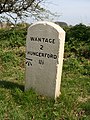
 Old Milestone (geograph 6114762).jpg 750 × 1,243; 176 KB
-
 ShiptonOnCherwell HolyCross EastWindow.jpg 1,920 × 2,560; 2.15 MB
-
 St James' Church School - geograph.org.uk - 1254935.jpg 640 × 427; 76 KB
-
 St James' Church School - geograph.org.uk - 1254943.jpg 640 × 391; 62 KB
-
 Standlake PrimarySchool.jpg 1,134 × 567; 529 KB
-

-

-
 StantonStJohn HolfordCentre East.jpg 2,980 × 1,490; 1.66 MB
-
 StantonStJohn School HolfordCentre South.jpg 3,000 × 1,800; 2.21 MB
-
 Signal gantry at Steventon - geograph.org.uk - 1537441.jpg 640 × 415; 68 KB
-
 Teaching Centre, Henry Box School.jpg 4,052 × 3,070; 2.05 MB
-
 Thame Community Hospital - geograph.org.uk - 1740118.jpg 3,872 × 2,592; 3.21 MB
-
 The Abingdon Arms - geograph.org.uk - 1146657.jpg 640 × 411; 91 KB
-
 TootBaldon ParishSchool.JPG 2,790 × 1,860; 1.54 MB
-
 Tower at Woodeaton Manor - geograph.org.uk - 352984.jpg 640 × 481; 218 KB
-
 Looking up at the bridge - geograph.org.uk - 1659404.jpg 640 × 427; 118 KB
-
 Walton Well Drinking Fountain - geograph.org.uk - 5961763.jpg 681 × 1,024; 190 KB
-
 Walton Well Drinking Fountain.jpg 3,000 × 4,000; 6.23 MB
-
 BlackBushes ManorRd milestone.jpg 731 × 1,024; 463 KB
-
-
 Old Milestone by the A338, near Manor Road Farm (geograph 5622291).jpg 533 × 800; 154 KB
-
 Waterperry StMaryV Chancel WindowE detail.jpg 2,880 × 1,920; 1.63 MB
-
 Waterperry StMaryV ChancelE.jpg 1,770 × 2,950; 2.09 MB
-
 Entrance to St Leonard's Church in Waterstock - geograph.org.uk - 1724848.jpg 999 × 1,500; 273 KB
-
 St Leonard's Church in Waterstock - geograph.org.uk - 1724847.jpg 1,500 × 1,000; 187 KB
-
 Lock or bridge - geograph.org.uk - 1639824.jpg 640 × 480; 148 KB
-
 Porch, St James the Great, West Hanney - geograph.org.uk - 770981.jpg 480 × 640; 109 KB
-

-
 Aqueduct in the bushes - geograph.org.uk - 1207761.jpg 640 × 426; 130 KB
-
 Bridge by the path - geograph.org.uk - 1210001.jpg 640 × 426; 83 KB
-
 More of the bridge - geograph.org.uk - 1209974.jpg 400 × 600; 98 KB
-
 Witney HighSt 1–5.jpg 1,280 × 630; 515 KB
-
 Wootton StPeter North1.jpg 3,000 × 1,800; 2.31 MB
-
 Wootton StPeter North2.jpg 3,000 × 2,000; 2.45 MB


.jpg)


.jpg)


_-_geograph.org.uk_-_1472332.jpg)


.jpg)


.jpg)


.jpg)
.jpg)


