Category:19th-century maps of Jura (department)
Jump to navigation
Jump to search
Subcategories
This category has only the following subcategory.
Media in category "19th-century maps of Jura (department)"
The following 8 files are in this category, out of 8 total.
-

-
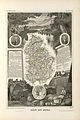
 142 of 'La France Illustrée- géographie générale ... Par F. J' (11200445964).jpg 1,271 × 1,585; 528 KB
-
 Carte géologique des Environs de St. Claude (Jura) 1857.jpg 3,698 × 5,419; 7.98 MB
-
 Carte routière du département du Jura - 1851.jpg 8,864 × 10,708; 12.3 MB
-
 Carte routière du département du Jura-retouched.png 7,856 × 9,520; 42.88 MB
-
 Carte routière du département du Jura.jpg 7,856 × 9,520; 9.9 MB
-
 Dépt. du Jura (région de l'est) - Fonds Ancely - B315556101 A LEVASSEUR 042.jpg 2,006 × 3,016; 2.15 MB
-


.jpg)
_1857.jpg)


_-_Fonds_Ancely_-_B315556101_A_LEVASSEUR_042.jpg)
