Category:19th-century maps of the Nile River
Jump to navigation
Jump to search
English: Preferably, this category should contain maps that show large portions of the Nile River (or the Nile countries) throughout the Nile's run of northeastern Africa. These maps should prominently feature the river.
Maps of small sections of the Nile river (like about the Nile Delta) are better placed in the respective categories of the countries (Egypt, Sudan, South Sudan, Ethiophia, Uganda), or in categories like "... maps of the Nile Delta".
Maps of small sections of the Nile river (like about the Nile Delta) are better placed in the respective categories of the countries (Egypt, Sudan, South Sudan, Ethiophia, Uganda), or in categories like "... maps of the Nile Delta".
Subcategories
This category has the following 2 subcategories, out of 2 total.
Media in category "19th-century maps of the Nile River"
The following 68 files are in this category, out of 68 total.
-
 1811 Cary Map of Arabia, Egypt ^ Abyssinia - Geographicus - Arabia-cary-1811.jpg 4,000 × 3,540; 2.84 MB
-
 1818 Pinkerton Map of Egypt - Geographicus - Egypt-pinkerton-1818.jpg 5,000 × 6,990; 8.39 MB
-
 1819 Cary Map of Arabia, Egypt ^ Abyssinia - Arabia.jpg 2,000 × 1,789; 1,008 KB
-
 Nubia and Abyssinia - DPLA - 63b9b367f142117b58b0bc8174bb771a.jpg 775 × 1,000; 246 KB
-
 Bulletin (20233357020).jpg 1,640 × 2,884; 589 KB
-
 Bulletin (20234817299).jpg 1,622 × 2,880; 664 KB
-
 Nubia and Abyssinia.png 9,046 × 7,418; 83.59 MB
-
 1842 map of Northeast Africa by John Arrowsmith.jpg 14,857 × 12,501; 16.98 MB
-
 Map of Egypt Nubia Sudan Darfur 1844.jpg 1,024 × 764; 190 KB
-

-
 Karte vom Nilgebiet Platt 1848.pdf 2,337 × 2,887; 734 KB
-

-
-
 Übersichtskarte der Nilländer.. (NYPL b14291191-37502).jpg 4,120 × 5,477; 5.2 MB
-
 Lepsius-Projekt tw 1-1-01.jpg 1,603 × 2,051; 544 KB
-
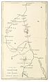 MELLY(1851) p1.258 Map of Khartoum and the Niles.jpg 1,271 × 2,129; 1,023 KB
-
 (1852) ROUTE FROM CAIRO TO KORDOFAN.jpg 1,209 × 2,193; 713 KB
-

-
 TOBIN(1855) p128 ROUTE ON THE NILE.jpg 2,726 × 3,735; 4.45 MB
-
 Viaggi spedizione 1857.JPG 956 × 1,196; 140 KB
-

-

-

-

-

-

-
-
-

-

-

-

-
 Le Nil - Abyssinie, Ethiopie, Nubie, Egypte, Arabie, Syrie, Assyrie - btv1b550112596.jpg 2,714 × 3,997; 1.34 MB
-

-
 Arabia, Egypt, Nubia and Abyssinia 1883 map (cropped).jpg 1,523 × 1,428; 2.5 MB
-
 Arabia, Egypt, Nubia and Abyssinia 1883 map.jpg 5,784 × 4,926; 25.74 MB
-
 ACSIE003 - Map of Egypt, Abyssinia, and the Soudan.jpg 650 × 787; 85 KB
-
 Die Gartenlaube (1884) b 172.jpg 1,247 × 1,869; 460 KB
-
 Egypte, Soudan, Abyssinie - btv1b53021204q.jpg 6,826 × 8,865; 6.76 MB
-
 Karte der Nilländer.png 2,468 × 3,647; 8.25 MB
-
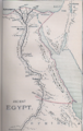
 Egypt and the basin of the Nile (2674836051).jpg 1,692 × 2,000; 2.94 MB
-

-
 Mahdi 1885.png 333 × 600; 418 KB
-
 Northeast Africa 1885.jpg 860 × 779; 240 KB
-

-
 Carta dell' Egitto, Sudan, Mar Rosso, Assab, Massaua, Abissinia ecc.tiff 6,274 × 5,420; 97.29 MB
-

-

-
-
 Metchnikoff - La Civilisation et les grands fleuves historiques - nil.png 650 × 1,642; 545 KB
-
 Übersichtskarte von Dr. W. Junkers Reisen in Nord- und Central-Afrika. 1875-1886.png 1,591 × 2,386; 5.73 MB
-
 Africa (Volume I) pg 70.jpg 1,002 × 2,254; 299 KB
-
 Africa (Volume I) pg 71.jpg 1,247 × 2,594; 201 KB
-
 Ancient Egypt (Myers, 1890).png 739 × 1,169; 1.78 MB
-
-
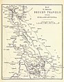
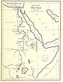
 Ethnographical Outline Map of the Egyptian Sudan, 1891.jpg 2,130 × 2,291; 1.13 MB
-
 Égypte et Abyssinie - DPLA - ce14359a1a6d626c45a884b312d99188.jpg 736 × 1,000; 205 KB
-
 Ägypten Dar Fur und Abessinien.jpg 2,832 × 3,488; 4.11 MB
-

-
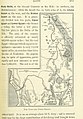
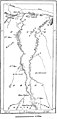
 Sketch Map - Distances and principal points in the Nile Valley.png 1,546 × 2,692; 2.56 MB
-
 Sketch map showing distribution of Dervish forces before opening of the campaign 1896.png 2,013 × 3,486; 3.39 MB
-

-
 Century Mag the Nile and NE Africa.png 1,062 × 1,079; 241 KB
-

-
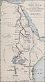
 River War 1-2 Map of the Nile.jpg 1,299 × 1,884; 354 KB
-

-
 Afrique Orientale 1862.jpg 3,026 × 3,835; 2.08 MB
-
 Third Salisbury administration, 1895-1900 (1900) (14776758771).jpg 5,476 × 6,444; 2.15 MB


.jpg)
.jpg)


.jpg)
_(14775178261).jpg)
.jpg)

_p1.258_Map_of_Khartoum_and_the_Niles.jpg)
_ROUTE_FROM_CAIRO_TO_KORDOFAN.jpg)
_p128_ROUTE_ON_THE_NILE.jpg)


%27_(11059674863).jpg)
%27_(11237903646).jpg)
%27_(11059277103).jpg)
%27_(11083270195).jpg)
.jpg)
.jpg)
)%27_(11103635273).jpg)
.jpg)

.jpg)


_-_btv1b530211586.jpg)
.jpg)


_b_172.jpg)


.jpg)


.jpg)
.jpg)
.jpg)
.jpg)

_pg_70.jpg)
_pg_71.jpg)
.png)
.jpg)


%27_(11233022974).jpg)


.jpg)

;_a_critical_dictionary_of_the_literary,_political_and_religious_history,_the_arch%C3%A6ology,_geography,_and_natural_history_of_the_Bible_(1899)_(14777051211).jpg)

%27_(11075470056).jpg)

_(14776758771).jpg)
_(14580762040).jpg)
.jpg)