Category:19th century maps of Cantal
Jump to navigation
Jump to search
Media in category "19th century maps of Cantal"
The following 7 files are in this category, out of 7 total.
-

-

-
 Cantal3.jpg 2,310 × 1,977; 2.95 MB
-
 Carte du département du Cantal - 1841.jpg 9,598 × 7,679; 11.44 MB
-
 Carte routière du département du Cantal - 1883.jpg 5,078 × 4,315; 2.94 MB
-
 Dépt. du Cantal (région du sud) - Fonds Ancely - B315556101 A LEVASSEUR 018.jpg 3,104 × 2,032; 2.06 MB
-
 France & Colonies-1894-Massif du Cantal.jpg 4,499 × 4,785; 3.69 MB
%27_(11113224633).jpg)
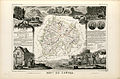
_-_Geographicus_-_Cantal-levasseur-1852.jpg)


_-_Fonds_Ancely_-_B315556101_A_LEVASSEUR_018.jpg)
