Category:2000 maps of the United States
Jump to navigation
Jump to search
Countries of Oceania: Fiji · New Zealand
States of the United States: Alabama · Arizona · California · Georgia · Iowa · Massachusetts · New York · Pennsylvania · South Carolina – Washington, D.C.
Subcategories
This category has the following 13 subcategories, out of 13 total.
A
- 2000 maps of Alabama (3 F)
- 2000 maps of Arizona (empty)
C
- 2000 maps of California (2 F)
D
G
I
M
- 2000 maps of Massachusetts (10 F)
N
P
S
- 2000 maps of South Carolina (2 F)
Media in category "2000 maps of the United States"
The following 11 files are in this category, out of 11 total.
-
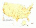
 Cherokee Speakers by County, 2000.png 1,040 × 675; 530 KB
-
 New 2000 asian density.gif 2,604 × 2,012; 550 KB
-
 New 2000 asian percent.gif 2,604 × 2,012; 562 KB
-
 New 2000 hispanic density.gif 2,604 × 2,012; 619 KB
-
 New 2000 hispanic percent.gif 2,604 × 2,012; 685 KB
-
 New 2000 indian percent.gif 2,604 × 2,012; 506 KB
-
 New 2000 white density.gif 2,604 × 2,012; 788 KB
-
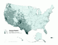
 Population Change by Percentage - 2000 US Census.png 5,285 × 3,762; 1.13 MB
-
 Townships.St.Clair.Co.map.png 394 × 400; 42 KB
-
 United States. LOC 00559160.jpg 2,444 × 3,102; 859 KB
-
 United States. LOC 00559160.tif 2,444 × 3,102; 21.69 MB


