Category:2000s maps of Louisiana
Jump to navigation
Jump to search
States of the United States: Alabama · Alaska · Arizona · Arkansas · California · Florida · Georgia · Hawaii · Iowa · Louisiana · Maine · Maryland · Massachusetts · Michigan · Minnesota · Montana · Nebraska · New Hampshire · New Jersey · New York · North Carolina · Ohio · Pennsylvania · South Carolina · Texas · Utah · Virginia · West Virginia · Wyoming – Washington, D.C.
Media in category "2000s maps of Louisiana"
The following 6 files are in this category, out of 6 total.
-
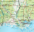 Louisiana ref 2001.jpg 600 × 565; 191 KB
-
 203433W sm.png 895 × 716; 33 KB
-
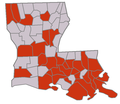 LouisianaH1N1.PNG 690 × 598; 25 KB
-
 Map of St. James Parish Louisiana With Municipal Labels.PNG 342 × 374; 24 KB
-

-
 USGS map of Sabine Pass.jpg 1,500 × 1,924; 900 KB


