Category:2007 in the London Borough of Islington
Jump to navigation
Jump to search
Boroughs of London: City of London · City of Westminster · Barking and Dagenham · Barnet · Bexley · Brent · Bromley · Camden · Croydon · Ealing · Enfield · Greenwich · Hackney · Hammersmith and Fulham · Haringey · Harrow · Havering · Hillingdon · Hounslow · Islington · Kensington and Chelsea · Kingston · Lambeth · Lewisham · Merton · Newham · Redbridge · Richmond · Southwark · Sutton · Tower Hamlets · Waltham Forest · Wandsworth
Subcategories
This category has the following 2 subcategories, out of 2 total.
2
- 2007 Emirates Cup (4 F)
A
Media in category "2007 in the London Borough of Islington"
The following 100 files are in this category, out of 100 total.
-
 173 Rosebery Avenue.jpg 850 × 440; 454 KB
-
 Former Water Board HQ, New River Head - geograph.org.uk - 397025.jpg 640 × 480; 145 KB
-
 Former water laboratory, New River Head - geograph.org.uk - 397016.jpg 640 × 480; 118 KB
-
 Farringdon station - geograph.org.uk - 464726.jpg 640 × 427; 93 KB
-
 Sandbox 270.JPG 1,280 × 1,023; 159 KB
-
 The Jerusalem Tavern, Britton St, EC1 - geograph.org.uk - 763837.jpg 640 × 480; 100 KB
-
 Artillery Arms, Bunhill Fields, EC1 (1352692966).jpg 960 × 1,280; 387 KB
-
 The Artillery Arms, Bunhill Row - geograph.org.uk - 583722.jpg 640 × 470; 65 KB
-
 Hugh llewelyn 319 425 (6331361697).jpg 2,592 × 1,944; 1.26 MB
-
 Hugh llewelyn 319 443 (6331362327).jpg 2,592 × 1,944; 1.24 MB
-
 Hugh llewelyn 365 529 (6332110350).jpg 2,592 × 1,944; 1.28 MB
-
 A Pavement on Seven Sisters Road - geograph.org.uk - 408638.jpg 480 × 640; 94 KB
-
 A1 Upper Street - geograph.org.uk - 653601.jpg 640 × 480; 60 KB
-
 A501 City Road, looking west - geograph.org.uk - 726185.jpg 640 × 480; 73 KB
-
 Alex Cafe, Islington - geograph.org.uk - 453902.jpg 640 × 480; 105 KB
-
 Alpino, Pentonville, London (1465304104).jpg 1,280 × 960; 320 KB
-

-
-
 Annette Road, Lower Holloway - geograph.org.uk - 359774.jpg 640 × 480; 122 KB
-
 Archway Park - geograph.org.uk - 615921.jpg 640 × 480; 197 KB
-
 Archway Road - geograph.org.uk - 616019.jpg 640 × 480; 129 KB
-
 Armoury House - geograph.org.uk - 514723.jpg 640 × 533; 90 KB
-
 Arsenal tube station - geograph.org.uk - 515000.jpg 640 × 409; 107 KB
-
 Arundel Square, Islington - geograph.org.uk - 453912.jpg 640 × 480; 126 KB
-
 Baltic Street East - geograph.org.uk - 594294.jpg 498 × 640; 96 KB
-
 Barclays Bank, City Rd - geograph.org.uk - 722870.jpg 480 × 640; 64 KB
-

-
 Butterfield Gardens, London Borough of Islington, N1 (1352657222).jpg 960 × 1,280; 344 KB
-
 Caledonian Park Tower (2354510575).jpg 800 × 600; 103 KB
-
 Caledonian road.jpg 2,272 × 1,704; 1.65 MB
-
 Central Perspective in Tunnel Vision - Flickr - fabbio.jpg 1,951 × 1,301; 1.92 MB
-
 Chadwell Street, EC1 - geograph.org.uk - 415632.jpg 640 × 480; 102 KB
-

-
 City Road London.jpg 709 × 444; 352 KB
-
 Clock Tower near The Angel - geograph.org.uk - 416430.jpg 480 × 640; 93 KB
-
 Clock tower, Angel - geograph.org.uk - 726545.jpg 480 × 640; 62 KB
-
 Cloudesley Mansions, Islington - geograph.org.uk - 549121.jpg 640 × 480; 134 KB
-
 Cloudesley Place, Islington - geograph.org.uk - 548974.jpg 480 × 640; 96 KB
-
 Colebrooke Row, Islington - geograph.org.uk - 628137.jpg 640 × 480; 135 KB
-

-
 Cowcross Street, Farringdon - geograph.org.uk - 443747.jpg 640 × 480; 114 KB
-
 Crescent Street, N1 - geograph.org.uk - 413922.jpg 640 × 480; 146 KB
-
 Crossley Street, Lower Holloway - geograph.org.uk - 587726.jpg 639 × 480; 110 KB
-
 Crouch End, Former railway station - geograph.org.uk - 474938.jpg 640 × 480; 144 KB
-
 Drayton Park railway station - geograph.org.uk - 514728.jpg 640 × 426; 106 KB
-
 Dunford Road, Lower Holloway - geograph.org.uk - 359348.jpg 640 × 480; 108 KB
-
 Farringdon 3rd rail AC overhead.JPG 1,280 × 960; 337 KB
-
 Farringdon Station Bahnsteig.JPG 2,560 × 1,920; 1.13 MB
-
 Farringdon Station southbound Thameslink platform geograph-3877475-by-Ben-Brooksbank.jpg 2,394 × 1,557; 2.86 MB
-
 Finsbury Barracks, City Road, EC1 - geograph.org.uk - 607358.jpg 640 × 480; 81 KB
-
 Finsbury Park Station Seven Sisters Road geograph-3880584-by-Ben-Brooksbank.jpg 2,392 × 1,422; 2.56 MB
-
 Finsbury Park Station, exterior 2007 geograph-3880560-by-Ben-Brooksbank.jpg 2,394 × 1,441; 2.58 MB
-
 Finsbury Square - geograph.org.uk - 325925.jpg 640 × 480; 139 KB
-
 Flats around Golden Lane - geograph.org.uk - 594256.jpg 640 × 437; 56 KB
-
 Foyer of Sadlers Wells Theatre - geograph.org.uk - 428426.jpg 480 × 640; 196 KB
-
 Greenhill Rents, EC1 - geograph.org.uk - 903437.jpg 640 × 480; 125 KB
-
 Grimthorpe, Percival Street Estate - geograph.org.uk - 415616.jpg 640 × 480; 129 KB
-
 Harberton Road, Archway - geograph.org.uk - 615432.jpg 639 × 480; 170 KB
-
 Hemingford Road, Barnsbury - geograph.org.uk - 624801.jpg 640 × 480; 160 KB
-
 Holloway Road - geograph.org.uk - 359332.jpg 640 × 480; 119 KB
-
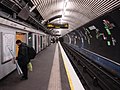
 Holloway Road tube station - geograph.org.uk - 513847.jpg 640 × 480; 128 KB
-
 Junction Road, Upper Holloway - geograph.org.uk - 548073.jpg 640 × 480; 120 KB
-
 London angel tube middle escalator upwards.jpg 1,200 × 1,600; 318 KB
-
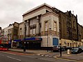
 Mecca Bingo Essex Road London N1.jpg 768 × 1,024; 263 KB
-
 Mecca Bingo Hall - geograph.org.uk - 342028.jpg 624 × 468; 292 KB
-
 Mecca Bingo, Essex Road, London N1.jpg 768 × 1,024; 245 KB
-
 Mount Pleasant postal sorting office 2.jpg 2,848 × 2,136; 1.43 MB
-
 Myddelton Passage, Islington - geograph.org.uk - 471527.jpg 640 × 480; 149 KB
-
 Myddelton Square, Islington - geograph.org.uk - 471498.jpg 640 × 480; 134 KB
-
 Myddelton Square, Islington - geograph.org.uk - 471520.jpg 480 × 640; 149 KB
-
 New Orleans Estate - geograph.org.uk - 370383.jpg 640 × 480; 153 KB
-
 Old Street Promenade of Light 2.jpg 2,848 × 2,136; 1.42 MB
-
-
 Paradise Park, Lower Holloway - geograph.org.uk - 587712.jpg 640 × 480; 154 KB
-
 Percy Circus, Finsbury - geograph.org.uk - 552280.jpg 640 × 480; 141 KB
-
 Planting out, Compton Terrace - geograph.org.uk - 614921.jpg 640 × 480; 129 KB
-
 Queen Boadicea Pub - geograph.org.uk - 415627.jpg 640 × 480; 142 KB
-
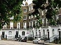
 Richmond Avenue, Barnsbury - geograph.org.uk - 624482.jpg 640 × 480; 137 KB
-
 Road Junction in Hornsey - geograph.org.uk - 370388.jpg 640 × 480; 122 KB
-
 Sadlers Wells Theatre, Rosebery Avenue - geograph.org.uk - 397013.jpg 640 × 480; 128 KB
-
 Saint Mellitus RC church, N4 - geograph.org.uk - 612687.jpg 480 × 640; 66 KB
-
 Shellgrove Road Estate, Dalston - geograph.org.uk - 400176.jpg 640 × 480; 94 KB
-
 Snow at Battlebridge basin.jpg 800 × 600; 105 KB
-
 St John Street London.jpg 1,299 × 888; 785 KB
-
 St Mark's Church, Islington - geograph.org.uk - 471513.jpg 640 × 480; 155 KB
-
 Stock Orchard Estate, Lower Holloway - geograph.org.uk - 411057.jpg 640 × 480; 119 KB
-

-

-

-
 Thornhill Crescent, Barnsbury - geograph.org.uk - 624495.jpg 639 × 480; 134 KB
-
 Thornhill Crescent, Barnsbury - geograph.org.uk - 624501.jpg 640 × 480; 168 KB
-
 Tomb of Thomas Bayes, Bunhill Cemetery, London, UK.jpg 4,000 × 3,000; 1.45 MB
-
 Traffic Lights, Farringdon Road, EC1 - geograph.org.uk - 825231.jpg 640 × 480; 136 KB
-
 Unionchapel.JPG 455 × 640; 76 KB
-
 Wall Maze, off Caledonian Road - geograph.org.uk - 602387.jpg 450 × 600; 146 KB
-
 Westbourne Road, Lower Holloway - geograph.org.uk - 587703.jpg 640 × 480; 109 KB
-
 What morning rush^ - geograph.org.uk - 614909.jpg 640 × 480; 61 KB
-
 Wheelwright Street, N7 - geograph.org.uk - 413904.jpg 640 × 480; 128 KB
-
 Wynford Road, N1 - geograph.org.uk - 414066.jpg 640 × 480; 84 KB
-
 Wynyatt Street, EC1 - geograph.org.uk - 415622.jpg 640 × 480; 117 KB


.jpg)

.jpg)
.jpg)
.jpg)


.jpg)


.jpg)
.jpg)


