Category:2012 aerial photographs of the United States
Jump to navigation
Jump to search
English: 2012 aerial photographs of the United States
Svenska: Flygfotografier från USA 2012
Deutsch: Luftbildfotografien aus die Vereinigte Staaten von Amerika von 2012
Media in category "2012 aerial photographs of the United States"
The following 30 files are in this category, out of 30 total.
-
 2012-06-15 Annapolis Maryland aerial.JPG 1,692 × 1,014; 485 KB
-
 20120909 012 Detroit, Michigan (8390388509).jpg 4,000 × 3,000; 2.01 MB
-
 Aerial Mattel Headquarters El Segundo May 2012.JPG 2,561 × 1,708; 2.14 MB
-
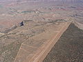 Aerial photo of part of Hurricane Mesa supersonic test track.jpg 2,560 × 1,920; 2.14 MB
-
 Approaching Salt Lake International Airport, West Valley City, Utah (7186842136).jpg 3,000 × 4,000; 2.65 MB
-
 Approaching Salt Lake International Airport, West Valley City, Utah (7186842838).jpg 4,000 × 3,000; 2.96 MB
-
 Approaching Salt Lake International Airport, West Valley City, Utah (7186843692).jpg 4,000 × 3,000; 3.06 MB
-
 Approaching Salt Lake International Airport, West Valley City, Utah (7186844280).jpg 4,000 × 3,000; 2.71 MB
-
 Approaching Salt Lake International Airport, West Valley City, Utah (7186844942).jpg 3,000 × 4,000; 2.55 MB
-
 Beardstown, Illinois (7235193870).jpg 4,000 × 3,000; 2.21 MB
-
 Beaver Lake Mountains, Near Milford, Utah (7186831836).jpg 4,000 × 3,000; 1.98 MB
-
 Beryl, Utah (7186831200).jpg 4,000 × 3,000; 2 MB
-
 Campbell County Wyoming Mines.png 2,400 × 1,856; 1.68 MB
-
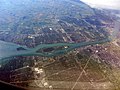
 Canada Michigan St Claire river Ontario Lambton county Chatham-Kent county IMG 1826.JPG 3,456 × 4,681; 10.19 MB
-
 CLT03FEB2012.png 7,125 × 7,488; 117.45 MB
-
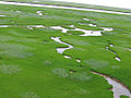 Coastal sedge meadow (6991515471).jpg 1,024 × 768; 447 KB
-
 Hennepin county MN Lake Calhoun IMG 1769 from east.JPG 4,760 × 2,707; 5.32 MB
-
 Hennepin county MN Lake Harriet IMG 1768 from east.JPG 5,184 × 3,139; 7.4 MB
-
 Hennepin county MN Minneapolis-Bloomington IMG 1766 Richfield Super Target HW 77.JPG 2,438 × 2,680; 2.72 MB
-
 Hennepin county MN Minneapolis-BrynMawr IMG 1771 Interstate 394 from east.JPG 3,179 × 3,509; 4.02 MB
-
 Hennepin county MN Minneapolis-Fulton HW 35W IMG 1767 from east.JPG 4,985 × 3,363; 7.17 MB
-
 Ice shanties in Riley's Bay DVIDS1114132.jpg 2,100 × 1,500; 860 KB
-
 Lake Erie and Ontario, Canada in Distance (7238178258).jpg 3,000 × 3,890; 1.33 MB
-
 Lake Erie Islands, Lake Erie in Ohio and Ontario, Canada (7992985986).jpg 4,000 × 3,000; 1.65 MB
-
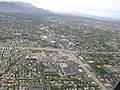
 Minneapolis 05042012.jpg 4,608 × 3,456; 7.03 MB
-
 Red Flag 12-4 120712-F-AQ406-101.jpg 4,256 × 2,832; 1.72 MB
-
 San Onofre Nuclear Generating Station, 2012.jpg 4,752 × 3,168; 8.17 MB
-
 Sioux City from the south aerial 01.jpg 4,288 × 2,848; 3.67 MB
-
 Southern Ontario at night.png 954 × 608; 876 KB
-


.jpg)


.jpg)
.jpg)
.jpg)
.jpg)
.jpg)
.jpg)
.jpg)
.jpg)


.jpg)


.jpg)
.jpg)


