Category:2016 maps of Canada
Jump to navigation
Jump to search
Countries of North America: Canada · Jamaica · Mexico · United States of America‡
‡: partly located in North America
‡: partly located in North America
| ← 2010 2011 2012 2013 2014 2015 2016 2017 2018 2019 → |
English: Maps of Canada from 2016 or related to Canada in 2016
Français : Les cartes du Canada de 2016 ou se rapportant au Canada en 2016
Media in category "2016 maps of Canada"
The following 3 files are in this category, out of 3 total.
-
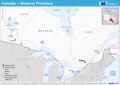 20160728 ECHO Canada Ontario Province.pdf 1,754 × 1,239; 453 KB
-
 ECDM 11052016 Canada USA events.pdf 1,625 × 1,125; 500 KB
-
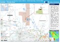 ECDM 20160504 Canada ForestFires.pdf 1,625 × 1,125; 683 KB