Category:2016 maps of Washington, D.C.
Jump to navigation
Jump to search
States of the United States: Arizona · California · Indiana · Iowa · Massachusetts · New York · Pennsylvania · Utah · Virginia – Washington, D.C.
| ← 2010 2013 2016 2018 |
Media in category "2016 maps of Washington, D.C."
The following 8 files are in this category, out of 8 total.
-
 NPS east-potomac-park-map.jpg 1,350 × 1,980; 336 KB
-
 NPS east-potomac-park-map.pdf 1,687 × 2,475; 2.45 MB
-
 NPS national-mall-3d-map.jpg 4,620 × 1,620; 1.18 MB
-
 NPS national-mall-bike-map.jpg 3,810 × 2,303; 2.49 MB
-
 NPS national-mall-map.jpg 4,519 × 3,371; 2.72 MB
-
 NPS national-mall-map.pdf 3,387 × 2,527; 10.79 MB
-
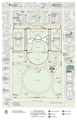
 NPS white-house-map.gif 1,560 × 2,423; 361 KB
-
 NPS white-house-map.pdf 2,925 × 4,543; 373 KB


