Category:2020 U.S. presidential election maps by state, Republican primary
Jump to navigation
Jump to search
Media in category "2020 U.S. presidential election maps by state, Republican primary"
The following 23 files are in this category, out of 23 total.
-

-
 2020 Massachusetts Republican presidential primary - Results by town.svg 810 × 502; 182 KB
-

-

-

-
 2020 Utah Republican Presidential Caucuses election by county.svg 810 × 810; 28 KB
-
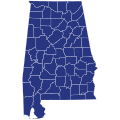
 2020ALGOPCD.svg 269 × 418; 98 KB
-
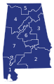
 2020ALGOPprimary.svg 810 × 810; 43 KB
-
 2020CAGOP.svg 810 × 810; 63 KB
-
 2020CAGOPCD.svg 810 × 810; 262 KB
-
 2020IAGOPcaucus.svg 810 × 532; 31 KB
-
 2020IAGOPcaucusCD.svg 810 × 532; 72 KB
-
 2020IAGOPcaucusCDvote.svg 482 × 326; 492 KB
-
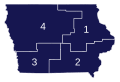
 2020IAGOPpresidentialcaucus.svg 744 × 498; 179 KB
-
 2020MEGOPpresidentialprimaries.png 800 × 1,129; 70 KB
-
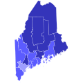 2020MEGOPpresidentialprimaries.svg 810 × 810; 43 KB
-
 2020MEGOPpresidentialprimariesdistrict.png 800 × 1,076; 68 KB
-
 2020NHGOPpresidentialCD.svg 810 × 810; 47 KB
-
 2020NHGOPpresidentialCDprimary.svg 810 × 810; 47 KB
-
 2020NHGOPpresidentialprimary.svg 744 × 744; 49 KB
-
 2020NHGOPprimary.svg 810 × 810; 14 KB
-
 Iowa - President - Republican Caucuses - Map - Counties.png 1,920 × 1,080; 129 KB
-
 Iowa - President - Republican Caucuses - Map - Counties.svg 512 × 396; 170 KB


