Category:21st-century maps of Prince Edward Island
Jump to navigation
Jump to search
Provinces and territories of Canada: Alberta · New Brunswick · Newfoundland and Labrador · Nova Scotia · Ontario · Prince Edward Island · Quebec · Saskatchewan · Northwest Territories · Nunavut · Yukon
Media in category "21st-century maps of Prince Edward Island"
The following 18 files are in this category, out of 18 total.
-
 2007 Prince Edward Island general election - Popular vote by polling division.svg 4,042 × 2,913; 4.26 MB
-
 2011 Prince Edward Island general election - Popular vote by polling division.svg 4,042 × 2,913; 4.27 MB
-
 2015 Prince Edward Island general election - Popular vote by polling division.svg 4,042 × 2,913; 4.29 MB
-

-

-
 2019 PEI Polls Map.svg 818 × 548; 9.17 MB
-
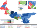
 2023 PEI General Election Map.svg 818 × 548; 5.91 MB
-
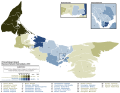
 2023 PEI Polls Map.svg 818 × 548; 9.2 MB
-
 Pei elections 2007.png 607 × 300; 48 KB
-
 PEI Election 2007.svg 1,039 × 761; 477 KB
-
 Pei2011.png 610 × 416; 21 KB
-
 Pei2015.png 610 × 416; 14 KB
-
 Prince Edward Island Election 2011 Map.svg 1,039 × 691; 161 KB
-
 Prince Edward Island Election Map 2015.svg 1,039 × 785; 556 KB
-
 Prince Edward Island general election 2019 - Results by Riding.svg 1,554 × 1,207; 3.78 MB
-
 Prince Edward Island general election, 2000 - Results By Riding.svg 1,048 × 723; 157 KB
-
 Prince Edward Island general election, 2003 - Results By Riding.svg 1,048 × 723; 156 KB
-
 Prince Edward Island MMP Referendum 2019 - Results by Riding.svg 1,554 × 1,207; 1.09 MB


