Category:23 Wojska Polskiego Street in Paczków
Jump to navigation
Jump to search
| Object location | | View all coordinates using: OpenStreetMap |
|---|
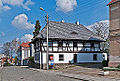
house in Paczków, Poland  | |||||
| Upload media | |||||
| Instance of | |||||
|---|---|---|---|---|---|
| Location | Paczków, Gmina Paczków, Nysa County, Opole Voivodeship, Poland | ||||
| Street address |
| ||||
| Heritage designation |
| ||||
| Inception |
| ||||
 | |||||
Polski: [:pl:Paczków
Media in category "23 Wojska Polskiego Street in Paczków"
The following 6 files are in this category, out of 6 total.
-
 2014 Paczków, ul Wojska Polskiego 23 01.JPG 2,406 × 2,133; 3.71 MB
-
 2014 Paczków, ul Wojska Polskiego 23 02.JPG 2,867 × 2,110; 4.13 MB
-
 2014 Paczków, ul Wojska Polskiego 23 03.JPG 3,075 × 2,196; 4.04 MB
-
 2014 Paczków, ul Wojska Polskiego 23 04.JPG 2,974 × 2,007; 3.7 MB
-
 Paczkow - dom kata PL.jpg 800 × 600; 127 KB
-
 Paczków, ul. Wojska Polskiego 23.jpg 2,048 × 1,536; 662 KB


