Category:56 Niepodległości Street in Nowa Ruda
Jump to navigation
Jump to search
| Object location | | View all coordinates using: OpenStreetMap |
|---|
Media in category "56 Niepodległości Street in Nowa Ruda"
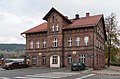
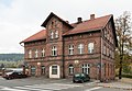
The following 7 files are in this category, out of 7 total.
-
 2016 Nowa Ruda, ul. Niepodległości 56 1.jpg 4,087 × 2,781; 6.36 MB
-
 2016 Nowa Ruda, ul. Niepodległości 56 2.jpg 3,724 × 2,456; 5.71 MB
-
 2016 Nowa Ruda, ul. Niepodległości 56 3.jpg 4,155 × 2,916; 7.23 MB
-
 2016 Nowa Ruda, ul. Niepodległości 56 4.jpg 3,666 × 2,526; 6 MB
-
 NowaRudaZWiK.JPG 1,998 × 1,484; 2.13 MB
-
 NowaRudaZWiK1.JPG 2,048 × 1,536; 741 KB
-
 NowaRudaZWiK2.JPG 2,048 × 1,536; 936 KB


