Category:A-Kerkhof 30 (Groningen)
Jump to navigation
Jump to search
| Object location | | View all coordinates using: OpenStreetMap |
|---|
 | |||||
| Upload media | |||||
| Instance of | |||||
|---|---|---|---|---|---|
| Location | Groningen, Netherlands | ||||
| Street address |
| ||||
| Heritage designation |
| ||||
 | |||||
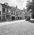
Nederlands: Vm. koetshuis met bovenwoning, 1897, G. Nijhuis
|
This is a category about rijksmonument number 485423
|
| Address |
|
Media in category "A-Kerkhof 30 (Groningen)"
The following 2 files are in this category, out of 2 total.
-
 Groningen Akerkhof 30.JPG 3,264 × 2,448; 4.72 MB
-
 Overzicht voorgevels - Groningen - 20365402 - RCE.jpg 1,176 × 1,200; 368 KB
