Category:A395 road (England)
Jump to navigation
Jump to search

road in England | |||||
| Upload media | |||||
| Instance of | |||||
|---|---|---|---|---|---|
| Location |
| ||||
| Transport network |
| ||||
| |||||
Media in category "A395 road (England)"
The following 17 files are in this category, out of 17 total.
-
 Cottages at Hallworthy - geograph.org.uk - 731925.jpg 640 × 480; 68 KB
-
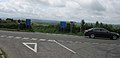 Cross roads on A395 - geograph.org.uk - 437313.jpg 640 × 308; 42 KB
-
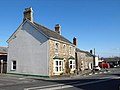
 Hallworthy - geograph.org.uk - 729188.jpg 640 × 425; 79 KB
-
 Junction at Hallworthy - geograph.org.uk - 731929.jpg 640 × 480; 130 KB
-
 Pipers Pool - geograph.org.uk - 437307.jpg 640 × 480; 83 KB
-
 Pipers Pool - geograph.org.uk - 699985.jpg 640 × 411; 53 KB
-
 Road junction on A395 - geograph.org.uk - 730772.jpg 640 × 406; 61 KB
-
 Ruin by the A395 - geograph.org.uk - 731796.jpg 480 × 640; 141 KB
-
 South Petherwin, near Botathan - geograph.org.uk - 511657.jpg 640 × 427; 217 KB
-
 Treneglos, the A395 on Wilsey Down - geograph.org.uk - 556991.jpg 640 × 427; 211 KB
-
 UK road A395.PNG 568 × 184; 9 KB
-
 A395 - geograph.org.uk - 731854.jpg 640 × 480; 100 KB
-
 A395 at Tremblary - geograph.org.uk - 731777.jpg 640 × 480; 132 KB
-
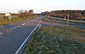
 A395 below Tresoke - geograph.org.uk - 729173.jpg 640 × 477; 90 KB
-
 A395 near Tresoke - geograph.org.uk - 731867.jpg 640 × 480; 82 KB
-
 A395 on Kittow's Moor - geograph.org.uk - 728939.jpg 640 × 480; 73 KB
-
 Layby on A395 - geograph.org.uk - 731870.jpg 640 × 480; 74 KB


