Category:A711 road (Scotland)
Jump to navigation
Jump to search

road in Scotland | |||||
| Upload media | |||||
| Instance of | |||||
|---|---|---|---|---|---|
| Location |
| ||||
| Transport network |
| ||||
| Has part(s) |
| ||||
| |||||
Subcategories
This category has only the following subcategory.
S
Media in category "A711 road (Scotland)"
The following 21 files are in this category, out of 21 total.
-
 A711 Junction - geograph.org.uk - 444613.jpg 640 × 480; 108 KB
-
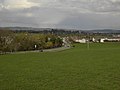
 Approaching Dundrennan on the A711 - geograph.org.uk - 572572.jpg 640 × 480; 131 KB
-
 Bridge over the Abbey Burn - geograph.org.uk - 1627066.jpg 640 × 464; 75 KB
-
 End of speed restrictons on the A711 - geograph.org.uk - 2112181.jpg 1,835 × 1,354; 725 KB
-
 Kirkgunzeon station site geograph-3727252-by-Ben-Brooksbank.jpg 2,394 × 1,335; 2.75 MB
-
 Lay-by beside the A711 - geograph.org.uk - 2112231.jpg 2,495 × 1,630; 841 KB
-
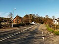
 Leaving Dumfries - geograph.org.uk - 782528.jpg 640 × 480; 50 KB
-
 Road junction - geograph.org.uk - 572562.jpg 640 × 480; 111 KB
-
 Road junction off the A711 - geograph.org.uk - 572556.jpg 640 × 480; 129 KB
-
 Road junction on the A711 - geograph.org.uk - 1307429.jpg 640 × 441; 79 KB
-

-
 Roundabout on the A711 - geograph.org.uk - 2112174.jpg 2,402 × 1,773; 781 KB
-
 School patrol road sign - geograph.org.uk - 1309690.jpg 640 × 491; 81 KB
-
 The A711 Dumfries to Dalbeatie road - geograph.org.uk - 571149.jpg 640 × 480; 130 KB
-
 The A711 road at Screel - geograph.org.uk - 572608.jpg 640 × 480; 115 KB
-
 The A711 road north of Dalbeattie - geograph.org.uk - 571319.jpg 640 × 480; 146 KB
-
 The A711 road west of Dundrennan - geograph.org.uk - 572544.jpg 640 × 480; 127 KB
-

-
 Tongland Village.jpg 640 × 480; 80 KB
-
 Townhead Telephone Exchange - geograph.org.uk - 694715.jpg 640 × 480; 83 KB
-
 UK road A711.PNG 597 × 184; 5 KB


