Category:Abbots Bromley
Jump to navigation
Jump to search

village and civil parish in Staffordshire, UK  | |||||
| Upload media | |||||
| Instance of | |||||
|---|---|---|---|---|---|
| Location | East Staffordshire, Staffordshire, West Midlands, England | ||||
 | |||||
Subcategories
This category has the following 10 subcategories, out of 10 total.
A
- Abbots Bromley horn dance (18 F)
- Abbots Bromley War Memorial (3 F)
E
- Environs of Abbots Bromley (4 F)
H
- Houses in Abbots Bromley (6 F)
N
P
R
- Anna Richardson (1 F)
S
Media in category "Abbots Bromley"
The following 200 files are in this category, out of 324 total.
(previous page) (next page)-
 A bend in Orange Lane - geograph.org.uk - 3554126.jpg 640 × 480; 90 KB
-
 A bend in the B5013 - geograph.org.uk - 3421691.jpg 640 × 480; 72 KB
-
 AB Netball training.jpg 2,158 × 3,089; 1.15 MB
-
 Abbots Bromley - geograph.org.uk - 5734457.jpg 640 × 480; 46 KB
-
 Abbots Bromley Community Fire Station.jpg 4,272 × 2,848; 2.23 MB
-
 Abbots Bromley High Street - geograph.org.uk - 5630241.jpg 640 × 360; 69 KB
-
 Abbots Bromley Netball Club.jpg 3,264 × 2,448; 2.04 MB
-
 Abbots Bromley original hobby horse.jpg 1,199 × 1,799; 830 KB
-
 Abbots Bromley, East along Bagot Street - geograph.org.uk - 4937442.jpg 4,943 × 3,097; 6.75 MB
-
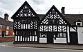 Abbots Bromley, Half timbered building in Bagot Street - geograph.org.uk - 4937437.jpg 5,144 × 3,202; 7.11 MB
-
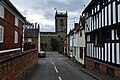 Abbots Bromley, St. Nicholas' Church - geograph.org.uk - 4937431.jpg 3,678 × 2,455; 4.67 MB
-
 Abbots Bromley, Staffs - geograph.org.uk - 928116.jpg 640 × 426; 57 KB
-
 Abbots Bromley, The Butter Cross - geograph.org.uk - 4937452.jpg 3,679 × 2,456; 4.25 MB
-
 Abbots Bromley, The Butter Cross - geograph.org.uk - 4937488.jpg 5,128 × 3,161; 7.54 MB
-
 Abbots Bromley, Village information and notice board - geograph.org.uk - 4937496.jpg 4,083 × 2,319; 6.63 MB
-
 Aborted landing - geograph.org.uk - 3554923.jpg 640 × 480; 43 KB
-
 All safely back on the ground - geograph.org.uk - 3555077.jpg 640 × 480; 67 KB
-
 Almshouses Bagot Street - geograph.org.uk - 5067382.jpg 3,456 × 2,304; 3.58 MB
-
 And they're off^ - geograph.org.uk - 439462.jpg 640 × 480; 189 KB
-
 Ash Brook Farm - geograph.org.uk - 439548.jpg 640 × 480; 89 KB
-
 Ashbrook and Bridge, Pinfold Lane - geograph.org.uk - 2546873.jpg 640 × 428; 102 KB
-
 Ashbrook Farm - geograph.org.uk - 440389.jpg 640 × 480; 97 KB
-
 Ashbrook Lane (B5234) - geograph.org.uk - 3421759.jpg 640 × 480; 79 KB
-
 Ashbrook Lane (B5234) in Abbots Bromley - geograph.org.uk - 5053370.jpg 4,000 × 3,000; 3.5 MB
-
 Ashbrook Lane, Heading East - geograph.org.uk - 439609.jpg 640 × 480; 65 KB
-
 Ashbrook Plantation from Ashlands - geograph.org.uk - 439590.jpg 640 × 480; 68 KB
-
 Ashbrook Plantation from Pinfold Lane - geograph.org.uk - 439568.jpg 640 × 480; 63 KB
-
 Ashlands - geograph.org.uk - 439577.jpg 640 × 480; 153 KB
-
 B5013 approaching junction - geograph.org.uk - 3421690.jpg 640 × 480; 86 KB
-
 B5013 towards Abbots Bromley - geograph.org.uk - 3421678.jpg 640 × 480; 78 KB
-
 B5013 towards Uttoxeter - geograph.org.uk - 5563802.jpg 640 × 480; 111 KB
-
 B5013 towards Uttoxeter - geograph.org.uk - 5564516.jpg 640 × 480; 121 KB
-
 B5013 towards Uttoxeter - geograph.org.uk - 5564520.jpg 640 × 480; 80 KB
-
 B5013 towards Uttoxeter - geograph.org.uk - 5564522.jpg 640 × 480; 94 KB
-
 B5014 towards Abbots Bromley - geograph.org.uk - 3421696.jpg 640 × 480; 50 KB
-
 B5234 heading east - geograph.org.uk - 3421796.jpg 640 × 480; 80 KB
-
 B5234 heading east - geograph.org.uk - 3421817.jpg 640 × 480; 74 KB
-
 B5234 heading east - geograph.org.uk - 3421828.jpg 640 × 480; 89 KB
-
 Bagot Almshouses, Abbots Bromley.jpg 1,600 × 1,064; 424 KB
-
 Bagot Street - Abbots Bromley (geograph 4030307).jpg 4,608 × 2,636; 5.49 MB
-
 Bagot Street - geograph.org.uk - 5067397.jpg 3,456 × 2,304; 3.4 MB
-
 Bagot Street, Abbots Bromley, Staffs - geograph.org.uk - 928118.jpg 640 × 426; 67 KB
-
 Bagot Street, Abbots Bromley, Staffs - geograph.org.uk - 928119.jpg 640 × 426; 63 KB
-
 Bagot's Bromley - geograph.org.uk - 1136644.jpg 640 × 479; 190 KB
-
 Bagot's Bromley Cottages - geograph.org.uk - 1136672.jpg 640 × 479; 120 KB
-
 Bagot's Bromley Farm - geograph.org.uk - 1136671.jpg 640 × 479; 155 KB
-
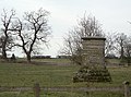 Bagot's Bromley monument - geograph.org.uk - 1136681.jpg 640 × 476; 190 KB
-
 Barn conversion at Highelms Farm - geograph.org.uk - 3863589.jpg 1,600 × 1,064; 406 KB
-
 Bath Wood - geograph.org.uk - 5235847.jpg 1,600 × 1,066; 473 KB
-
 Beech Nurseries, near Bromley Wood - geograph.org.uk - 402735.jpg 640 × 474; 113 KB
-
 Bentilee - geograph.org.uk - 402725.jpg 640 × 480; 156 KB
-
 Birds at Blithfield - geograph.org.uk - 2071394.jpg 1,024 × 768; 108 KB
-
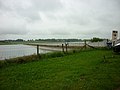
 Blithfield Reservoir - geograph.org.uk - 123378.jpg 640 × 480; 94 KB
-
 Blithfield reservoir - geograph.org.uk - 2432151.jpg 640 × 480; 153 KB
-
 Blithfield Reservoir - geograph.org.uk - 2439140.jpg 800 × 600; 238 KB
-
 Blithfield Reservoir - geograph.org.uk - 2460091.jpg 640 × 428; 57 KB
-
 Blithfield Reservoir - geograph.org.uk - 3421669.jpg 1,200 × 900; 255 KB
-
 Blithfield Reservoir - geograph.org.uk - 4030276.jpg 3,723 × 2,827; 4.06 MB
-
 Blithfield Reservoir - geograph.org.uk - 5397567.jpg 2,000 × 1,333; 1.9 MB
-
 Blithfield Reservoir car park - geograph.org.uk - 1919934.jpg 1,024 × 768; 122 KB
-
 Blithfield Reservoir shoreline - geograph.org.uk - 2071341.jpg 1,024 × 768; 170 KB
-
 Blunts Hollow - geograph.org.uk - 4030320.jpg 3,241 × 2,111; 2.88 MB
-
 Blunts Hollow approaching the junction with Glass Lane - geograph.org.uk - 4030317.jpg 3,208 × 2,688; 3.69 MB
-
 Blunts Hollow entering Hoar Cross - geograph.org.uk - 3555092.jpg 640 × 480; 82 KB
-
 Breach House - geograph.org.uk - 439562.jpg 640 × 480; 78 KB
-
 Bridge on the way to Newlands - geograph.org.uk - 439372.jpg 640 × 480; 167 KB
-
 Bridleway off the B5013 - geograph.org.uk - 2535910.jpg 640 × 428; 118 KB
-
 Buildings at Slate House Farm - geograph.org.uk - 4030339.jpg 3,208 × 2,362; 3.17 MB
-
 Cattle towards Heatley Bank Farm - geograph.org.uk - 5563804.jpg 640 × 480; 68 KB
-
 Certified campsite - geograph.org.uk - 1136682.jpg 640 × 479; 281 KB
-
 Church Lane, Abbots Bromley, Staffs - geograph.org.uk - 928103.jpg 640 × 456; 82 KB
-
 Church Lane, Abbots Bromley, Staffs - geograph.org.uk - 928121.jpg 640 × 426; 57 KB
-
 Coming in to land - geograph.org.uk - 3554932.jpg 480 × 640; 50 KB
-
 Controlled felling - geograph.org.uk - 1136638.jpg 640 × 479; 260 KB
-

-
 Cross of the Hand (1) - geograph.org.uk - 2071407.jpg 1,024 × 768; 102 KB
-
 Cross of the Hand (2) - geograph.org.uk - 2071413.jpg 1,024 × 768; 124 KB
-
 Cross of the Hand (3) - geograph.org.uk - 2071420.jpg 1,024 × 768; 560 KB
-
 Cross of the Hand (4) - geograph.org.uk - 2071426.jpg 1,024 × 768; 134 KB
-
 Cross of the Hand (5) - geograph.org.uk - 2071429.jpg 1,024 × 768; 121 KB
-
 Cross Roads near Netherwood Farm - geograph.org.uk - 2540196.jpg 640 × 428; 67 KB
-
 Dairy farming near Abbots Bromley - geograph.org.uk - 402717.jpg 640 × 480; 175 KB
-
 Disused and Scrap Farm Machinery - geograph.org.uk - 2546771.jpg 640 × 428; 66 KB
-

-
 Driveway Leaving Bromley Park Farm - geograph.org.uk - 2540203.jpg 640 × 428; 76 KB
-
 Driveway to Bagot's Bromley Farm - geograph.org.uk - 1136673.jpg 479 × 640; 194 KB
-
 Dunstal - geograph.org.uk - 1136685.jpg 640 × 479; 237 KB
-
 Dunstal Brook - geograph.org.uk - 1136690.jpg 640 × 479; 204 KB
-
 Dunstal Hall Farm - geograph.org.uk - 1136687.jpg 640 × 479; 124 KB
-
 Dunstal Lane - geograph.org.uk - 1136683.jpg 640 × 479; 121 KB
-
 Early evening on the Causeway - geograph.org.uk - 1439899.jpg 425 × 640; 66 KB
-
 Earthwork at Bagot's Bromley - geograph.org.uk - 1136678.jpg 640 × 477; 168 KB
-
 Earthwork at Bagot's Bromley - geograph.org.uk - 1136679.jpg 640 × 479; 132 KB
-
 Edge of Warren Plantation - geograph.org.uk - 3421685.jpg 640 × 480; 91 KB
-
 Entering Willslock - geograph.org.uk - 5564524.jpg 640 × 480; 64 KB
-
 Entrance to Fishers Pit Farm - geograph.org.uk - 2540209.jpg 640 × 428; 71 KB
-

-
 Entrance to Little Dunstal Farm - geograph.org.uk - 2535791.jpg 640 × 428; 79 KB
-
-
 Entrance to Warren Farm - geograph.org.uk - 1136691.jpg 640 × 479; 246 KB
-
 Estate, Abbots Bromley - geograph.org.uk - 2459895.jpg 640 × 428; 68 KB
-
 Evening tree shadow, north of Hobb Lane - geograph.org.uk - 5859012.jpg 1,024 × 576; 171 KB
-
 Farm at Hall Hill - geograph.org.uk - 439277.jpg 640 × 480; 101 KB
-
 Farm building off Ashbrook Lane - geograph.org.uk - 3421753.jpg 1,024 × 579; 110 KB
-
 Farm building, Slate House Farm - geograph.org.uk - 3421787.jpg 640 × 480; 61 KB
-
 Farm buildings, Blunts Hollow - geograph.org.uk - 3555083.jpg 640 × 480; 117 KB
-
 Farm track near Parkgate - geograph.org.uk - 3421836.jpg 640 × 480; 67 KB
-
 Farm track off Ashbrook Lane - geograph.org.uk - 3421754.jpg 1,024 × 768; 231 KB
-
 Farm track off Pinfold Lane - geograph.org.uk - 3421779.jpg 640 × 480; 92 KB
-
 Farming 2011 - geograph.org.uk - 2546826.jpg 640 × 428; 84 KB
-
 Farmland and hot air balloon - geograph.org.uk - 3554141.jpg 480 × 640; 33 KB
-
 Farmland and hot air balloon - geograph.org.uk - 3554146.jpg 480 × 640; 41 KB
-

-
 Farmland at The Warren - geograph.org.uk - 4030303.jpg 3,798 × 2,539; 4.62 MB
-
 Farmland between Hobb Lane and Floyer's Coppice - geograph.org.uk - 5859067.jpg 1,024 × 768; 190 KB
-
 Farmland near Gilleon's Hall - geograph.org.uk - 3554132.jpg 900 × 1,200; 269 KB
-
 Farmland near Heatley Hall - geograph.org.uk - 1136670.jpg 640 × 479; 144 KB
-
 Farmland near Yeatsall - geograph.org.uk - 3421676.jpg 640 × 480; 59 KB
-
 Farmland north of Hobb Lane - geograph.org.uk - 5859019.jpg 1,024 × 768; 277 KB
-
 Farmland north of the B5234 - geograph.org.uk - 3421800.jpg 640 × 480; 43 KB
-
 Farmland off Glass Lane - geograph.org.uk - 2546809.jpg 640 × 428; 93 KB
-
 Farmland off Glass Lane - geograph.org.uk - 3554135.jpg 640 × 480; 61 KB
-
 Farmland off Pinfold Lane - geograph.org.uk - 3421768.jpg 640 × 480; 89 KB
-
 Farmland off Uttoxeter Road - geograph.org.uk - 3421693.jpg 640 × 480; 63 KB
-
 Farmland on the south side of Hobb Lane - geograph.org.uk - 5859059.jpg 1,024 × 768; 198 KB
-
 Farmland towards Hart's Farm - geograph.org.uk - 3421775.jpg 640 × 480; 68 KB
-
 Farmland, Blunts Hollow - geograph.org.uk - 3555088.jpg 640 × 480; 76 KB
-
 Farmland, Bromley Hurst - geograph.org.uk - 3554116.jpg 640 × 480; 51 KB
-
 Farmland, Mount Pleasant - geograph.org.uk - 3554120.jpg 640 × 480; 77 KB
-
 Farmland, Parkgate - geograph.org.uk - 3421831.jpg 640 × 480; 87 KB
-
 Farmland, Rookery Farm - geograph.org.uk - 3554124.jpg 640 × 480; 69 KB
-
 Farmland, The Warren - geograph.org.uk - 3421686.jpg 640 × 480; 72 KB
-
 Fenceline with tree - geograph.org.uk - 231366.jpg 480 × 640; 95 KB
-
 Field and Woodland View at Bagots Park Triangulation Pillar - geograph.org.uk - 5052868.jpg 4,000 × 3,000; 3.56 MB
-
 Field near Cook's Coppice - geograph.org.uk - 5563791.jpg 640 × 480; 57 KB
-
 Field of Wheat - geograph.org.uk - 2537132.jpg 640 × 428; 89 KB
-
 Fishers Pit Farm - geograph.org.uk - 439616.jpg 640 × 480; 125 KB
-

-
 Follow the hedge - follow Ash Brook - geograph.org.uk - 439543.jpg 640 × 466; 190 KB
-
 Footpath above Abbots Bromley - geograph.org.uk - 181977.jpg 640 × 427; 84 KB
-
 Footpath Crossing Seedcroft Lane - geograph.org.uk - 2459975.jpg 640 × 428; 112 KB
-
 Footpath From Bromley Wood - geograph.org.uk - 2486948.jpg 1,496 × 1,122; 697 KB
-
 Footpath from Glass Lane - geograph.org.uk - 2546843.jpg 640 × 428; 123 KB
-
 Footpath from Heatley Green Farm - geograph.org.uk - 2535891.jpg 640 × 428; 111 KB
-

-
 Footpath near Gilleon's Hall - geograph.org.uk - 3554128.jpg 640 × 480; 91 KB
-
 Footpath Near Hart Farm - geograph.org.uk - 440358.jpg 640 × 480; 78 KB
-
 Footpath off Port Lane - geograph.org.uk - 1136725.jpg 479 × 640; 167 KB
-
 Footpath off Port Lane - geograph.org.uk - 1136729.jpg 640 × 479; 195 KB
-
 Footpath Through Poplar Farm - geograph.org.uk - 440409.jpg 640 × 480; 88 KB
-
 Footpath to B5234 - geograph.org.uk - 439606.jpg 640 × 480; 68 KB
-
 Footpath To Forge Farm - geograph.org.uk - 440374.jpg 640 × 480; 84 KB
-
 Ford in the field, Bridge on the road - geograph.org.uk - 439476.jpg 640 × 480; 129 KB
-
 Forest track - geograph.org.uk - 1136640.jpg 640 × 479; 224 KB
-
 Forge Farm - geograph.org.uk - 439340.jpg 640 × 480; 95 KB
-
-
 Gated track to Coppice Farm - geograph.org.uk - 5859054.jpg 1,024 × 768; 127 KB
-
 Gateway off Heatley Lane - geograph.org.uk - 1136650.jpg 479 × 640; 267 KB
-
 Glass Lane - geograph.org.uk - 3554136.jpg 640 × 480; 112 KB
-
 Glass Lane - geograph.org.uk - 3554917.jpg 640 × 480; 93 KB
-
 Goats Lodge, Abbots Bromley.jpg 640 × 428; 73 KB
-
 Grange Farm - geograph.org.uk - 4030316.jpg 4,358 × 1,515; 2.98 MB
-
 Grass Field on the B5234 - geograph.org.uk - 2540182.jpg 640 × 428; 72 KB
-
 Grazing Greylag - geograph.org.uk - 1136740.jpg 640 × 479; 178 KB
-
 Green Lane Perhaps - geograph.org.uk - 2459960.jpg 640 × 428; 120 KB
-
 Guardhouse for RAF Abbots Bromley - geograph.org.uk - 2535756.jpg 640 × 428; 99 KB
-
 Hart's Farm taken from SK 1025 - geograph.org.uk - 2682484.jpg 640 × 428; 78 KB
-

-
 Heatley - geograph.org.uk - 1136652.jpg 640 × 422; 157 KB
-
 Heatley Back Lane - geograph.org.uk - 1136658.jpg 640 × 479; 175 KB
-
 Heatley Back Lane - geograph.org.uk - 1136662.jpg 479 × 640; 265 KB
-
 Heatley Bank Farm - geograph.org.uk - 5564517.jpg 640 × 454; 49 KB
-
 Heatley Green Farm - geograph.org.uk - 1136611.jpg 640 × 469; 125 KB
-
 Heatley Green Farm - geograph.org.uk - 1136612.jpg 640 × 479; 172 KB
-
 Heatley Hall Farm - geograph.org.uk - 1136660.jpg 640 × 479; 174 KB
-
 Heatley Hall Farm - geograph.org.uk - 1136665.jpg 640 × 479; 125 KB
-
 Heatley Hall Farm - geograph.org.uk - 1136668.jpg 640 × 479; 155 KB
-
 Heatley Hall Farmhouse - geograph.org.uk - 2535863.jpg 640 × 428; 92 KB
-
 Heatley Lane - geograph.org.uk - 1136616.jpg 640 × 479; 227 KB
-
 Herd of Jersey Cows - geograph.org.uk - 2535937.jpg 640 × 428; 86 KB
-
 High Street, Abbots Bromley - geograph.org.uk - 3421744.jpg 640 × 480; 60 KB
-
 High Street, Abbots Bromley - geograph.org.uk - 5630226.jpg 640 × 360; 66 KB
-
 Hobb Lane - geograph.org.uk - 2537099.jpg 640 × 428; 86 KB
-
 Hobb Lane off the B5013 - geograph.org.uk - 2439908.jpg 800 × 600; 250 KB
-
 Hobb Lane, heading eastwards from the B5013 - geograph.org.uk - 5859003.jpg 1,024 × 768; 217 KB
-
 Hobb Lane, looking east - geograph.org.uk - 5859063.jpg 1,024 × 768; 187 KB
-

-

-
 Houses on Seedcroft Lane - geograph.org.uk - 1136758.jpg 640 × 422; 96 KB
-

-
 Just made it^ - geograph.org.uk - 3554930.jpg 480 × 640; 53 KB
-
 Knobbly Oak - geograph.org.uk - 1136647.jpg 479 × 640; 284 KB
-

-
 Lane heading south - geograph.org.uk - 3554123.jpg 640 × 480; 79 KB
-
 Lane near Gilleon's Hall - geograph.org.uk - 3554127.jpg 640 × 480; 70 KB
-
 Lane to Hart's and Park Farms - geograph.org.uk - 5053386.jpg 4,000 × 3,000; 3.03 MB
-
 Lane To Poplar Farm - geograph.org.uk - 440411.jpg 640 × 480; 104 KB
-
 Large field off the B5013 - geograph.org.uk - 5564519.jpg 640 × 480; 75 KB
-
 Lichfield Road (B5014) - geograph.org.uk - 3421749.jpg 640 × 480; 62 KB
-
 Lichfield Road (B5014) - geograph.org.uk - 3554117.jpg 640 × 480; 78 KB


_-_geograph.org.uk_-_3421759.jpg)
_in_Abbots_Bromley_-_geograph.org.uk_-_5053370.jpg)


.jpg)


_-_geograph.org.uk_-_2071407.jpg)
_-_geograph.org.uk_-_2071413.jpg)
_-_geograph.org.uk_-_2071420.jpg)
_-_geograph.org.uk_-_2071426.jpg)
_-_geograph.org.uk_-_2071429.jpg)


_at_Slate_House_-_geograph.org.uk_-_5053339.jpg)


_-_geograph.org.uk_-_3421749.jpg)
_-_geograph.org.uk_-_3554117.jpg)