Category:Abbottabad District maps
Jump to navigation
Jump to search
Media in category "Abbottabad District maps"
The following 22 files are in this category, out of 22 total.
-
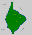
 Abbottabad NWFP2.svg 1,000 × 1,075; 142 KB
-
 Abbottabad Union Councils.svg 397 × 391; 98 KB
-
 Abbottabad District, Khyber Pakhtunkhwa.png 3,840 × 3,840; 1.23 MB
-
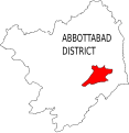
 Abbottabad Thumb.png 300 × 260; 39 KB
-
 Bagnotar Sub Div.svg 1,539 × 1,033; 8 KB
-
 Bakot Sub Div.svg 502 × 568; 9 KB
-
 Berote Kalan Sub Div.svg 677 × 552; 10 KB
-
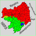
 Khyber Pakhtunkhwa Districts AbbotAbad.svg 2,682 × 4,166; 491 KB
-
 KKH.png 595 × 851; 1.46 MB
-
 Malkot Abbottabad.svg 613 × 498; 32 KB
-
 Nagri Tutial Abbottabad.png 600 × 490; 15 KB
-
 Namli Maira Abbottabad.png 571 × 493; 13 KB
-
 Nathia Gali Abbottabad.png 435 × 447; 9 KB
-
 Nathia Gali NWFP.svg 435 × 447; 47 KB
-
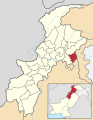 Pakistan - Khyber Pakhtunkhwa - Abbottabad.svg 654 × 841; 207 KB
-
 Palak Sub Div.svg 716 × 777; 17 KB
-
 Seer Gharbi Abbottabad.png 571 × 530; 54 KB
-
 Seer Gharbi Abbottabad.svg 397 × 391; 98 KB
-
 Sirban Hill Geology.jpg 2,502 × 2,552; 5.69 MB
-
 Ast KKH.png 420 × 599; 331 KB
-
 Salhad Abbottabad.svg 573 × 496; 36 KB
-
 काराकोरम राजमार्ग.png 595 × 851; 450 KB


