Category:Aerial photographs of Clallam County, Washington
Jump to navigation
Jump to search
Media in category "Aerial photographs of Clallam County, Washington"
The following 15 files are in this category, out of 15 total.
-

-
 Aerial photograph of Sooes River mouth on Makah Reservation.jpg 2,560 × 1,920; 1.78 MB
-
 Aerial view of Port Angeles.jpg 4,272 × 2,848; 1.75 MB
-
 Dungeness National Wildlife Refuge aerial.jpg 660 × 195; 23 KB
-
-
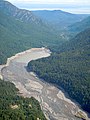
 Elwha river nearshore silt drift NPS Photo 2012 (17137801028).jpg 3,648 × 2,736; 1.67 MB
-
 Gline's Canyon Dam Elwha river arial NPS Photo 2011 (16703100864).jpg 1,475 × 1,600; 468 KB
-
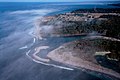
 La Push River mouth.jpg 2,560 × 1,920; 1.74 MB
-
-
 Makah Nation and Waatch River - panoramio.jpg 2,560 × 1,920; 1.49 MB
-
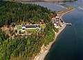 Marine Sciences Laboratory at the Pacific Northwest National Laboratory.jpg 4,200 × 3,000; 2.84 MB
-
 Point of the Arches, Washington - panoramio.jpg 2,560 × 1,920; 1.73 MB
-
 PORT ANGELES AND OLYMPIC MOUNTAINS - NARA - 552171.jpg 3,000 × 2,026; 656 KB
-
 PortAngeles.jpg 448 × 336; 22 KB
-
 Quileute Nation & La Push, Washington - panoramio.jpg 2,440 × 1,538; 1.38 MB
.jpg)


.jpg)
.jpg)
.jpg)

.jpg)


