Category:Aerial photographs of lakes of Germany
Jump to navigation
Jump to search
Subcategories
This category has the following 16 subcategories, out of 16 total.
A
- Aerial views of Rurtalsperre (15 F)
B
- Aerial photographs of Balksee (31 F)
C
H
M
- Aerial photographs of Müritz (14 F)
O
S
Media in category "Aerial photographs of lakes of Germany"
The following 200 files are in this category, out of 387 total.
(previous page) (next page)-
 20140601 120632 Venner Moor, Senden (DSC02061).jpg 4,912 × 3,264; 3.49 MB
-
 20140601 121713 Aasee, Münster (DSC02111).jpg 4,912 × 3,264; 2.35 MB
-
 20140601 122324 Rieselfelder, Münster (DSC02134).jpg 4,912 × 3,264; 2.58 MB
-
 20140601 122327 Rieselfelder, Münster (DSC02135).jpg 4,912 × 3,264; 1.93 MB
-
 20140601 122338 Rieselfelder, Münster (DSC02137).jpg 4,912 × 3,264; 2.09 MB
-
 20140601 122340 Rieselfelder, Münster (DSC02138).jpg 4,912 × 3,264; 2.9 MB
-
 20140601 123537 Beversee mit Kleingärten, Ostbevern (DSC02153).jpg 4,912 × 3,264; 2.53 MB
-
 20140601 124953 Baggerseen in der Emsaue, Warendorf (DSC02195).jpg 4,912 × 3,264; 2.64 MB
-
 20140601 130604 Freizeitsee Tuttenbrock, Abgrabungsseen, Beckum (DSC02245).jpg 4,912 × 3,264; 1.8 MB
-
 20140601 130610 Steinbruch Friedrichhorst und Freizeitsee Tuttenbrock, Beckum (DSC02246).jpg 4,912 × 3,264; 1.79 MB
-
 20140601 130744 Freizeitsee Tuttenbrock, Beckum (DSC02253).jpg 4,912 × 3,264; 2.13 MB
-

-
 20140601 135028 Westquarz-Sandgrube Flaesheim-Ahsen, Datteln (DSC02394).jpg 4,912 × 3,264; 4.17 MB
-
 20140601 135229 Halterner Stausee mit Sandbetrieb Seehof, Haltern am See (DSC02402).jpg 4,912 × 3,264; 4.1 MB
-
 20140601 135254 Halterner Stausee, Haltern am See (DSC02403).jpg 4,912 × 3,264; 3.77 MB
-
 20140601 135301 Halterner Stausee, Haltern am See (DSC02404).jpg 4,912 × 3,264; 4.68 MB
-
 20140601 135310 Halterner Stausee, Haltern am See (DSC02405).jpg 4,912 × 3,264; 3.81 MB
-
 20140601 135340 Halterner Stausee, Haltern am See (DSC02406).jpg 4,912 × 3,264; 3.69 MB
-
 20140601 135347 Halterner Stausee, Haltern am See (DSC02407).jpg 4,912 × 3,264; 3.75 MB
-
 20140601 135406 Halterner Stausee, Haltern am See (DSC02411).jpg 4,912 × 3,264; 3.73 MB
-
 20140601 135411 Halterner Stausee, Haltern am See (DSC02412).jpg 4,912 × 3,264; 3.79 MB
-
 20140601 135608 Silberseen II und III, Haltern am See (DSC02415).jpg 4,912 × 3,264; 4.81 MB
-
 20140601 135617 Silberseen II und III, Haltern am See (DSC02416).jpg 4,912 × 3,264; 4.6 MB
-
 20140601 135625 Silbersee, Haltern am See (DSC02417).jpg 4,912 × 3,264; 3.72 MB
-
 20140601 135629 Silbersee, Haltern am See (DSC02418).jpg 4,912 × 3,264; 3.95 MB
-
 20140601 135659 Teiche in der Heubachniederung, Dülmen & Haltern (DSC02419).jpg 4,912 × 3,264; 5.47 MB
-

-
 20140601 135729 Teiche in der Heubachniederung, Dülmen & Haltern (DSC02421).jpg 4,912 × 3,264; 5.65 MB
-
 20140601 135800 Teiche in der Heubachniederung, Dülmen & Haltern (DSC02422).jpg 4,912 × 3,264; 4.67 MB
-
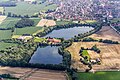
 20140720 114452 Pröbsting-See, Borken (DSC04470).jpg 3,264 × 4,912; 4.29 MB
-
 20140720 114523 Pröbsting-See, Borken (DSC04481).jpg 4,912 × 3,264; 4.92 MB
-
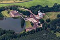
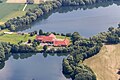
 20140720 114528 Haus Pröbsting, Borken (DSC04482).jpg 4,912 × 3,264; 4.84 MB
-
 20140720 114709 Teich an der Borkener Aa, Borken (DSC04497).jpg 3,264 × 4,912; 4.93 MB
-
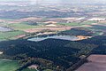
 20140720 115201 Abgrabungssee Gemenwirthe, Borken (DSC04574).jpg 4,912 × 3,264; 4.82 MB
-
 20140720 115339 Klostersee Burlo, Borken (DSC04592).jpg 4,912 × 3,264; 4.19 MB
-
 20140720 115530 Klostersee Burlo, Borken (DSC04617).jpg 4,912 × 3,264; 3.75 MB
-
 20140720 115612 Klostersee Burlo, Borken (DSC04624).jpg 4,912 × 3,264; 3.87 MB
-
 2019-10-26-Pescher See Koeln-.jpg 8,746 × 3,844; 23.95 MB
-
 Aerial image of Altmühlsee (view from the southeast).jpg 5,300 × 3,200; 5.8 MB
-
 Aerial image of Ampersee (view from the south).jpg 3,900 × 2,200; 4.63 MB
-
 Aerial image of Badenburg Lake (view from the south).jpg 3,800 × 2,200; 5.65 MB
-
 Aerial image of Bansee (view from the south).jpg 3,700 × 2,300; 5.04 MB
-
 Aerial image of Blassee (view from the southwest).jpg 3,200 × 2,200; 4.98 MB
-
 Aerial image of Brunnensee (view from the southeast).jpg 3,300 × 2,000; 4.12 MB
-
 Aerial image of Ebersberger Weiherkette (view from the southeast).jpg 3,800 × 2,000; 4.51 MB
-
 Aerial image of Egglburger See (view from the southeast).jpg 3,600 × 2,300; 3.93 MB
-
 Aerial image of Einbessee (view from the south).jpg 3,300 × 2,000; 4.24 MB
-
 Aerial image of Eschenauer See (view from the south).jpg 3,500 × 2,200; 3.68 MB
-
 Aerial image of Fasaneriesee (view from the south).jpg 5,300 × 3,000; 8.95 MB
-
 Aerial image of Feldmochinger See (view from the southwest).jpg 4,000 × 2,800; 6.8 MB
-
 Aerial image of Friedberger Baggersee (view from the southeast).jpg 5,000 × 3,000; 6.57 MB
-
 Aerial image of Garchinger See.jpg 3,800 × 2,000; 4.38 MB
-
 Aerial image of Griessee (view from the southeast).jpg 3,700 × 2,200; 5.57 MB
-
 Aerial image of Großer Alpsee (view from the northeast).jpg 4,900 × 3,200; 7.65 MB
-
 Aerial image of Großer Brombachsee (view from the southeast).jpg 5,200 × 3,100; 6.28 MB
-
 Aerial image of Großer Kesselsee (view from the southwest).jpg 3,300 × 2,100; 4.43 MB
-
 Aerial image of Grüntensee (view from the southwest).jpg 4,200 × 2,800; 6.29 MB
-
 Aerial image of Hackensee (view from the southwest).jpg 3,800 × 2,200; 5.66 MB
-
 Aerial image of Happurger See (view from the west).jpg 5,200 × 3,100; 7.25 MB
-
 Aerial image of Hartsee (view from the south).jpg 3,400 × 2,400; 4.47 MB
-
 Aerial image of Hochmoor am Kesselsee (view from the southwest).jpg 3,700 × 2,300; 6.16 MB
-
 Aerial image of Hofsee and Katzensee (view from the southwest).jpg 3,700 × 2,300; 4.47 MB
-
 Aerial image of Hofstätter See (view from the south).jpg 4,000 × 1,800; 3.76 MB
-
 Aerial image of Hollerner See.jpg 3,900 × 2,600; 4.91 MB
-
 Aerial image of Igelsbachsee (view from the southeast).jpg 5,500 × 3,500; 9.33 MB
-
 Aerial image of Karlsfelder See.jpg 3,400 × 2,700; 4.33 MB
-
 Aerial image of Kastenseeoner See (view from the southeast).jpg 3,700 × 2,200; 4.9 MB
-
 Aerial image of Kautsee (view from the south).jpg 3,396 × 2,400; 5.63 MB
-
 Aerial image of Kirchsee in Oberbayern (view from the south).jpg 3,900 × 2,100; 4.78 MB
-
 Aerial image of Kleinhesseloher See.jpg 5,568 × 3,712; 7.47 MB
-
 Aerial image of Lake Simssee (view from the southwest).jpg 5,300 × 3,600; 8.77 MB
-
 Aerial image of Langbürgner See (view from the southwest).jpg 4,200 × 2,300; 5.71 MB
-
 Aerial image of Laubensee (view from the south).jpg 3,600 × 2,200; 3.32 MB
-
 Aerial image of Lerchenauer See (view from the south).jpg 4,000 × 3,300; 8.04 MB
-
 Aerial image of Liebensteinspeicher (view from the west).jpg 5,100 × 3,300; 8.84 MB
-
 Aerial image of Liensee (view from the west).jpg 3,200 × 2,300; 4.5 MB
-
 Aerial image of Mallertshofer See.jpg 3,500 × 2,400; 4.76 MB
-
 Aerial image of Markkleeberger See.jpg 5,560 × 2,580; 3.32 MB
-
 Aerial image of Niedersonthofener See (view from the east).jpg 5,100 × 3,100; 7.35 MB
-
 Aerial image of Oberschleißheim Regatta Course (view from the southwest).jpg 4,600 × 3,400; 6.49 MB
-
 Aerial image of Olchinger See (view from the southwest).jpg 3,600 × 2,200; 4.78 MB
-
 Aerial image of Pelhamer See (view from the southwest).jpg 3,600 × 2,400; 4.72 MB
-
 Aerial image of Regattaparksee (view from the northwest).jpg 5,000 × 3,300; 5.62 MB
-
 Aerial image of Rinssee (view from the south).jpg 3,900 × 2,200; 4.02 MB
-
 Aerial image of Rottachsee (view from the southwest).jpg 5,200 × 2,600; 5.71 MB
-
 Aerial image of Schloßsee (view from the southwest).jpg 3,000 × 2,400; 3.98 MB
-
 Aerial image of Seeleitensee, Mittersee, and Jägersee (view from the south).jpg 3,800 × 2,200; 4.61 MB
-
 Aerial image of Seeon.jpg 5,320 × 2,580; 4.33 MB
-
 Aerial image of Siferlinger See (view from the south).jpg 3,600 × 2,400; 4.3 MB
-
 Aerial image of Soyensee (view from the southwest).jpg 3,800 × 2,100; 3.85 MB
-
 Aerial image of Staudhamer See (view from the south).jpg 3,700 × 2,000; 3.84 MB
-
 Aerial image of Steinsee in Niederseeon (view from the south).jpg 3,200 × 2,200; 3.7 MB
-
 Aerial image of Stettner See (view from the south).jpg 3,600 × 2,200; 4.55 MB
-
 Aerial image of Thaler See (view from the southwest).jpg 3,300 × 2,400; 4.63 MB
-
 Aerial image of the Alatsee (view from the southwest).jpg 4,400 × 3,300; 7.95 MB
-
 Aerial image of the Alpsee (view from the southwest).jpg 5,200 × 3,200; 6.18 MB
-
 Aerial image of the Chiemsee (view from the southwest).jpg 5,500 × 2,600; 4.66 MB
-
 Aerial image of the Chiemsee municipality.jpg 5,568 × 3,712; 4.68 MB
-
 Aerial image of the Eggstätt-Hemhof Lakes (view from the southwest).jpg 5,000 × 3,600; 8.37 MB
-
 Aerial image of the Eggstätt-Hemhof Lakes.jpg 5,400 × 3,400; 4.52 MB
-
 Aerial image of the Forggensee (view from the southwest).jpg 5,000 × 3,500; 5.89 MB
-
 Aerial image of the Fraueninsel.jpg 5,400 × 3,200; 4.61 MB
-
 Aerial image of the Froschhauser See (view from the southeast).jpg 5,500 × 3,500; 5.83 MB
-
 Aerial image of the Hopfensee (view from the south).jpg 5,300 × 2,600; 5.24 MB
-
 Aerial image of the Ismaning Reservoir (view from the southeast).jpg 5,300 × 2,600; 5.34 MB
-
 Aerial image of the Kochelsee (view from the south).jpg 5,500 × 3,200; 6.47 MB
-
 Aerial image of the Langwieder lake district (view from the south).jpg 4,000 × 2,400; 5.84 MB
-
 Aerial image of the Obinger See (view from the west).jpg 4,800 × 3,400; 6.36 MB
-
 Aerial image of the Pilsensee (view from the southwest).jpg 5,300 × 2,700; 5.48 MB
-
 Aerial image of the Riegsee (view from the south).jpg 4,800 × 3,200; 4.71 MB
-
 Aerial image of the Schliersee (view from the south).jpg 5,200 × 3,600; 8.06 MB
-
 Aerial image of the Schwansee (view from the southwest).jpg 5,500 × 3,300; 8.05 MB
-
 Aerial image of the Seehamer See (view from the west).jpg 4,300 × 3,500; 5.85 MB
-
 Aerial image of the Seeon Lakes.jpg 5,460 × 3,560; 6.22 MB
-
 Aerial image of the Staffelsee (view from the southeast).jpg 5,300 × 3,400; 6.53 MB
-
 Aerial image of the Staffelsee.jpg 5,250 × 3,000; 4.09 MB
-
 Aerial image of the Tachinger See (view from the south).jpg 5,400 × 3,200; 5.24 MB
-
 Aerial image of the Tegernsee (view from the southeast).jpg 5,400 × 3,500; 7.61 MB
-
 Aerial image of the Waginger See (view from the southeast).jpg 5,000 × 3,600; 5.87 MB
-
 Aerial image of the Waginger See and Tachinger See (view from the southeast).jpg 4,400 × 3,500; 5.33 MB
-
 Aerial image of the Walchensee (view from the southeast).jpg 5,400 × 3,300; 6.74 MB
-
 Aerial image of the Walchensee (view from the southwest).jpg 5,300 × 3,500; 6.74 MB
-
 Aerial image of the Weißensee (view from the southeast).jpg 4,700 × 3,500; 6.58 MB
-
 Aerial image of the Wörth island, Staffelsee (view from the southwest).jpg 5,300 × 3,700; 7.4 MB
-
 Aerial image of the Wörthsee (view from the southwest).jpg 5,200 × 2,900; 5.62 MB
-
 Aerial image of Unterschleißheimer See.jpg 3,900 × 2,500; 5.94 MB
-
 Aerial image of Waldschwaigsee (view from the southeast).jpg 3,700 × 2,200; 4.56 MB
-
 Aerial image of Zillhamer See and Ameranger See (view from the south).jpg 3,700 × 2,400; 4.63 MB
-
 Aerial view of the lake and sand beach at Otto-Maigler-See in Hürth, Germany (48331367942).jpg 5,464 × 3,640; 12.75 MB
-
 Aerial view of the lake Hürther Waldsee (Theresiasee) in Hürth, Germany (48331225141).jpg 5,464 × 3,640; 14.48 MB
-
 Aerials Bavaria 16.06.2006 12-03-19.jpg 1,965 × 1,473; 1.82 MB
-
 Allner-013.jpg 3,648 × 2,736; 5.65 MB
-
 Altlandsberg asv2022-09 img16 Wilkendorf Luftbild.jpg 5,464 × 3,640; 16.91 MB
-
 Atzenhof Trausnitz 2009.JPG 3,008 × 2,000; 1.23 MB
-
 Bad Wünnenberg Aabachsee Sauerland-Ost 246.jpg 4,256 × 2,832; 9.82 MB
-
 Bad Wünnenberg Aabachsee Sauerland-Ost 247.jpg 4,256 × 2,832; 10.1 MB
-
 Bad Wünnenberg Aabachsee Sauerland-Ost 248.jpg 3,589 × 2,388; 7.41 MB
-
 Bad Wünnenberg Aabachsee Sauerland-Ost 249.jpg 4,256 × 2,832; 9.9 MB
-
 Bad Wünnenberg Aabachsee Sauerland-Ost 250.jpg 4,256 × 2,832; 11.34 MB
-
 Bad Wünnenberg Aabachsee Sauerland-Ost 251.jpg 4,256 × 2,832; 11.22 MB
-
 Bad Wünnenberg Aabachsee Sauerland-Ost 261.jpg 4,256 × 2,832; 9.73 MB
-
 Bad Wünnenberg Aabachsee Sauerland-Ost 262.jpg 4,256 × 2,832; 8.75 MB
-
 Bannwaldsee von Nordwesten.JPG 1,853 × 2,310; 1.36 MB
-
 Bantikower See, Luftaufnahme (2014).JPG 4,032 × 2,272; 4.6 MB
-
 Bergkamen, Beversee -- 2014 -- 8863.jpg 5,184 × 3,456; 12.95 MB
-
 Berlin Alboinplatz Blanke Helle UAV 05-2017.jpg 4,095 × 2,730; 5.94 MB
-
 Berlin Arkenberger Baggersee asv2022-07 img1.jpg 5,125 × 3,203; 10.17 MB
-
 Berlin Arkenberger Baggersee asv2022-07 img2.jpg 5,171 × 3,447; 12.13 MB
-
 Berlin Arkenberger Baggersee und Aussenring asv2022-07.jpg 5,356 × 3,013; 11.36 MB
-
 Berlin Gehrensee asv2022-07 img1.jpg 4,520 × 2,825; 12.65 MB
-
 Berlin Gehrensee asv2022-07 img2.jpg 4,581 × 3,436; 15.33 MB
-
 Berlin Halensee in Grunewald UAV 04-2017.jpg 4,808 × 3,203; 7.05 MB
-
 Berlin Schlachtensee asv2022-08 img1.jpg 5,078 × 3,174; 10.36 MB
-
 Berlin Schlachtensee asv2022-08 img2.jpg 5,464 × 3,415; 12.3 MB
-
 Berlin Volkspark Friedrichshain 09-2017 img3.jpg 4,590 × 3,058; 5.87 MB
-
 Berlin-Wannsee Betriebswerk Luftbild asv2022-09.jpg 4,767 × 3,575; 15.12 MB
-
 Blick auf den nördlichen Bereich vom Otto-Maigler-See in Hürth, Deutschland (48331223481).jpg 5,464 × 3,640; 13.38 MB
-
 Bonn, Ennert, Dornheckensee.jpg 3,648 × 2,736; 5.37 MB
-
 Borken, Schönstatt-Au -- 2014 -- 2233.jpg 5,472 × 3,648; 16.38 MB
-
 Borken, Schönstatt-Au -- 2014 -- 2234.jpg 5,472 × 3,648; 16.88 MB
-
 Borken, Schönstatt-Au -- 2014 -- 2237.jpg 5,472 × 3,648; 16.44 MB
-
 Borken, Schönstatt-Au -- 2014 -- 2253.jpg 5,472 × 3,648; 14.22 MB
-
 Borken, Schönstatt-Au -- 2014 -- 2254.jpg 5,472 × 3,648; 15.75 MB
-
 Borken, Schönstatt-Au -- 2014 -- 2258.jpg 5,472 × 3,648; 14.68 MB
-
 BRBHavel asv2022-07 img19 Gördensee.jpg 5,140 × 3,213; 9.72 MB
-
 Buldern, Samsonsee -- 2014 -- 8151.jpg 5,056 × 3,371; 10.65 MB
-
 Buldern, Samsonsee -- 2014 -- 8152.jpg 5,184 × 3,456; 12.49 MB
-
 Buldern, Samsonsee -- 2014 -- 8153.jpg 5,184 × 3,456; 12.6 MB
-
 Buldern, Samsonsee -- 2014 -- 8158.jpg 5,184 × 3,456; 11.33 MB
-
 Buldern, Samsonsee -- 2014 -- 9207.jpg 5,184 × 3,456; 12.88 MB
-
 Buldern, Samsonsee -- 2014 -- 9212.jpg 5,184 × 3,456; 12.54 MB
-
 Buldern, Samsonsee -- 2014 -- 9955.jpg 5,184 × 3,456; 10.61 MB
-
 Coesfeld, Baggersee Stevede -- 2014 -- 7699.jpg 5,184 × 3,456; 11.63 MB
-
 Coesfeld, Baggersee Stevede -- 2014 -- 7700.jpg 5,184 × 3,456; 11.76 MB
-
 Diemelsee Staumauer Sauerland-Ost 180.jpg 4,256 × 2,832; 9.06 MB
-
 Diemelsee Staumauer Sauerland-Ost 181.jpg 4,256 × 2,832; 9.37 MB
-
 Diemelsee Staumauer Sauerland-Ost 182.jpg 4,256 × 2,832; 9.74 MB
-
 Dülmen, Buldern, Samsonsee -- 2014 -- 4216.jpg 5,184 × 3,456; 21.4 MB
-
 Dülmen, Heubachniederung -- 2014 -- 8956.jpg 5,184 × 3,456; 11.59 MB
-
 Dülmen, Heubachniederung -- 2014 -- 8959.jpg 5,184 × 3,456; 11.84 MB
-
 Dülmen, Heubachniederung -- 2014 -- 8960.jpg 5,184 × 3,456; 12.32 MB
-
 Dülmen, Heubachniederung -- 2014 -- 8961.jpg 5,184 × 3,456; 11.64 MB
-
 Dülmen, Heubachniederung -- 2014 -- 8962.jpg 4,645 × 3,196; 7.67 MB
-
 Dülmen, Heubachniederung -- 2014 -- 9047.jpg 5,184 × 3,456; 11.7 MB
-
 Dülmen, Kirchspiel, Dernekamp -- 2014 -- 2691.jpg 5,472 × 3,648; 16.61 MB
-
 Dülmen, Kirchspiel, Dernekamp -- 2014 -- 2692.jpg 5,472 × 3,648; 19.23 MB
-
 Dülmen, Oedlerteich -- 2014 -- 8967.jpg 5,184 × 3,456; 14.67 MB
-
 Dülmen, Oedlerteich -- 2014 -- 9045.jpg 5,184 × 3,456; 11.91 MB
-
 Dülmen, Teiche der Heubachniederung -- 2014 -- 8963.jpg 5,184 × 3,456; 11.6 MB
-
 Dülmen, Teiche der Heubachniederung -- 2014 -- 8964.jpg 5,184 × 3,456; 11.87 MB
-
 Dülmen, Vogelvennteich -- 2014 -- 9046.jpg 5,184 × 3,456; 10.88 MB
-
 Ennigerloh, Naturschutzgebiet Steinbruch Anneliese -- 2014 -- 8670.jpg 5,184 × 3,456; 12.94 MB
-
 Eulenberg.jpg 3,648 × 2,736; 5.36 MB
-
 Funtensee Orthophoto.jpg 1,256 × 1,124; 562 KB
-
 Gescher, Kuhlenvenn -- 2014 -- 7701.jpg 5,184 × 3,456; 12.61 MB
-
 Grossräschener See 002.JPG 4,032 × 2,272; 4.8 MB
-
 Großdubrau Blaue Adria Aerial Pan.jpg 9,833 × 3,910; 29.83 MB
-
 Großdubrau Blaue Adria Aerial.jpg 3,909 × 2,077; 6.33 MB
-
 Großdubrau Crosta Aerial Pan.jpg 8,861 × 3,506; 22.93 MB
-
 Großdubrau Crosta Aerial.jpg 3,889 × 2,077; 5.81 MB
.jpg)
.jpg)
.jpg)
.jpg)
.jpg)
.jpg)
.jpg)
.jpg)
.jpg)
.jpg)
.jpg)
.jpg)
.jpg)
.jpg)
.jpg)
.jpg)
.jpg)
.jpg)
.jpg)
.jpg)
.jpg)
.jpg)
.jpg)
.jpg)
.jpg)
.jpg)
.jpg)
.jpg)
.jpg)
.jpg)
.jpg)
.jpg)
.jpg)
.jpg)
.jpg)
.jpg)
.jpg)

.jpg)
.jpg)
.jpg)
.jpg)
.jpg)
.jpg)
.jpg)
.jpg)
.jpg)
.jpg)
.jpg)
.jpg)
.jpg)

.jpg)
.jpg)
.jpg)
.jpg)
.jpg)
.jpg)
.jpg)
.jpg)
.jpg)
.jpg)
.jpg)

.jpg)

.jpg)
.jpg)
.jpg)

.jpg)
.jpg)
.jpg)
.jpg)
.jpg)
.jpg)


.jpg)
.jpg)
.jpg)
.jpg)
.jpg)
.jpg)
.jpg)
.jpg)
.jpg)

.jpg)
.jpg)
.jpg)
.jpg)
.jpg)
.jpg)
.jpg)
.jpg)
.jpg)

.jpg)

.jpg)

.jpg)
.jpg)
.jpg)
.jpg)
.jpg)
.jpg)
.jpg)
.jpg)
.jpg)
.jpg)
.jpg)

.jpg)

.jpg)
.jpg)
.jpg)
.jpg)
.jpg)
.jpg)
.jpg)
.jpg)
.jpg)

.jpg)
.jpg)
.jpg)
_in_H%C3%BCrth,_Germany_(48331225141).jpg)


.JPG)


.jpg)


