Category:Agriculture in the Shetland Islands
Jump to navigation
Jump to search
Council areas (municipalities) of Scotland: Aberdeen · Aberdeenshire · Angus · Argyll and Bute · Clackmannanshire · Dumfries and Galloway · Dundee · East Ayrshire · East Dunbartonshire · East Lothian · East Renfrewshire · Edinburgh · Falkirk · Fife · Glasgow · Highland · Inverclyde · Midlothian · Moray · North Ayrshire · North Lanarkshire · Outer Hebrides · Orkney Islands · Perth and Kinross · Renfrewshire · Scottish Borders · Shetland Islands · South Ayrshire · South Lanarkshire · Stirling · West Dunbartonshire · West Lothian
Subcategories
This category has the following 7 subcategories, out of 7 total.
C
F
P
S
Media in category "Agriculture in the Shetland Islands"
The following 48 files are in this category, out of 48 total.
-
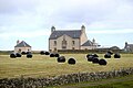 Bales at Belmont - geograph.org.uk - 4633066.jpg 1,024 × 683; 133 KB
-
 Buggies at the Unst Show - geograph.org.uk - 942590.jpg 640 × 426; 112 KB
-
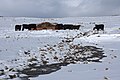 Cattle at Hamar, Baltasound - geograph.org.uk - 1723357.jpg 800 × 533; 98 KB
-
 Cattle in the snow at Hamar, Baltasound - geograph.org.uk - 1723356.jpg 800 × 384; 105 KB
-
 Collecting silage bales, Baltasound - geograph.org.uk - 5868501.jpg 1,600 × 1,065; 397 KB
-
 Corn stooks at Belmont - geograph.org.uk - 4732009.jpg 1,024 × 576; 98 KB
-
 Feeding station near Burrafirth - geograph.org.uk - 5012019.jpg 640 × 480; 180 KB
-
 Fresh eggs, Norwick - geograph.org.uk - 5083740.jpg 1,024 × 682; 211 KB
-
 Fruit cultivation on Yell - geograph.org.uk - 792288.jpg 640 × 483; 100 KB
-
 Harrowing times at Uyeasound - geograph.org.uk - 5746558.jpg 1,024 × 682; 134 KB
-
 Harvesting oats, Uyeasound - geograph.org.uk - 5904123.jpg 1,600 × 1,067; 585 KB
-
 Hay at Gloup - geograph.org.uk - 4781427.jpg 4,000 × 2,664; 3.33 MB
-
 Hay Cutting, Uyea Break - geograph.org.uk - 4631068.jpg 3,844 × 2,500; 1.53 MB
-
 Keolki Field livestock enclosure - geograph.org.uk - 2605168.jpg 4,320 × 3,240; 5.42 MB
-
 Lifting potatoes at Clivocast, Uyeasound - geograph.org.uk - 5591642.jpg 1,024 × 683; 151 KB
-
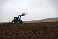
 Ploughing at Belmont - geograph.org.uk - 4919406.jpg 1,024 × 681; 199 KB
-
 Preparing the fields - geograph.org.uk - 771630.jpg 640 × 426; 69 KB
-
 Scarecrow at Underhoull, Westing - geograph.org.uk - 4732034.jpg 1,024 × 576; 90 KB
-
 Sheep, Bale and Wheatear, Baltasound - geograph.org.uk - 5124682.jpg 1,024 × 682; 217 KB
-
 Silage bale, Baltasound - geograph.org.uk - 5868505.jpg 1,600 × 1,067; 413 KB
-
 Silage bales and shed at Hannigarth - geograph.org.uk - 2577720.jpg 800 × 533; 148 KB
-

-
 Silage bales at Brakefield, Baltasound - geograph.org.uk - 2188269.jpg 800 × 533; 135 KB
-
 Silage bales at Clivocast - geograph.org.uk - 2624370.jpg 800 × 533; 121 KB
-
 Silage bales at Clivocast, Uyeasound - geograph.org.uk - 5563389.jpg 1,024 × 683; 132 KB
-
 Silage bales at Lund - geograph.org.uk - 1497767.jpg 640 × 425; 68 KB
-
 Silage bales at Ordaal, Baltasound - geograph.org.uk - 5556102.jpg 1,024 × 683; 122 KB
-
 Silage bales at Ungirsta, Haroldswick - geograph.org.uk - 5468677.jpg 1,600 × 1,065; 377 KB
-
 Silage bales beside the Houb, Baltasound - geograph.org.uk - 6241496.jpg 1,600 × 1,065; 335 KB
-
 Silage bales in snow, Baltasound - geograph.org.uk - 2177158.jpg 800 × 534; 157 KB
-
 Silage bales, Baliasta - geograph.org.uk - 2694428.jpg 800 × 534; 215 KB
-
 Silage bales, Baltasound - geograph.org.uk - 5249484.jpg 1,600 × 889; 451 KB
-
 Silage bales, Belmont Farm - geograph.org.uk - 1598040.jpg 640 × 426; 50 KB
-
 Silage bales, Buddabrake - geograph.org.uk - 2194890.jpg 800 × 534; 124 KB
-

-
 Silage bales, Uyea Breck, Uyeasound - geograph.org.uk - 5615237.jpg 1,024 × 683; 54 KB
-
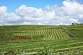
 Silage fields at Newgord, Westing - geograph.org.uk - 3147037.jpg 1,024 × 681; 197 KB
-
 Silage-making at Baltasound - geograph.org.uk - 2554592.jpg 800 × 534; 209 KB
-
 Silage-making at Skaw - geograph.org.uk - 2030430.jpg 800 × 534; 216 KB
-
 Tractor in a field at Baltasound - geograph.org.uk - 4169656.jpg 1,024 × 681; 149 KB
-
 Tractor Tracks IMG 6213 (24070993785).jpg 4,245 × 2,225; 3.19 MB
-
 Tractor Tracks MG 0289 (24545117173).jpg 4,927 × 2,669; 4.6 MB
-
 Tractor Tracks MG 7623 (31862735114).jpg 5,164 × 2,825; 4.28 MB
-
 Uregarth farm buildings, Baltasound - geograph.org.uk - 1552588.jpg 640 × 426; 33 KB
-
 View over Gossabrough - geograph.org.uk - 2587967.jpg 1,377 × 1,000; 1.15 MB
-
 Voar Work MG 8362 (32946866853).jpg 5,154 × 2,910; 4.68 MB
-
 Voxter plantation - geograph.org.uk - 317568.jpg 426 × 640; 92 KB
-
 Working on the croft at Ordaal, Baltasound - geograph.org.uk - 5473540.jpg 1,600 × 1,065; 260 KB


.jpg)
.jpg)
.jpg)


.jpg)

