Category:Ainthorpe, North Yorkshire
Jump to navigation
Jump to search
English: Ainthorpe is a village in the civil parish of Danby, North Yorkshire, UK
village in North Yorkshire, England, UK  | |||||
| Upload media | |||||
| Instance of | |||||
|---|---|---|---|---|---|
| Location | Danby, Scarborough, North Yorkshire, Yorkshire and the Humber, England | ||||
 | |||||
Media in category "Ainthorpe, North Yorkshire"
The following 29 files are in this category, out of 29 total.
-
 Ainthorpe Sub Station - geograph.org.uk - 29521.jpg 640 × 480; 74 KB
-
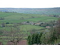 Ainthorpe.jpg 640 × 480; 106 KB
-
 Esk Dale - geograph.org.uk - 442095.jpg 640 × 427; 70 KB
-
 Fields at Ainthorpe - geograph.org.uk - 2703290.jpg 640 × 434; 219 KB
-
 Houses between Brook Lane & Easton Lane, Ainthorpe (geograph 5826132).jpg 1,024 × 768; 262 KB
-
 Landslip near The Coombs - geograph.org.uk - 116975.jpg 640 × 427; 57 KB
-
 Road to Low Coombs Farm - geograph.org.uk - 725383.jpg 640 × 480; 165 KB
-
 Waterlogged Field and St. Hilda's Church - geograph.org.uk - 285779.jpg 480 × 640; 150 KB
-
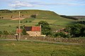
 Welcome to Crag Farm - geograph.org.uk - 729799.jpg 640 × 489; 180 KB
-
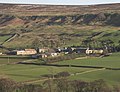
 Ainthorpe - geograph.org.uk - 17772.jpg 640 × 480; 119 KB
-
 Ainthorpe Lane - geograph.org.uk - 576329.jpg 640 × 480; 102 KB
-
 Ainthorpe Rigg - geograph.org.uk - 544102.jpg 640 × 467; 143 KB
-
 Ajalon House and Applegarth Farm - geograph.org.uk - 336223.jpg 640 × 489; 69 KB
-
 Bridge over Great Fryup Dale beck - geograph.org.uk - 336233.jpg 640 × 401; 48 KB
-
 Bridleway on Ainthorpe Rigg - geograph.org.uk - 725376.jpg 640 × 480; 147 KB
-
 Bridleway to Ainthorpe - geograph.org.uk - 531878.jpg 640 × 551; 88 KB
-
 Butterwicks Farm - geograph.org.uk - 116996.jpg 640 × 365; 59 KB
-
 Cottage Near Stonebeck Gate Farm - geograph.org.uk - 442097.jpg 640 × 427; 76 KB
-

-
 Forester's Lodge in Fryup - geograph.org.uk - 116985.jpg 640 × 433; 53 KB
-

-
 Great Fryup Dale Beck - geograph.org.uk - 336229.jpg 640 × 427; 61 KB
-

-
 Near Fryup Lodge - geograph.org.uk - 211463.jpg 640 × 427; 62 KB
-
 Raven Hill Farm - geograph.org.uk - 211468.jpg 640 × 417; 68 KB
-
 Road Along Little Fryup Dale - geograph.org.uk - 442103.jpg 640 × 427; 74 KB
-
 Slate Hill House - geograph.org.uk - 442098.jpg 640 × 427; 68 KB
-
 Slidney Beck Farm - geograph.org.uk - 211470.jpg 640 × 427; 75 KB
-
 Stoneyard, Ainthorpe - geograph.org.uk - 285785.jpg 640 × 384; 73 KB


.jpg)


