Category:Akita Prefectural Road Route 28
Jump to navigation
Jump to search
English: Category for the Akita Prefectural Road Route 28
日本語: 秋田県道28号秋田岩見船岡線に関するカテゴリ
road in Akita Prefecture, Japan | |||||
| Upload media | |||||
| Instance of | |||||
|---|---|---|---|---|---|
| Location | |||||
| Transport network |
| ||||
| Connects with |
| ||||
| Owned by | |||||
| Maintained by | |||||
| Start time |
| ||||
| Length |
| ||||
| Terminus | |||||
| Partially coincident with |
| ||||
 | |||||
Subcategories
This category has the following 3 subcategories, out of 3 total.
Media in category "Akita Prefectural Road Route 28"
The following 8 files are in this category, out of 8 total.
-
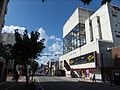 Akita prefectural road route 28, Minami-Yurakucho Street.jpg 3,264 × 2,448; 2.94 MB
-
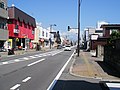 Akita Prefectural Road 28 at Tegata-Nishiyachi.jpg 3,072 × 2,304; 1.34 MB
-
 Akita Prefectural Road 28 at Tegata-Yamazaki-chō.jpg 3,264 × 2,448; 3.42 MB
-
 Akita prefectural road route 28 at Taihei-Hatta.jpg 3,264 × 2,448; 1.97 MB
-
 Akita prefectural road route 28 at Yanagida.jpg 3,264 × 2,448; 2 MB
-
 Gochōmebashi crossing.jpg 3,264 × 2,448; 1.99 MB
-
 Tobu Gas Akita branch.jpg 3,264 × 2,448; 3.54 MB
-
 View of Mt. Taihei from Taihei-nakazeki, Akita City.jpg 3,264 × 2,448; 3.52 MB


