Category:Albert-Heim-Hütte
Jump to navigation
Jump to search
| Object location | | View all coordinates using: OpenStreetMap |
|---|
 | |||||
| Upload media | |||||
| Instance of | |||||
|---|---|---|---|---|---|
| Location | Uri, Switzerland | ||||
| Owned by |
| ||||
| Date of official opening |
| ||||
| Mountain range | |||||
| Elevation above sea level |
| ||||
| official website | |||||
 | |||||
Media in category "Albert-Heim-Hütte"
The following 8 files are in this category, out of 8 total.
-
 Albert heim huette 20130816.jpg 4,328 × 3,246; 2.7 MB
-
 Albert-Heim-Hütte.jpg 1,476 × 628; 988 KB
-
 Bielenhorn.jpg 1,600 × 1,126; 1.23 MB
-
 ETH-BIB-Albert Heim-Hütte mit Gruppe-Dia 247-03083.tif 3,248 × 2,835; 8.87 MB
-
 ETH-BIB-Albert Heim-Hütte vom Galenstock-Dia 247-03081.tif 2,900 × 3,370; 28.1 MB
-
 ETH-BIB-Locus der Albert Heim-Hütte SAC Uto-Dia 247-03082.tif 3,262 × 2,799; 8.81 MB
-
 Heim albert + fanck arnold geological field trip orig.png 2,804 × 1,642; 7.02 MB
-
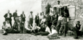 Heim albert + fanck arnold geological field trip.png 2,804 × 1,358; 6.45 MB


