Category:Albury, Surrey
Jump to navigation
Jump to search
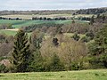
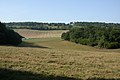
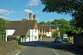
English: Albury is a village and civil parish in the borough of Guildford in Surrey, England, about south-east of Guildford town centre. The village is within an Area of Outstanding Natural Beauty and Site of Special Scientific Interest.
village and civil parish in the borough of Guildford in Surrey, England  | |||||
| Upload media | |||||
| Instance of | |||||
|---|---|---|---|---|---|
| Location | Guildford, Surrey, South East England, England | ||||
| Area |
| ||||
| official website | |||||
 | |||||
Subcategories
This category has the following 11 subcategories, out of 11 total.
A
- Albury Heath (20 F)
C
F
L
- Little London, Surrey (7 F)
N
- Newlands Corner (47 F)
O
- Optohedron (6 F)
S
- Silent Pool, Surrey (19 F)
T
W
Media in category "Albury, Surrey"
The following 200 files are in this category, out of 1,035 total.
(previous page) (next page)-
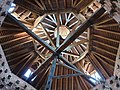 2019-0915Su 1351-34 GS9 ceiling of Pigeon house in Albury Surrey.jpg 4,032 × 3,024; 4.63 MB
-
 4Albury 20120019.jpg 1,600 × 1,071; 1.28 MB
-
 A bench with a view - geograph.org.uk - 4074338.jpg 2,048 × 1,536; 1.53 MB
-
 A footpath to Newbarn - geograph.org.uk - 3297976.jpg 640 × 426; 57 KB
-
 A green lane - geograph.org.uk - 3297974.jpg 640 × 426; 102 KB
-
 A line of trees by the Pilgrims' Way - geograph.org.uk - 3297993.jpg 640 × 426; 61 KB
-
 A living tunnel - geograph.org.uk - 2172156.jpg 3,008 × 2,000; 1.86 MB
-
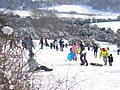 A Snow Event^ - geograph.org.uk - 1147707.jpg 640 × 480; 119 KB
-
 A sunken section of Lockhurst Hatch Lane - geograph.org.uk - 2081442.jpg 640 × 430; 185 KB
-
 A248 - geograph.org.uk - 1277857.jpg 640 × 427; 64 KB
-
 A248 - geograph.org.uk - 3182894.jpg 640 × 430; 73 KB
-
 A248 - geograph.org.uk - 3291155.jpg 640 × 426; 53 KB
-
 A248 near Albury - geograph.org.uk - 4577235.jpg 2,000 × 1,333; 2.55 MB
-
 A248, Albury Street - geograph.org.uk - 3182873.jpg 640 × 430; 92 KB
-
 A248, westbound - geograph.org.uk - 3182869.jpg 640 × 430; 81 KB
-
 A25 - geograph.org.uk - 3206187.jpg 640 × 430; 93 KB
-
 A25 in the Tillingbourne Valley - geograph.org.uk - 3182973.jpg 640 × 430; 76 KB
-
 A25 near Albury (geograph 5950470).jpg 4,082 × 2,259; 671 KB
-
 A25 near Albury - geograph.org.uk - 3182969.jpg 640 × 430; 73 KB
-
 A25 near Albury - geograph.org.uk - 4577224.jpg 2,000 × 1,333; 2.52 MB
-
 A25 past Home Farm - geograph.org.uk - 2599271.jpg 640 × 428; 73 KB
-

-
 Access Road near Albury - geograph.org.uk - 4576924.jpg 2,000 × 1,333; 2.68 MB
-
 Across Waterloo Pond near Albury Mill - geograph.org.uk - 963811.jpg 640 × 360; 107 KB
-
 After school, Albury - geograph.org.uk - 2611582.jpg 640 × 428; 107 KB
-
 House next to Post Office, Albury - geograph.org.uk - 148700.jpg 640 × 480; 92 KB
-
 Albury - geograph.org.uk - 105752.jpg 640 × 423; 147 KB
-
 Albury - The Street - geograph.org.uk - 5257548.jpg 1,920 × 2,560; 2.7 MB
-
 Albury - Tillingbourne Valley - geograph.org.uk - 5259230.jpg 2,560 × 1,920; 2.52 MB
-
 Albury Bowling Green - geograph.org.uk - 2061492.jpg 2,560 × 1,920; 1.75 MB
-
 Albury Bunting - geograph.org.uk - 2978593.jpg 4,288 × 3,216; 3.92 MB
-
 Albury Celebrates - geograph.org.uk - 2978400.jpg 4,288 × 3,216; 3.54 MB
-
 Albury Cheers - geograph.org.uk - 2978388.jpg 3,216 × 4,288; 2.81 MB
-
 Albury Chimneys - geograph.org.uk - 2466785.jpg 2,560 × 1,920; 1.64 MB
-
 Albury chimneys -052.jpg 1,600 × 1,071; 1.28 MB
-
 Albury chimneys surrey -052.jpg 2,000 × 1,435; 2.07 MB
-
 Albury Downs - geograph.org.uk - 2384440.jpg 2,560 × 1,920; 1.73 MB
-
 Albury Downs - geograph.org.uk - 2719349.jpg 2,560 × 1,920; 1.74 MB
-
 Albury Downs - geograph.org.uk - 2824385.jpg 1,024 × 768; 119 KB
-
 Albury Downs - geograph.org.uk - 4203056.jpg 2,048 × 1,536; 3.09 MB
-
 Albury Downs - geograph.org.uk - 4203107.jpg 2,048 × 1,536; 3.29 MB
-
 Albury Downs - geograph.org.uk - 4203425.jpg 2,048 × 1,536; 3.2 MB
-
 Albury Downs - geograph.org.uk - 5259239.jpg 2,560 × 1,920; 2.51 MB
-
 Albury Downs - geograph.org.uk - 5505644.jpg 1,000 × 662; 736 KB
-
 Albury Downs - geograph.org.uk - 5505647.jpg 1,000 × 674; 704 KB
-
 Albury Downs - geograph.org.uk - 5505650.jpg 1,000 × 662; 622 KB
-
 Albury Downs - geograph.org.uk - 5505652.jpg 1,000 × 662; 922 KB
-
 Albury Downs - geograph.org.uk - 993317.jpg 640 × 480; 91 KB
-
 Albury Downs at Newlands Corner - geograph.org.uk - 4844301.jpg 2,048 × 1,536; 1.51 MB
-
 Albury Downs at Newlands Corner - geograph.org.uk - 4848684.jpg 1,910 × 1,428; 891 KB
-
 Albury Downs from Warren Lane - geograph.org.uk - 2901847.jpg 4,288 × 3,216; 3.74 MB
-
 Albury Downs, east of White Lane - geograph.org.uk - 4195418.jpg 1,024 × 768; 120 KB
-
 Albury Downs, Pyramidal orchid white form.jpg 2,664 × 4,000; 1.91 MB
-
 Albury Downs, view.jpg 8,000 × 1,659; 4.18 MB
-
 Albury Embroidery - geograph.org.uk - 2978755.jpg 4,288 × 3,216; 2.8 MB
-
 Albury Estate - geograph.org.uk - 27758.jpg 640 × 428; 105 KB
-
 Albury Estate buildings on the A248 - geograph.org.uk - 2611585.jpg 640 × 428; 102 KB
-
 Albury Estate Cottages - geograph.org.uk - 2720498.jpg 2,560 × 1,920; 1.81 MB
-
 Albury Estate Offices - geograph.org.uk - 669485.jpg 640 × 480; 104 KB
-
 Albury Flag Day - geograph.org.uk - 2978334.jpg 4,288 × 3,216; 3.32 MB
-
 Albury Flower Show - geograph.org.uk - 1940271.jpg 2,560 × 1,920; 1.85 MB
-
 Albury from Newlands Corner - geograph.org.uk - 2800969.jpg 4,288 × 3,216; 2.31 MB
-
 Albury from St Martha's Hill - geograph.org.uk - 2109757.jpg 2,560 × 1,920; 1.68 MB
-
 Albury Hall - geograph.org.uk - 2466907.jpg 1,920 × 2,560; 2.24 MB
-
 Albury Hall - geograph.org.uk - 669505.jpg 640 × 480; 105 KB
-
 Albury Heath in February - geograph.org.uk - 4362198.jpg 1,024 × 789; 182 KB
-
 Albury Heath in November - geograph.org.uk - 4252806.jpg 1,024 × 768; 133 KB
-
 Albury History - geograph.org.uk - 2978743.jpg 4,288 × 3,216; 3.51 MB
-
 Albury in Bloom - geograph.org.uk - 1939530.jpg 2,560 × 1,920; 1.75 MB
-
 Albury in mid March 2012 - geograph.org.uk - 2850742.jpg 640 × 480; 51 KB
-
 Albury junction - geograph.org.uk - 2240066.jpg 640 × 418; 96 KB
-
 Albury landfill.jpg 3,072 × 2,304; 3.11 MB
-
 Albury Lodge - geograph.org.uk - 2466896.jpg 2,560 × 1,920; 2.4 MB
-
 Albury Mill - geograph.org.uk - 2466809.jpg 2,560 × 1,920; 2.36 MB
-
 Albury Millennium Avenue tree sponsors - geograph.org.uk - 5225118.jpg 5,202 × 3,465; 2.55 MB
-
 Albury Organic Vineyard - geograph.org.uk - 2719322.jpg 2,560 × 1,920; 1.7 MB
-
 Albury Organic Vineyard - geograph.org.uk - 2720509.jpg 2,560 × 1,920; 1.81 MB
-
 Albury Park - geograph.org.uk - 3178634.jpg 640 × 430; 98 KB
-
 Albury Park - geograph.org.uk - 3178645.jpg 640 × 430; 124 KB
-
 Albury Park - geograph.org.uk - 3178651.jpg 640 × 430; 146 KB
-
 Albury Park - geograph.org.uk - 3178669.jpg 640 × 430; 103 KB
-
 Albury Park - geograph.org.uk - 3178685.jpg 640 × 430; 96 KB
-
 Albury Park - geograph.org.uk - 3178696.jpg 640 × 430; 112 KB
-
 Albury Park - geograph.org.uk - 3178713.jpg 640 × 430; 58 KB
-
 Albury Park - geograph.org.uk - 3178721.jpg 640 × 430; 61 KB
-
 Albury Park - geograph.org.uk - 3178728.jpg 640 × 430; 71 KB
-
 Albury Park Celebrates - geograph.org.uk - 2978690.jpg 4,288 × 3,216; 3.53 MB
-
 Albury Park Lodge - geograph.org.uk - 2061587.jpg 2,560 × 1,920; 2.26 MB
-
 Albury pillbox in Water Lane 01.jpg 2,992 × 2,992; 4.46 MB
-
 Albury pillbox in Water Lane 02.jpg 2,992 × 2,992; 3.06 MB
-
 Albury Sand Pit - geograph.org.uk - 2901936.jpg 4,288 × 3,216; 3.51 MB
-
 Albury Sand Pit - geograph.org.uk - 3291184.jpg 640 × 426; 54 KB
-
 Albury Sand Pit - geograph.org.uk - 3291192.jpg 640 × 426; 104 KB
-
 Albury Sand Pit - geograph.org.uk - 4576911.jpg 1,997 × 1,333; 2.13 MB
-
 Albury Sand Pit entrance road - geograph.org.uk - 4576917.jpg 2,000 × 1,333; 2.38 MB
-
 Albury Sculpture - geograph.org.uk - 2903533.jpg 3,216 × 4,288; 3.6 MB
-
 Albury seen from above - geograph.org.uk - 4453172.jpg 768 × 1,024; 298 KB
-
 Albury Sign - geograph.org.uk - 2719402.jpg 2,560 × 1,920; 1.81 MB
-
 Albury Street (A248) - geograph.org.uk - 3291157.jpg 640 × 426; 48 KB
-
 Albury Street (A248), lime tree avenue.jpg 3,000 × 2,250; 2.53 MB
-
 Albury Street - geograph.org.uk - 1939161.jpg 2,560 × 1,920; 1.76 MB
-
 Albury Street - geograph.org.uk - 2466781.jpg 1,920 × 2,560; 2.13 MB
-
 Albury village centre - geograph.org.uk - 3491180.jpg 2,048 × 1,536; 1.51 MB
-
 Albury Vineyard - geograph.org.uk - 2719329.jpg 2,560 × 1,920; 1.68 MB
-
 Albury Vineyard - geograph.org.uk - 5257559.jpg 2,560 × 1,920; 2.77 MB
-
 Albury Vineyard, Surrey.jpg 4,160 × 3,120; 5.42 MB
-
 Albury, Brook Farm.jpg 3,000 × 1,995; 1.41 MB
-
 Albury, Church Lane - geograph.org.uk - 6215690.jpg 1,024 × 790; 219 KB
-
 Albury, Fox Way, Broomfields Wood.jpg 3,000 × 1,995; 2.8 MB
-
 Albury, Fox Way, View from Broomfields towards Brook.jpg 3,000 × 1,995; 1.27 MB
-
 Albury, from the Suez Sandpit viewpoint.jpg 3,500 × 2,625; 3.61 MB
-
 Albury, Home Farm - geograph.org.uk - 2444707.jpg 3,168 × 2,395; 5.3 MB
-
 Albury, Home Farm - geograph.org.uk - 2444725.jpg 2,797 × 1,943; 3.85 MB
-
 Albury, Silent Pool Pillbox (1).jpg 2,500 × 1,662; 2 MB
-
 Albury, Silent Pool Pillbox (2).jpg 2,500 × 1,662; 1.96 MB
-
 Along the North Downs Line - geograph.org.uk - 6073595.jpg 768 × 1,024; 174 KB
-
 An odd layout on the A25 - geograph.org.uk - 2599295.jpg 640 × 428; 91 KB
-
 Ancient pollard oak near Ford Farm (1) - geograph.org.uk - 6075136.jpg 768 × 1,024; 339 KB
-
 Ancient pollard oak near Ford Farm (2) - geograph.org.uk - 6073608.jpg 768 × 1,024; 313 KB
-
 Ancient trackway - geograph.org.uk - 3213443.jpg 640 × 430; 100 KB
-
 Ancient Trackway, North Downs - geograph.org.uk - 2798788.jpg 4,288 × 3,216; 3.64 MB
-
 Ancient Yew, The Roughs - geograph.org.uk - 600548.jpg 480 × 640; 154 KB
-
 Angling Shop, Albury - geograph.org.uk - 669518.jpg 640 × 480; 82 KB
-
 Anthony-devis-albury-house-1792.jpg 1,200 × 867; 130 KB
-
 Apostles church in the mist - geograph.org.uk - 5225089.jpg 5,202 × 3,465; 4.81 MB
-
 Approaching Weston Yard - geograph.org.uk - 2466827.jpg 2,560 × 1,920; 2.44 MB
-
 August Lane - geograph.org.uk - 2903109.jpg 4,288 × 3,216; 3.7 MB
-
 Autumnal colours on the A25 - geograph.org.uk - 2667124.jpg 3,538 × 2,649; 2.57 MB
-
 Bare Trees - geograph.org.uk - 2798693.jpg 4,288 × 3,216; 3.6 MB
-
 Barn by footpath 226 - geograph.org.uk - 2661945.jpg 640 × 480; 94 KB
-
 Barn on Blackheath Lane - geograph.org.uk - 2901949.jpg 4,288 × 3,216; 3.5 MB
-
 Barn, Blackheath Lane - geograph.org.uk - 2272760.jpg 640 × 318; 22 KB
-
 Barn, Brook Farm - geograph.org.uk - 3168878.jpg 640 × 430; 73 KB
-
 Barnstorming Albury - geograph.org.uk - 2978572.jpg 4,288 × 3,216; 3.39 MB
-
 Barrier on bridleway, Albury Downs - geograph.org.uk - 2599350.jpg 640 × 480; 148 KB
-
 Barrier on the bridleway, Blackheath - geograph.org.uk - 2080265.jpg 640 × 430; 192 KB
-
 Barrier, Albury Downs - geograph.org.uk - 3209334.jpg 640 × 430; 100 KB
-

-
 Before Brook Crossing on Brook Hill - geograph.org.uk - 4597633.jpg 2,560 × 1,920; 2.01 MB
-
 Belted Galloways, Albury Downs - geograph.org.uk - 2799705.jpg 4,288 × 3,216; 3.56 MB
-
 Bench, Blackheath - geograph.org.uk - 2080245.jpg 640 × 430; 172 KB
-
 Bend on Brook Hill - geograph.org.uk - 4600635.jpg 2,560 × 1,920; 2 MB
-
 Bend, Park Rd - geograph.org.uk - 3175412.jpg 640 × 430; 104 KB
-
 Birget Hill (1) - geograph.org.uk - 4920696.jpg 1,024 × 768; 132 KB
-
 Birget Hill (2) - geograph.org.uk - 4920826.jpg 1,024 × 776; 117 KB
-
 Blackheath Common - geograph.org.uk - 2080225.jpg 640 × 430; 173 KB
-
 Blackheath Common - geograph.org.uk - 2080234.jpg 640 × 430; 132 KB
-
 Blackheath Forest - geograph.org.uk - 2903014.jpg 4,288 × 3,216; 3.76 MB
-
 Blackheath Forest - geograph.org.uk - 6192192.jpg 3,021 × 2,015; 7.75 MB
-
 Blackheath Forest near Albury - geograph.org.uk - 188423.jpg 640 × 480; 151 KB
-
 Blackheath Lane Railway Bridge - geograph.org.uk - 2902892.jpg 3,216 × 4,288; 3.43 MB
-
 Blackheath Lane, south of Albury - geograph.org.uk - 4431189.jpg 768 × 1,024; 264 KB
-
 Bracken undergrowth, Blackheath - geograph.org.uk - 2080252.jpg 640 × 430; 201 KB
-
 Bracken, Silver Wood - geograph.org.uk - 3184936.jpg 640 × 430; 131 KB
-
 Bridge over the Tilling Bourne, Albury - geograph.org.uk - 2278127.jpg 1,600 × 1,200; 654 KB
-
 Bridleway across Blackheath Common - geograph.org.uk - 2079959.jpg 640 × 430; 200 KB
-
 Bridleway by Kiln Hanger - geograph.org.uk - 1386977.jpg 640 × 480; 133 KB
-
 Bridleway east of Lockhurst Hatch Farm - geograph.org.uk - 2081461.jpg 640 × 430; 167 KB
-
 Bridleway from Lockhurst Hatch Farm - geograph.org.uk - 2081463.jpg 640 × 430; 163 KB
-
 Bridleway from Lockhurst Hatch Farm - geograph.org.uk - 2081465.jpg 640 × 430; 175 KB
-
 Bridleway heading east across Blackheath - geograph.org.uk - 2080215.jpg 640 × 430; 192 KB
-
 Bridleway heading north through Winterfold Wood - geograph.org.uk - 2609184.jpg 1,024 × 768; 291 KB
-
 Bridleway leaving Blackheath - geograph.org.uk - 2081317.jpg 640 × 430; 188 KB
-
 Bridleway marker, Blackheath - geograph.org.uk - 2080223.jpg 640 × 430; 199 KB
-
 Bridleway near Ford Farm - geograph.org.uk - 5353854.jpg 640 × 426; 77 KB
-
 Bridleway off Lockhurst Hatch Lane - geograph.org.uk - 2081438.jpg 640 × 430; 180 KB
-
 Bridleway on Blackheath - geograph.org.uk - 2599928.jpg 1,024 × 768; 277 KB
-
 Bridleway on North Downs - geograph.org.uk - 2798773.jpg 4,288 × 3,216; 3.54 MB
-
 Bridleway through the trees - geograph.org.uk - 2080274.jpg 640 × 430; 201 KB
-
 Bridleway to Jelley's Copse - geograph.org.uk - 2903063.jpg 4,288 × 3,216; 3.56 MB
-
 Bridleway to Water Lane - geograph.org.uk - 2824365.jpg 1,024 × 768; 241 KB
-
 Bridleway, Albury Downs - geograph.org.uk - 3209338.jpg 640 × 430; 108 KB
-
 Bridleway, Blackheath - geograph.org.uk - 2080219.jpg 640 × 430; 198 KB
-
 Bridleway, Blackheath - geograph.org.uk - 2080226.jpg 640 × 430; 190 KB
-
 Bridleway, Blackheath - geograph.org.uk - 2080235.jpg 640 × 430; 148 KB
-
 Bridleway, Blackheath Common - geograph.org.uk - 2079964.jpg 640 × 430; 191 KB
-
 Bridleway, Blackheath Common - geograph.org.uk - 2080230.jpg 640 × 430; 152 KB
-
 Bridleways merge in Winterfold Wood - geograph.org.uk - 2599904.jpg 1,024 × 768; 246 KB
-
 Bridleways off Farley Heath Rd - geograph.org.uk - 2081328.jpg 640 × 430; 184 KB
-
 Bronze Age, Flint arrowhead (FindID 401943).jpg 1,488 × 1,209; 708 KB
-
 Brook - geograph.org.uk - 6192306.jpg 3,657 × 2,439; 7.63 MB
-
 Brook Cottage - geograph.org.uk - 3168874.jpg 640 × 430; 73 KB
-
 Brook Farm - geograph.org.uk - 3168871.jpg 640 × 430; 78 KB
-
 Brook Farmhouse - geograph.org.uk - 3168881.jpg 640 × 430; 66 KB
-
 Brook Hill - geograph.org.uk - 3168852.jpg 640 × 430; 85 KB
-
 Brook Lane - geograph.org.uk - 3168883.jpg 640 × 430; 89 KB
-
 Brook Lane - geograph.org.uk - 3172422.jpg 640 × 430; 91 KB
-
 Brook Lane - geograph.org.uk - 3172425.jpg 640 × 430; 113 KB
-
 Brook Lane Railway Bridge - geograph.org.uk - 2903400.jpg 4,288 × 3,216; 3.51 MB
-
 Broomfields - geograph.org.uk - 6192194.jpg 2,862 × 1,909; 7.5 MB
-
 Bulldozer at Shere Sand Pit - geograph.org.uk - 2798855.jpg 4,288 × 3,216; 2.55 MB
-
 Bulldozer Dozing - geograph.org.uk - 2798941.jpg 4,288 × 3,216; 2.7 MB
-
 Bushes by the bridleway, Blackheath - geograph.org.uk - 2080239.jpg 640 × 430; 175 KB
-
 By Albury Warren - geograph.org.uk - 669443.jpg 640 × 480; 124 KB
-
 By the A248 - geograph.org.uk - 3291164.jpg 640 × 426; 61 KB
-
 Byway junction - geograph.org.uk - 3162710.jpg 640 × 430; 119 KB
-
 Byway junction - geograph.org.uk - 3162714.jpg 640 × 430; 112 KB
-
 Byway junction by Helmet Copse - geograph.org.uk - 2604842.jpg 1,024 × 768; 241 KB
-
 Byway junction, Winterfold Wood - geograph.org.uk - 3159264.jpg 640 × 430; 98 KB
-
 Byway to Farley Green - geograph.org.uk - 3165238.jpg 640 × 430; 126 KB


.jpg)


_-_geograph.org.uk_-_3291157.jpg)
,_lime_tree_avenue.jpg)


.jpg)
.jpg)


_-_geograph.org.uk_-_6075136.jpg)
_-_geograph.org.uk_-_6073608.jpg)


_-_geograph.org.uk_-_4920696.jpg)
_-_geograph.org.uk_-_4920826.jpg)


.jpg)


