Category:Aldwick
Jump to navigation
Jump to search
village in the United Kingdom | |||||
| Upload media | |||||
| Instance of | |||||
|---|---|---|---|---|---|
| Location | Arun, West Sussex, South East England, England | ||||
| Population |
| ||||
| Area |
| ||||
 | |||||
English: Aldwick is a settlement and civil parish in the Arun District of West Sussex, England. The parish includes the settlement of Rose Green and is part of a conurbation with Bognor Regis.
Subcategories
This category has the following 4 subcategories, out of 4 total.
A
- Aldwick Beach (39 F)
R
Media in category "Aldwick"
The following 200 files are in this category, out of 328 total.
(previous page) (next page)-
 'Work of Art' on Aldwick beach - geograph.org.uk - 6524372.jpg 1,200 × 1,600; 893 KB
-
 A home by the seaside - geograph.org.uk - 4547850.jpg 1,600 × 1,200; 533 KB
-
 A peek into Shorecroft, Aldwick - geograph.org.uk - 6524477.jpg 1,600 × 1,200; 612 KB
-
 A row of beach huts - geograph.org.uk - 1887439.jpg 800 × 591; 105 KB
-

-
 Advertisement on street corner - geograph.org.uk - 4614132.jpg 800 × 600; 161 KB
-
 Adwick - Woodlands Primary School.jpg 640 × 474; 94 KB
-
 Aldwich Gardens, Bognor Regis - geograph.org.uk - 4547834.jpg 1,600 × 1,200; 380 KB
-
 Aldwick - geograph.org.uk - 2393575.jpg 856 × 1,280; 197 KB
-
 Aldwick Avenue (private) - geograph.org.uk - 4568479.jpg 640 × 426; 77 KB
-
 Aldwick Bay - long view towards Pagham - geograph.org.uk - 4553219.jpg 1,600 × 1,200; 288 KB
-
 Aldwick Beach - geograph.org.uk - 3220678.jpg 1,920 × 1,080; 816 KB
-
 Aldwick Beach - geograph.org.uk - 3301949.jpg 640 × 480; 107 KB
-
 Aldwick Beach - geograph.org.uk - 3301997.jpg 640 × 480; 101 KB
-
 Aldwick Beach - geograph.org.uk - 3302038.jpg 640 × 480; 107 KB
-
 Aldwick Beach - geograph.org.uk - 4571406.jpg 640 × 426; 54 KB
-
 Aldwick Beach - geograph.org.uk - 4571409.jpg 640 × 426; 63 KB
-
 Aldwick Beach - geograph.org.uk - 4571412.jpg 640 × 426; 64 KB
-
 Aldwick Beach - geograph.org.uk - 4571415.jpg 640 × 426; 68 KB
-
 Aldwick Beach - geograph.org.uk - 4571418.jpg 640 × 426; 84 KB
-
 Aldwick Beach - geograph.org.uk - 4571420.jpg 640 × 426; 72 KB
-
 Aldwick Beach - geograph.org.uk - 4571423.jpg 640 × 426; 71 KB
-
 Aldwick Beach - geograph.org.uk - 4571425.jpg 640 × 426; 69 KB
-
 Aldwick Beach - geograph.org.uk - 4571427.jpg 640 × 426; 58 KB
-
 Aldwick Beach - geograph.org.uk - 4571428.jpg 640 × 426; 57 KB
-
 Aldwick Beach looking East - geograph.org.uk - 4551166.jpg 1,600 × 1,200; 440 KB
-
 Aldwick beach looking towards Bognor - geograph.org.uk - 6524356.jpg 1,600 × 1,200; 459 KB
-
 Aldwick beach showing Vegetated Shingle - geograph.org.uk - 6473023.jpg 1,600 × 1,200; 434 KB
-
 Aldwick beach with 'fixed object' - geograph.org.uk - 6524350.jpg 1,600 × 1,200; 421 KB
-
 Aldwick Beach, Bognor - geograph.org.uk - 3231838.jpg 2,048 × 1,360; 469 KB
-
 Aldwick Beach, Bognor Regis - geograph.org.uk - 4551159.jpg 1,600 × 1,200; 381 KB
-
 Aldwick Boat Pound in winter - geograph.org.uk - 6687241.jpg 1,600 × 1,200; 340 KB
-

-

-

-
 Aldwick Road at the junction of Gossamer Lane - geograph.org.uk - 3413252.jpg 2,048 × 1,536; 650 KB
-
 Aldwick Road by Slated Barn Garage - geograph.org.uk - 3413214.jpg 2,048 × 1,536; 1.4 MB
-
 Aldwick Road, Aldwick - geograph.org.uk - 2397955.jpg 1,280 × 856; 259 KB
-
 Aldwick Road, Bognor Regis - geograph.org.uk - 2393531.jpg 1,280 × 856; 196 KB
-
 Aldwick Road, Bognor Regis - geograph.org.uk - 3413933.jpg 2,048 × 1,536; 1.38 MB
-

-
 Aldwick Street - geograph.org.uk - 1036771.jpg 640 × 420; 94 KB
-
 Aldwick, beach huts - geograph.org.uk - 3893203.jpg 1,024 × 768; 173 KB
-
 Aldwick, Marine Park Gardens - geograph.org.uk - 3893220.jpg 1,024 × 768; 153 KB
-
 AldwickVillageSign.jpg 427 × 640; 84 KB
-
 AlexanderDennis Enviro200 SL64 HXJ Aldwick.jpg 1,066 × 762; 585 KB
-
 Apartments at the end of Aldwick Avenue - geograph.org.uk - 6524034.jpg 1,600 × 1,200; 484 KB
-
 Apartments on Fish Lane, Aldwick. - geograph.org.uk - 4547885.jpg 1,600 × 1,200; 683 KB
-
 Apple Grove - geograph.org.uk - 2950429.jpg 2,048 × 1,536; 693 KB
-
 Approaching Heghbrok Way from the west - geograph.org.uk - 4615363.jpg 800 × 500; 112 KB
-

-
 Aptly named Dark Lane - geograph.org.uk - 3519219.jpg 640 × 427; 68 KB
-
 B2166 heading for Bognor Regis seafront - geograph.org.uk - 3629696.jpg 3,264 × 2,448; 4.14 MB
-
 Barn, Aldwick Farm - geograph.org.uk - 3712318.jpg 640 × 480; 189 KB
-
 Barrack Lane, Aldwick - geograph.org.uk - 4552455.jpg 1,600 × 1,200; 525 KB
-
 Beach access from Barrack Lane - geograph.org.uk - 3519402.jpg 640 × 427; 83 KB
-
 Beach at Aldwick - geograph.org.uk - 4568498.jpg 640 × 426; 73 KB
-
 Beach at Bognor Regis - geograph.org.uk - 2877876.jpg 1,600 × 1,200; 539 KB
-
 Beach Huts, Aldwick - geograph.org.uk - 3225279.jpg 1,920 × 1,080; 754 KB
-
 Beach huts, between Bognor and Aldwick - geograph.org.uk - 6496078.jpg 1,600 × 1,200; 543 KB
-
 Beach opposite Marine Drive west - geograph.org.uk - 1985843.jpg 1,600 × 1,200; 533 KB
-
 Beach vegetation at Aldwick (2) - geograph.org.uk - 4552415.jpg 1,600 × 1,200; 432 KB
-
 Beach vegetation at Aldwick - geograph.org.uk - 4551213.jpg 1,600 × 1,200; 445 KB
-
 Beach, Aldwick - geograph.org.uk - 4568500.jpg 640 × 426; 85 KB
-
 Bench and flower bed, Marine Gardens - geograph.org.uk - 5398455.jpg 5,202 × 3,465; 5.67 MB
-
 Bench, Trees and Mast - geograph.org.uk - 6687259.jpg 1,600 × 1,200; 438 KB
-
 Blackmill Court, Princess Avenue, Bognor Regis - geograph.org.uk - 6523560.jpg 1,600 × 1,200; 461 KB
-
 Blocked Beach, Aldwick - geograph.org.uk - 4551173.jpg 1,600 × 1,200; 503 KB
-
 Boat yard opposite West Park - geograph.org.uk - 3519180.jpg 640 × 427; 89 KB
-
 Boats in boat pound, Aldwick - geograph.org.uk - 6496073.jpg 1,600 × 1,200; 505 KB
-
 Boats on Bognor Beach - geograph.org.uk - 1985849.jpg 1,594 × 1,600; 654 KB
-
 Bognor Beach - geograph.org.uk - 2391790.jpg 1,280 × 856; 308 KB
-
 Bognor Regis beach - geograph.org.uk - 3603316.jpg 8,679 × 2,300; 7.75 MB
-
 Bognor Regis Seafront - geograph.org.uk - 3301942.jpg 640 × 480; 94 KB
-
 Bognor Regis, The Waverley - geograph.org.uk - 3893214.jpg 1,024 × 734; 114 KB
-
 Breakwater preventing further walk on Aldwick beach - geograph.org.uk - 6524406.jpg 1,600 × 1,200; 526 KB
-

-
 Building with a sea view - geograph.org.uk - 3519200.jpg 640 × 427; 71 KB
-
 Bungalow For Sale in Rose Green Road - geograph.org.uk - 3145084.jpg 4,000 × 3,000; 2.32 MB
-
 Bungalows on Fish Lane, Aldwick - geograph.org.uk - 4547897.jpg 1,600 × 1,189; 238 KB
-
 Buoys will be buoys...... - geograph.org.uk - 3208076.jpg 1,920 × 1,080; 887 KB
-
 Buried groynes - geograph.org.uk - 4568499.jpg 640 × 426; 78 KB
-
 Bus stop on Aldwick Road approaching the B2166 - geograph.org.uk - 3629683.jpg 3,264 × 2,448; 3.79 MB
-
 Chawkmare Coppice - geograph.org.uk - 4568484.jpg 640 × 426; 49 KB
-
 Choice of paths at Aldwick Green - geograph.org.uk - 4553238.jpg 1,600 × 1,200; 638 KB
-
 Co-op Funeral Services, Nyetimber Lane, Rose Green - geograph.org.uk - 6590405.jpg 1,600 × 1,200; 351 KB
-
 Coast Guard Cottages - geograph.org.uk - 3519320.jpg 640 × 427; 75 KB
-
 Coastguards Parade, Barrack Lane - geograph.org.uk - 2253406.jpg 1,024 × 763; 244 KB
-
 Coastguards Parade, Barrack Lane - geograph.org.uk - 2254846.jpg 1,024 × 727; 221 KB
-
 Coastguards Parade, Barrack Lane - geograph.org.uk - 2257313.jpg 1,024 × 744; 223 KB
-

-

-
 Craigwell Lane - geograph.org.uk - 4568490.jpg 640 × 426; 74 KB
-
 Craigwell Lane - geograph.org.uk - 4568491.jpg 640 × 426; 74 KB
-
 Craigwell Lane - geograph.org.uk - 4568495.jpg 640 × 426; 54 KB
-
-
 Cross the bridge to the fun of the fair - geograph.org.uk - 4615364.jpg 800 × 600; 156 KB
-
 Dark Lane - geograph.org.uk - 4568489.jpg 640 × 426; 92 KB
-
 Dark Lane-Hightrees, Aldwick - geograph.org.uk - 6524503.jpg 1,600 × 1,200; 607 KB
-
 Deserted beach - geograph.org.uk - 4568505.jpg 640 × 426; 63 KB
-
 Deserted beach - geograph.org.uk - 4568508.jpg 640 × 426; 73 KB
-
 Dog walking, Pagham Beach - geograph.org.uk - 4571433.jpg 640 × 426; 68 KB
-

-

-
 Elevated sea view, Aldwick beach - geograph.org.uk - 6524338.jpg 1,600 × 1,200; 589 KB
-
 Empty beach - geograph.org.uk - 4568504.jpg 640 × 426; 63 KB
-
 Empty beach - geograph.org.uk - 4568507.jpg 640 × 426; 50 KB
-
 Entrance to Aldwick Bay Estate - geograph.org.uk - 2946043.jpg 2,048 × 1,536; 687 KB
-
 Entrance to Barrack Lane - geograph.org.uk - 3519381.jpg 640 × 427; 103 KB
-
 Entrance to Colts Bay, off Barrack Lane - geograph.org.uk - 2254880.jpg 1,024 × 758; 311 KB
-
 Entrance to the Craigweil Estate - geograph.org.uk - 4551185.jpg 1,600 × 1,200; 637 KB
-
 Exit from park to Heghbrok Way - geograph.org.uk - 4615717.jpg 800 × 600; 157 KB
-
 Fire Station, Bognor Regis - geograph.org.uk - 336628.jpg 640 × 428; 88 KB
-
 Fish Lane - geograph.org.uk - 4568480.jpg 640 × 426; 83 KB
-
 Fish Lane - geograph.org.uk - 4568481.jpg 640 × 426; 80 KB
-
 Fish Lane - geograph.org.uk - 4568485.jpg 640 × 426; 83 KB
-
 Fish Lane - geograph.org.uk - 4568486.jpg 640 × 426; 87 KB
-
 Fish Lane - geograph.org.uk - 4568487.jpg 640 × 426; 94 KB
-
 Fish Lane, Aldwick looking east - geograph.org.uk - 6524510.jpg 1,600 × 1,200; 608 KB
-
 Fish Lane, Aldwick, West Sussex - geograph.org.uk - 6524070.jpg 1,600 × 1,200; 589 KB
-
 Fishermans Walk - geograph.org.uk - 2254913.jpg 1,024 × 761; 281 KB
-
 Flower beach, "vegetated shingle" - geograph.org.uk - 3520414.jpg 640 × 427; 122 KB
-
 Flower beach, "vegetated shingle" - geograph.org.uk - 3520434.jpg 640 × 427; 72 KB
-
 Footpath behind the beach huts - geograph.org.uk - 4568461.jpg 640 × 426; 57 KB
-
 Footpath behind the beach huts - geograph.org.uk - 4568464.jpg 640 × 426; 57 KB
-
 Footpath behind the beach huts - geograph.org.uk - 4568471.jpg 640 × 426; 55 KB
-
 Footpath behind the beach huts - geograph.org.uk - 4568472.jpg 640 × 426; 60 KB
-
 Footpath from Aldwick Felds to Aldwick Gardens - geograph.org.uk - 4545992.jpg 1,600 × 1,200; 868 KB
-
 Footpath from Barrack Lane to Pryors Lane - geograph.org.uk - 2253438.jpg 1,024 × 769; 253 KB
-

-

-
 Footpath to the sea - geograph.org.uk - 4568496.jpg 640 × 426; 69 KB
-
 Footpath to the sea - geograph.org.uk - 4568497.jpg 640 × 426; 65 KB
-
 Foreshore, Aldwick - geograph.org.uk - 4568502.jpg 640 × 426; 65 KB
-
 Fountain in Marine Gardens, Bognor Regis - geograph.org.uk - 5112829.jpg 1,600 × 1,200; 741 KB
-
 Furse Feld - Silverston Avenue - geograph.org.uk - 4441259.jpg 640 × 480; 69 KB
-
 Furse Feld from Heghbrok Way, Bognor Regis - geograph.org.uk - 4544432.jpg 1,600 × 1,200; 392 KB
-
 Gated Footpath - geograph.org.uk - 2905372.jpg 2,048 × 1,536; 696 KB
-

-

-
 Gilwynes Court - geograph.org.uk - 4615721.jpg 800 × 600; 135 KB
-
 High Trees - geograph.org.uk - 4568488.jpg 640 × 426; 95 KB
-
 Hook Lane Close - geograph.org.uk - 2905386.jpg 2,048 × 1,536; 648 KB
-
 Hotel behind the park - geograph.org.uk - 4568466.jpg 640 × 426; 80 KB
-
 House at start of Fish Lane, Aldwick, Bognor Regis - geograph.org.uk - 6687252.jpg 1,600 × 1,200; 359 KB
-
 House on Fish Lane - geograph.org.uk - 4568482.jpg 640 × 426; 66 KB
-
 House with solar panels, Chawkmare Coppice, Aldwick - geograph.org.uk - 6524508.jpg 1,600 × 1,200; 533 KB
-
 Houses in St Richard's Drive - geograph.org.uk - 6640459.jpg 640 × 480; 59 KB
-
 Houses on Gossamer Lane by Aigburth Road - geograph.org.uk - 3413873.jpg 2,048 × 1,536; 1.39 MB
-
 Houses with a sea view - geograph.org.uk - 4551151.jpg 1,600 × 1,200; 460 KB
-
 Human Sun Dial - geograph.org.uk - 5398462.jpg 5,202 × 3,465; 6.21 MB
-

-
 Ice cream kiosk - geograph.org.uk - 4568468.jpg 640 × 426; 73 KB
-
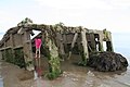
 Inside the Mulberry Caisson - geograph.org.uk - 3208061.jpg 2,592 × 1,944; 2.34 MB
-

-

-

-
 King's Parade - geograph.org.uk - 4568473.jpg 640 × 426; 68 KB
-
 King's Parade - Nyewood Lane - geograph.org.uk - 4441195.jpg 640 × 480; 68 KB
-
 King's Parade - Silverston Avenue - geograph.org.uk - 4441211.jpg 640 × 480; 51 KB
-
 King's Parade, Bognor Regis - geograph.org.uk - 2390425.jpg 1,280 × 855; 236 KB
-
 Kingsway, Aldwick, Bognor Regis - geograph.org.uk - 4553197.jpg 1,600 × 1,200; 356 KB
-
 Kiosk behind Marine Drive - geograph.org.uk - 4568465.jpg 640 × 426; 84 KB
-
 Lee on Shore from the sea line - geograph.org.uk - 6524405.jpg 1,600 × 1,200; 626 KB
-
-

-

-

-
 Looking into Bay Walk from the north - geograph.org.uk - 4613760.jpg 800 × 600; 173 KB
-
 Looking into Furse Field - geograph.org.uk - 4615365.jpg 800 × 600; 154 KB
-
 Looking into Hook Lane Close - geograph.org.uk - 4614089.jpg 800 × 600; 118 KB
-
 Looking into Osborne Way - geograph.org.uk - 4614094.jpg 800 × 600; 102 KB
-
 Looking into Truro Crescent - geograph.org.uk - 4614116.jpg 800 × 600; 112 KB
-

-
 Looking north on Bay Walk - geograph.org.uk - 4613768.jpg 800 × 600; 149 KB
-
-
 Looking southwards along The Ridings - geograph.org.uk - 4613741.jpg 800 × 600; 120 KB
-

-

-
 Looking west towards Selsey from Aldwick - geograph.org.uk - 5576976.jpg 1,600 × 1,200; 618 KB
-

-
 Manor Way - geograph.org.uk - 2950416.jpg 2,048 × 1,536; 686 KB
-
 Marine Drive West - geograph.org.uk - 3519188.jpg 640 × 427; 55 KB
-
 Marine Gardens fountain - geograph.org.uk - 5398447.jpg 5,202 × 3,465; 4.22 MB
-
 Marine Gardens shelter - geograph.org.uk - 5398451.jpg 5,202 × 3,465; 3.32 MB
-
 Marine Gardens, Bognor Regis - geograph.org.uk - 4694729.jpg 1,600 × 1,200; 408 KB
-
 Marine Park Gardens - geograph.org.uk - 2390597.jpg 856 × 1,280; 237 KB
-
-
 Marine Park Gardens, Marine Drive West - geograph.org.uk - 1887368.jpg 800 × 600; 145 KB
-
 Millennium monument on the beach - geograph.org.uk - 4613777.jpg 800 × 600; 179 KB
-
 Mulberry Caisson battered by waves, Aldwick beach - geograph.org.uk - 6524361.jpg 1,600 × 1,200; 447 KB
-

-
 New footbridge to West Park, Aldwick, Bognor Regis - geograph.org.uk - 4545977.jpg 1,600 × 1,200; 637 KB
-
 North and South Lodges, Aldwick Lane - geograph.org.uk - 6524029.jpg 1,600 × 1,200; 529 KB
-
 North Lodge, Aldwick Lane - geograph.org.uk - 4551128.jpg 1,600 × 1,200; 591 KB
-
 Not the Rose Green Friary - geograph.org.uk - 4614100.jpg 800 × 600; 80 KB
-
 Notice to dog owners - geograph.org.uk - 2253416.jpg 768 × 1,024; 152 KB
-
 Nyetimber Lane alongside Avisford Park on the left - geograph.org.uk - 3629672.jpg 3,264 × 2,448; 4.35 MB
-
 Nyetimber Lane, Aldwick - geograph.org.uk - 3413339.jpg 2,048 × 1,536; 1.25 MB
-
 Nyewood Lane - Aldwick Road - geograph.org.uk - 4439396.jpg 640 × 480; 63 KB


_-_geograph.org.uk_-_4568479.jpg)


_-_geograph.org.uk_-_4552415.jpg)


,_Coastguards_Parade,_Barrack_Lane_-_geograph.org.uk_-_2255064.jpg)


