Category:Alnham
Vai alla navigazione
Vai alla ricerca
hamlet and civil parish in Northumberland, England  | |||||
| Carica un file multimediale | |||||
| Istanza di | |||||
|---|---|---|---|---|---|
| Luogo | Northumberland, Nord Est dell'Inghilterra, Inghilterra | ||||
 | |||||
Italiano: Alnham è un piccolo centro urbano della regione di Northumberland, nel nord dell'Inghilterra. È situata approssimativamente a 23 km (circa 14 miglia) a ovest di Alnwick.
Nederlands: Alnham is een dorp en civil parish in Northumberland, in Noord-Engeland. Het ligt ongeveer 23 kilometer ten westen van Alnwick. Alnham ligt ten zuidoosten van de Cheviot-heuvels, waar de rivier Aln ontspringt.
Sottocategorie
Questa categoria contiene le 9 sottocategorie indicate di seguito, su un totale di 9.
C
- Cushat Law (8 F)
G
- Great Ryle (13 F)
L
- Little Ryle (8 F)
M
P
- Prendwick (15 F)
S
- Scrainwood (10 F)
- St David's Cairn (4 F)
U
- Unthank, Alnham (2 F)
V
- The Vicar's Pele, Alnham (4 F)
File nella categoria "Alnham"
Questa categoria contiene 200 file, indicati di seguito, su un totale di 525.
(pagina precedente) (pagina successiva)-
 'Grey Yade of Coppath' near Alnham - geograph.org.uk - 4215015.jpg 1 024 × 768; 270 KB
-
 A cairn on Hogdon Law - geograph.org.uk - 2315172.jpg 640 × 427; 176 KB
-
 A fine stone-built culvert - geograph.org.uk - 3776174.jpg 1 600 × 1 129; 307 KB
-
 A muddy byway - geograph.org.uk - 4416315.jpg 1 600 × 1 200; 633 KB
-
 A new crop of hill lambs on Hazeltonrig Hill - geograph.org.uk - 2387387.jpg 1 024 × 769; 347 KB
-
 A public footpath on Northfieldhead Hill - geograph.org.uk - 2315160.jpg 427 × 640; 161 KB
-
 Above Pigdon's Leap - geograph.org.uk - 2387130.jpg 1 024 × 768; 248 KB
-
 Above Redscar Sike - geograph.org.uk - 3965441.jpg 2 560 × 1 920; 2,1 MB
-
 Access track west of Salter's Road - geograph.org.uk - 2385817.jpg 1 024 × 768; 232 KB
-
 Ainsey Burn - geograph.org.uk - 3965405.jpg 2 560 × 1 920; 1,99 MB
-
 Alnham - geograph.org.uk - 2218690.jpg 3 888 × 2 109; 1,23 MB
-
 Alnham House - geograph.org.uk - 2218731.jpg 3 847 × 2 442; 1,49 MB
-
 Alnham House - geograph.org.uk - 3901909.jpg 1 600 × 1 087; 170 KB
-
 Alnham Moor Farm - geograph.org.uk - 3455026.jpg 1 600 × 1 000; 476 KB
-
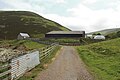
 Alnham War Memorial Hall - geograph.org.uk - 1331994.jpg 640 × 480; 84 KB
-
 Alnham War Memorial Hall - geograph.org.uk - 2389181.jpg 1 024 × 769; 248 KB
-
 Alnhammoor beside the River Breamish - geograph.org.uk - 4090705.jpg 1 600 × 1 110; 348 KB
-
 Alnhammoor Farm - geograph.org.uk - 381918.jpg 640 × 480; 44 KB
-
 Alongside Sting Burn - geograph.org.uk - 5806112.jpg 2 000 × 1 333; 449 KB
-
 Ancient settlement viewed from Chubden - geograph.org.uk - 4339511.jpg 1 600 × 1 316; 346 KB
-
 Approaching Coldlaw Cairn - geograph.org.uk - 5807029.jpg 2 000 × 1 333; 401 KB
-
 Approaching Low Bleackhope along Salters Road - geograph.org.uk - 5806195.jpg 1 890 × 1 246; 438 KB
-
 Approaching the hillfort - geograph.org.uk - 3518150.jpg 1 600 × 1 200; 245 KB
-
 Arable field, Ryle - geograph.org.uk - 3497839.jpg 640 × 433; 53 KB
-
 Arable land near Alnham - geograph.org.uk - 3498693.jpg 640 × 360; 212 KB
-
 At the edge of the Cheviots - geograph.org.uk - 5953035.jpg 4 320 × 3 240; 1,61 MB
-
 Below Sheilclough Edge - geograph.org.uk - 5807005.jpg 2 000 × 1 333; 377 KB
-
 Blackchester Hill - geograph.org.uk - 4151975.jpg 2 560 × 1 920; 2,79 MB
-
 Blacksmiths Cottage, Alnham - geograph.org.uk - 2389190.jpg 1 024 × 769; 233 KB
-
 Bog on slope of Scotsman's Knowe - geograph.org.uk - 5064104.jpg 1 500 × 773; 940 KB
-
 Bowl Holes - geograph.org.uk - 2219063.jpg 3 888 × 2 395; 1,63 MB
-
 Bridge over Scrainwood Burn - geograph.org.uk - 1868684.jpg 600 × 450; 400 KB
-
 Bridge over Scrainwood Burn - geograph.org.uk - 3901874.jpg 1 600 × 1 079; 259 KB
-
 Bridleway and Track towards Hazeltonrig - geograph.org.uk - 1868676.jpg 600 × 450; 326 KB
-
 Bridleway from Hazeltonrig to Alnham - geograph.org.uk - 2388926.jpg 1 024 × 768; 236 KB
-

-
 Bridleway towards Gibb's Hill - geograph.org.uk - 1965942.jpg 600 × 450; 237 KB
-
 Buildings at High Bleakhope - geograph.org.uk - 5806963.jpg 2 000 × 1 333; 375 KB
-
 Buildings at Low Bleakhope - geograph.org.uk - 5806204.jpg 2 000 × 1 333; 465 KB
-
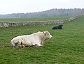 Bulls at Alnham House - geograph.org.uk - 3901907.jpg 1 600 × 1 228; 290 KB
-
 Bush Cleugh - geograph.org.uk - 1171016.jpg 640 × 480; 97 KB
-
 Bush Cleugh - geograph.org.uk - 2218637.jpg 3 888 × 2 592; 2,14 MB
-
 Bush Cleugh - geograph.org.uk - 5806174.jpg 2 000 × 1 333; 479 KB
-
 Bush Cleugh from Salter's Road - geograph.org.uk - 1170908.jpg 640 × 360; 75 KB
-
 Bush Knowe in winter snow - geograph.org.uk - 1747999.jpg 640 × 480; 35 KB
-
 Cairn on Chubden - geograph.org.uk - 4339489.jpg 1 600 × 1 146; 423 KB
-
 Cairn on North Pike - geograph.org.uk - 5993511.jpg 1 600 × 1 200; 634 KB
-
 Cairn on South Pike - geograph.org.uk - 5993515.jpg 1 600 × 1 200; 625 KB
-
 Cairn, under Bloodybush Edge - geograph.org.uk - 3965427.jpg 2 560 × 1 920; 1,99 MB
-
 Camera shy - geograph.org.uk - 5953040.jpg 4 320 × 3 240; 1,83 MB
-
 Carswell Cleugh - geograph.org.uk - 2218481.jpg 3 888 × 2 319; 1,42 MB
-
 Carter Knowe - geograph.org.uk - 3497860.jpg 640 × 480; 264 KB
-
 Castle Farm, Alnham - geograph.org.uk - 2389241.jpg 1 024 × 768; 243 KB
-
 Castle Hill fort - geograph.org.uk - 5953036.jpg 4 320 × 3 240; 1,42 MB
-
 Castle Hill, Alnham - geograph.org.uk - 3518102.jpg 1 600 × 1 200; 252 KB
-
 Castle Hill, Alnham hillfort - geograph.org.uk - 3518173.jpg 1 600 × 1 103; 213 KB
-
 Cattle grazing on south eastern slopes of Hogdon Law - geograph.org.uk - 3518136.jpg 1 600 × 1 155; 163 KB
-
 Cattle grid on road to Ewartly Shank - geograph.org.uk - 3518291.jpg 1 600 × 1 168; 277 KB
-
 Cattle grid... - geograph.org.uk - 5504964.jpg 3 008 × 2 000; 2,49 MB
-
 Cattle in the sunlight - geograph.org.uk - 5953059.jpg 4 276 × 2 456; 1,24 MB
-
 Cattle munching silage - geograph.org.uk - 3903169.jpg 1 600 × 1 314; 275 KB
-
 Chesters - geograph.org.uk - 1700776.jpg 1 600 × 1 095; 443 KB
-
 Chubden Camp from slopes of Old Fawdon Hill - geograph.org.uk - 4980243.jpg 1 024 × 768; 219 KB
-
 Cobden Burn Valley - geograph.org.uk - 1700798.jpg 1 600 × 1 095; 346 KB
-
 Coldlaw Cairn - geograph.org.uk - 5807038.jpg 2 000 × 1 333; 292 KB
-

-
 Coming off the moors... - geograph.org.uk - 5504962.jpg 3 008 × 2 000; 2,67 MB
-
 Coppath Burn overgrown with reeds - geograph.org.uk - 1203219.jpg 640 × 480; 106 KB
-
 Coppath Burn Romano-British Settlement - geograph.org.uk - 2385859.jpg 1 024 × 768; 270 KB
-
 Cotton grass on Hazeltonrig Hill - geograph.org.uk - 1004760.jpg 640 × 480; 135 KB
-
 Country road near Urchin's Bank - geograph.org.uk - 2466623.jpg 640 × 480; 86 KB
-
 Cow and calf above Alnham - geograph.org.uk - 2388997.jpg 1 191 × 1 588; 343 KB
-
 Cows and sheep on a hillside at Alnham - geograph.org.uk - 3482098.jpg 3 872 × 2 592; 3,24 MB
-
 Crossing Spartley Burn - geograph.org.uk - 910477.jpg 480 × 640; 68 KB
-
 Dammed pond near Alnham - geograph.org.uk - 2389559.jpg 1 024 × 768; 261 KB
-
 Descending Bloodybush Edge - geograph.org.uk - 3963938.jpg 2 560 × 1 920; 2,09 MB
-
-
 Desolate moorland west of Comb Fell - geograph.org.uk - 5064106.jpg 1 500 × 816; 1,07 MB
-

-
 Disused Pig Sty and "Netty" - geograph.org.uk - 4919434.jpg 1 066 × 800; 474 KB
-
 Ditch west of Hart Law - geograph.org.uk - 1203233.jpg 640 × 480; 82 KB
-
 Drainage ditch and farm equipment - geograph.org.uk - 3902854.jpg 1 600 × 1 208; 444 KB
-
 Drainage works in progress - geograph.org.uk - 3901905.jpg 1 600 × 1 063; 270 KB
-
 Dunmoor Hill - geograph.org.uk - 383958.jpg 640 × 480; 75 KB
-
 East lodge at Alnham House - geograph.org.uk - 1203784.jpg 640 × 480; 85 KB
-
 East Lodge, Alnham House - geograph.org.uk - 1332006.jpg 640 × 480; 92 KB
-
 Enclosed Settlement near Mere Burn - geograph.org.uk - 4980045.jpg 1 024 × 768; 231 KB
-
 Ewartly Shank - geograph.org.uk - 1171300.jpg 640 × 360; 46 KB
-
 Ewartly Shank - geograph.org.uk - 1864833.jpg 3 863 × 2 555; 1,89 MB
-
 Ewartly Shank - geograph.org.uk - 3305750.jpg 1 500 × 1 125; 1,83 MB
-
 Ewartly Shank Farm - geograph.org.uk - 389757.jpg 640 × 480; 81 KB
-
 Ewartly Shank from High Knowes - geograph.org.uk - 2386188.jpg 1 024 × 768; 149 KB
-
 Ewe Hill - geograph.org.uk - 1435433.jpg 640 × 480; 68 KB
-
 Ewe with twin lambs - geograph.org.uk - 3903136.jpg 1 600 × 1 296; 240 KB
-
 Fanny's Burn - geograph.org.uk - 3903165.jpg 1 600 × 1 200; 675 KB
-
 Fannysburn Plantation - geograph.org.uk - 4919520.jpg 1 066 × 800; 371 KB
-
 Farm Equipment on Ewe Hill - geograph.org.uk - 6256552.jpg 1 600 × 1 200; 409 KB
-
 Farm road south of Hazeltonrig - geograph.org.uk - 389686.jpg 640 × 480; 110 KB
-
 Farm road, Alnham - geograph.org.uk - 3498676.jpg 640 × 480; 222 KB
-
 Farm track above Hazeltonrig - geograph.org.uk - 1204491.jpg 640 × 480; 73 KB
-
 Farm track at the head of the Breamish Valley - geograph.org.uk - 5820956.jpg 2 000 × 1 333; 293 KB
-
 Farmland and View towards Caisley Plantation - geograph.org.uk - 4919532.jpg 1 066 × 800; 257 KB
-
 Farmland near Yetlington (1) - geograph.org.uk - 2177906.jpg 640 × 381; 106 KB
-
 Fence above Dow Cleugh - geograph.org.uk - 5806154.jpg 2 000 × 1 333; 354 KB
-
-
 Fence following line of trees - geograph.org.uk - 3903148.jpg 1 600 × 1 265; 369 KB
-
 Fence junction south of Coldlaw Cairn - geograph.org.uk - 5807019.jpg 2 000 × 1 333; 445 KB
-
-
 Fence west of High Knowes - geograph.org.uk - 2386160.jpg 1 024 × 768; 201 KB
-
 Fences meet at Black Butt - geograph.org.uk - 5805079.jpg 2 000 × 1 333; 336 KB
-
 Fern 'fiddles' by the Spartley Burn - geograph.org.uk - 2387238.jpg 768 × 1 024; 329 KB
-
 Field east of Alnham Castle - geograph.org.uk - 2389755.jpg 1 024 × 768; 230 KB
-
 Fields at Union Gate - geograph.org.uk - 2466610.jpg 640 × 480; 90 KB
-
 Fields north-west of Northfieldhead - geograph.org.uk - 2385538.jpg 1 024 × 768; 174 KB
-
 Flagstone path west of Cairn Hill - geograph.org.uk - 4604478.jpg 767 × 1 024; 335 KB
-
-
 Footbridge (new) over River Breamish - geograph.org.uk - 2030749.jpg 3 648 × 2 736; 3,7 MB
-
 Footbridge over Spartley Burn - geograph.org.uk - 1868716.jpg 600 × 450; 361 KB
-
 Footbridge over the Scrainwood Burn - geograph.org.uk - 1868480.jpg 600 × 450; 284 KB
-
 Footbridge over the Scrainwood Burn - geograph.org.uk - 1868670.jpg 600 × 450; 394 KB
-
-
 Footpath to Castle Hill - geograph.org.uk - 5952477.jpg 4 320 × 3 240; 2,83 MB
-
 Footpath to Ewartly Shank - geograph.org.uk - 5953047.jpg 4 320 × 2 726; 2,41 MB
-
 Footpath towards Bleak Law - geograph.org.uk - 1872187.jpg 600 × 450; 243 KB
-
 Ford and Footbridge over River Aln - geograph.org.uk - 4919302.jpg 1 066 × 800; 446 KB
-

-
 Ford and Footbridge, Scrainwood Burn - geograph.org.uk - 1868467.jpg 600 × 450; 353 KB
-
 Ford and Footbridge, Spartley Burn - geograph.org.uk - 1868713.jpg 600 × 450; 396 KB
-
 Ford at Alnham - geograph.org.uk - 3985898.jpg 3 872 × 2 592; 4,83 MB
-
 Ford at Alnhammoor - geograph.org.uk - 3985821.jpg 3 872 × 2 592; 4,79 MB
-
 Ford at Hazeltonrig - geograph.org.uk - 3985919.jpg 3 872 × 2 592; 4,81 MB
-
 Ford at Linhope - geograph.org.uk - 4389203.jpg 3 872 × 2 592; 4,35 MB
-
 Ford at Linhope - geograph.org.uk - 4389206.jpg 3 872 × 2 592; 4,32 MB
-
 Ford on bridleway south of Alnham - geograph.org.uk - 1203800.jpg 640 × 480; 81 KB
-
 Ford on the Hazeltonrig Burn - geograph.org.uk - 3985928.jpg 3 872 × 2 592; 4,85 MB
-
 Ford on the Spartley Burn - geograph.org.uk - 3985938.jpg 3 872 × 2 592; 4,59 MB
-
 Ford over Cobden Sike - geograph.org.uk - 2655270.jpg 3 648 × 2 736; 4,03 MB
-
 Ford south-west of Alnhammoor - geograph.org.uk - 3145298.jpg 1 024 × 768; 360 KB
-
 Forest plantation by Cobden Burn - geograph.org.uk - 3147055.jpg 1 024 × 768; 286 KB
-
 Forest plantation south of Hazeltonrig Burn - geograph.org.uk - 2387814.jpg 1 024 × 768; 243 KB
-

-
 Functional bridge over the River Breamish - geograph.org.uk - 4090712.jpg 1 600 × 1 200; 591 KB
-
 Gate and field boundary near Scrainton - geograph.org.uk - 1331979.jpg 640 × 480; 111 KB
-
 Gate by Tod Stones - geograph.org.uk - 2387244.jpg 1 024 × 768; 283 KB
-
 Gate into Plantation, Chesters Burn - geograph.org.uk - 6256509.jpg 1 600 × 1 200; 824 KB
-
 Gate north of High Knowes - geograph.org.uk - 2386248.jpg 1 024 × 768; 223 KB
-
 Gate on lower slopes of High Cantle - geograph.org.uk - 5831932.jpg 1 600 × 1 200; 646 KB
-

-
 Gate to the Vicarage, Alnham - geograph.org.uk - 1171732.jpg 640 × 481; 131 KB
-
 Gate west of Blackchester Hill - geograph.org.uk - 1204160.jpg 640 × 480; 67 KB
-
 Grassy moor below Sheilcleugh Edge - geograph.org.uk - 5806999.jpg 2 000 × 1 333; 357 KB
-
 Grazing sheep - geograph.org.uk - 638992.jpg 640 × 480; 114 KB
-
 Grouse butts on Broad Shin - geograph.org.uk - 1132181.jpg 640 × 360; 52 KB
-
 Hairpin bend on road west of Alnham - geograph.org.uk - 1204609.jpg 640 × 360; 62 KB
-
 Halfmoon Plantation - geograph.org.uk - 3775534.jpg 1 600 × 1 200; 488 KB
-
 Halfmoon Plantation - geograph.org.uk - 3775554.jpg 1 600 × 1 200; 371 KB
-

-
 Hart Law - geograph.org.uk - 1203288.jpg 640 × 360; 57 KB
-
 Hazeltonrig (renovation progressing) - geograph.org.uk - 2388918.jpg 1 024 × 768; 215 KB
-
 Hazeltonrig (renovation work) - geograph.org.uk - 1868702.jpg 600 × 450; 281 KB
-
 Hazeltonrig - geograph.org.uk - 2218706.jpg 3 663 × 2 023; 1,35 MB
-
 Hazeltonrig Burn - geograph.org.uk - 2387730.jpg 1 024 × 768; 264 KB
-

-
 Hazeltonrig from bridleway to Alnham - geograph.org.uk - 2388951.jpg 1 024 × 768; 231 KB
-
 Hazeltonrig Plantation - geograph.org.uk - 1204591.jpg 640 × 480; 95 KB
-
 Hazeltonrig Plantation - geograph.org.uk - 2389858.jpg 1 024 × 768; 296 KB
-

-
 Heather moor south of Sting Head - geograph.org.uk - 5805092.jpg 2 000 × 1 333; 401 KB
-

-
-
 Hedgerow and pasture above the Mere Burn - geograph.org.uk - 1332143.jpg 640 × 480; 107 KB
-
 Hedgerow trees near Alnham - geograph.org.uk - 3498688.jpg 640 × 360; 207 KB
-
 High Bleakhope - geograph.org.uk - 1864846.jpg 3 483 × 1 886; 841 KB
-
 High Cantle - geograph.org.uk - 1749052.jpg 640 × 480; 87 KB
-
 High Knowes - geograph.org.uk - 2218673.jpg 3 888 × 2 398; 1,9 MB
-
 High Knowes palisaded settlement - geograph.org.uk - 2385974.jpg 3 000 × 998; 756 KB
-
 High Knowes palisaded settlement - geograph.org.uk - 2386035.jpg 1 024 × 576; 203 KB
-
 Hushie Cairn on Hogdon Law - geograph.org.uk - 2315185.jpg 640 × 427; 166 KB
-
 In Castle Hill hillfort - geograph.org.uk - 3518303.jpg 1 600 × 1 200; 265 KB
-
 Interior of the sheepfold - geograph.org.uk - 3517680.jpg 1 600 × 1 253; 485 KB
-
 Kidland Forest - geograph.org.uk - 5805102.jpg 2 000 × 1 333; 463 KB
-

-

-
 Lightly wooded land, Alnham - geograph.org.uk - 3498681.jpg 640 × 480; 327 KB
-
 Little Dod - geograph.org.uk - 1864873.jpg 3 888 × 2 395; 1,3 MB
-
 Little Dod - geograph.org.uk - 2218664.jpg 3 888 × 2 295; 1,61 MB
-

-
 Looking down the valley of the Sting Burn - geograph.org.uk - 5806137.jpg 2 000 × 1 333; 325 KB
-
 Looking down the western slopes of Chubden - geograph.org.uk - 4339479.jpg 1 600 × 1 200; 382 KB
-
 Looking down to the River Breamish - geograph.org.uk - 5807012.jpg 2 000 × 1 333; 343 KB
-
 Looking into the Breamish Valley from Coldlaw Cairn - geograph.org.uk - 5820918.jpg 2 000 × 1 333; 265 KB
-
 Looking into the centre of Castle Hill hillfort - geograph.org.uk - 3518116.jpg 1 600 × 1 200; 252 KB
-
 Looking north across the Aln valley - geograph.org.uk - 3776146.jpg 1 600 × 1 200; 328 KB
-
 Looking up to Hogdon Law - geograph.org.uk - 910501.jpg 480 × 640; 79 KB
-
 Low Bleakhope - geograph.org.uk - 2218628.jpg 3 888 × 2 592; 1,85 MB
-
 Marker Post on Restricted Byway to Alnhammoor - geograph.org.uk - 5993534.jpg 1 600 × 1 200; 568 KB
-
 Marsh below Castle Farm - geograph.org.uk - 2389294.jpg 1 024 × 768; 249 KB
-
 Marshy hollows by Smalehope Burn - geograph.org.uk - 1171146.jpg 640 × 360; 66 KB
-

-
 Meggrim's Knowe - geograph.org.uk - 2218617.jpg 3 888 × 2 592; 1,84 MB


_by_garden_back_gate_of_Tower_House_-_geograph.org.uk_-_2385322.jpg)


_-_geograph.org.uk_-_2177906.jpg)


_over_River_Breamish_-_geograph.org.uk_-_2030749.jpg)


_-_geograph.org.uk_-_2388918.jpg)
_-_geograph.org.uk_-_1868702.jpg)


