Category:Altes Rathaus Oberems
Jump to navigation
Jump to search
| Object location | | View all coordinates using: OpenStreetMap |
|---|
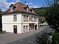
This is the category of the Hessian Kulturdenkmal (cultural monument) with the ID 100184 (Wikidata)
|
| Upload media | |||||
| Instance of | |||||
|---|---|---|---|---|---|
| Location | Oberems, Glashütten, Hochtaunuskreis, Darmstadt Government Region, Hesse, Germany | ||||
| Heritage designation | |||||
 | |||||
Media in category "Altes Rathaus Oberems"
The following 4 files are in this category, out of 4 total.
-
 Altes Rathaus Oberems.jpg 2,288 × 1,712; 793 KB
-
 Oberems, Frankfurter Straße 1 (1).jpg 5,904 × 4,168; 14.55 MB
-
 Oberems, Frankfurter Straße 1, Rückseite.JPG 4,880 × 3,256; 8.98 MB
-
 Oberems, Frankfurter Straße 1.jpg 5,664 × 3,592; 12.11 MB

.jpg)

