Category:Alvikstunneln
Jump to navigation
Jump to search
| Object location | | View all coordinates using: OpenStreetMap |
|---|
| Object location | | View all coordinates using: OpenStreetMap |
|---|
 | |||||
| Upload media | |||||
| Instance of | |||||
|---|---|---|---|---|---|
| Location | Västerort, Stockholm Municipality, Stockholm County, Sweden | ||||
| Inception |
| ||||
| Length |
| ||||
| Connecting line | |||||
 | |||||
Media in category "Alvikstunneln"
The following 10 files are in this category, out of 10 total.
-
 Alvikstunneln 2009.jpg 2,376 × 1,716; 1.27 MB
-
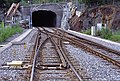 Bf Alvik (unten), doppelte Gleisverbindung Ri. Gröndal.jpg 3,868 × 2,604; 3.05 MB
-
 ET 409 einf. in Alvik (unten).jpg 3,850 × 2,591; 2.98 MB
-
 I11 486 Alvikstunnel.jpg 4,266 × 2,844; 3.61 MB
-
 I11 488 Alvikstunnel, ET 4.jpg 4,248 × 2,832; 2.32 MB
-
 I11 489 Alvikstunnel, ET 425.jpg 4,248 × 2,832; 3.53 MB
-
 I11 490 Alvikstunnel, ET 425.jpg 4,266 × 2,844; 3.5 MB
-
 I11 494 Alvikstunnel, ET 412.jpg 4,356 × 2,904; 3.13 MB
-
 I11 495 Alvikstunnel, ET 412.jpg 4,248 × 2,832; 3.88 MB
-
 I11 496 Alvikstunnel, ET 412.jpg 4,248 × 2,832; 4.34 MB
,_doppelte_Gleisverbindung_Ri._Gr%C3%B6ndal.jpg)
.jpg)


