Category:Am Mellensee
Zur Navigation springen
Zur Suche springen

Gemeinde im Landkreis Teltow-Fläming   | |||||
| Medium hochladen | |||||
| Ist ein(e) |
| ||||
|---|---|---|---|---|---|
| Ort | Landkreis Teltow-Fläming, Brandenburg, Deutschland | ||||
| Liegt am oder im Gewässer | |||||
| Einwohnerzahl |
| ||||
| Fläche |
| ||||
| Höhe über dem Meeresspiegel |
| ||||
| offizielle Website | |||||
 | |||||
Deutsch: Am Mellensee ist eine deutsche Gemeinde im Landkreis Teltow-Fläming in Brandenburg.
Unterkategorien
Es werden 10 von insgesamt 10 Unterkategorien in dieser Kategorie angezeigt:
In Klammern die Anzahl der enthaltenen Kategorien (K), Seiten (S), Dateien (D)
Medien in der Kategorie „Am Mellensee“
Folgende 200 Dateien sind in dieser Kategorie, von 215 insgesamt.
(vorherige Seite) (nächste Seite)-
 " Die Wurst am Stengel...." - panoramio.jpg 2.592 × 1.944; 2,05 MB
-
 "Platz in der Sonne" - mit Diebstahlsicherung - panoramio.jpg 2.592 × 1.944; 2,71 MB
-
 20220808.Am Mellensee.Hauptstraße 17.-011.jpg 6.936 × 9.248; 16,74 MB
-
 20220808.Am Mellensee.Hauptstraße 17.-012.jpg 9.248 × 6.936; 16,98 MB
-
 20220808.Am Mellensee.Hauptstraße 17.-013.jpg 9.248 × 6.936; 17,63 MB
-
 20220808.Am Mellensee.Hauptstraße 17.-014.jpg 9.248 × 6.936; 16,47 MB
-
 20220808.Am Mellensee.Hotel Morada.-011.jpg 9.248 × 6.936; 11,21 MB
-
 20220808.Am Mellensee.Hotel Morada.-012.jpg 9.340 × 7.005; 9,93 MB
-
 20220808.Am Mellensee.Hotel Morada.-013.jpg 9.248 × 5.202; 10,06 MB
-
 20220808.Erlebnisbahn Zossen-Mellensee.-022.1.jpg 9.248 × 6.936; 11,67 MB
-
 20220808.Erlebnisbahn Zossen-Mellensee.-022.2.jpg 9.248 × 6.936; 7,86 MB
-
 20220808.Erlebnisbahn Zossen-Mellensee.-022.3.jpg 9.310 × 6.982; 7,11 MB
-
 20220808.Erlebnisbahn Zossen-Mellensee.-022.5.jpg 9.248 × 6.936; 8,73 MB
-
 20220808.Erlebnisbahn Zossen-Mellensee.-023.1.jpg 9.248 × 6.936; 23,02 MB
-
 20220808.Erlebnisbahn Zossen-Mellensee.-023.2.jpg 9.248 × 6.936; 24,64 MB
-
 20220808.Erlebnisbahn Zossen-Mellensee.-023.3.jpg 9.248 × 6.936; 20,4 MB
-
 20220808.Erlebnisbahn Zossen-Mellensee.-023.4.jpg 9.248 × 6.936; 22,68 MB
-
 20220808.Erlebnisbahn Zossen-Mellensee.-024.1.jpg 9.248 × 6.936; 19,72 MB
-
 20220808.Erlebnisbahn Zossen-Mellensee.-024.2.jpg 9.248 × 6.936; 20,44 MB
-
 20220808.Erlebnisbahn Zossen-Mellensee.-024.3.jpg 9.248 × 6.936; 18,15 MB
-
 20220808.Erlebnisbahn Zossen-Mellensee.-024.4.jpg 9.248 × 6.936; 12,73 MB
-
 20220808.Erlebnisbahn Zossen-Mellensee.-025.1.jpg 9.248 × 6.936; 15,36 MB
-
 20220808.Erlebnisbahn Zossen-Mellensee.-025.2.jpg 9.248 × 6.936; 16,64 MB
-
 20220808.Nottekanal.-009.jpg 9.248 × 6.936; 25,79 MB
-
 20220808.Restaurant am Wildpark.-011.jpg 9.248 × 6.936; 24,98 MB
-
 20220808.Restaurant am Wildpark.-012.jpg 9.248 × 6.936; 26,34 MB
-
 20220808.Schachtabdeckung.Brandenburg.-01.jpg 6.936 × 6.776; 19,06 MB
-
 20220811.Restaurant am Wildpark.-011.jpg 9.248 × 6.936; 12,86 MB
-
 20220811.Restaurant am Wildpark.-012.jpg 8.476 × 6.358; 5,99 MB
-
 20220811.Restaurant am Wildpark.-013.jpg 6.936 × 9.248; 12,98 MB
-
 20220811.Restaurant am Wildpark.-014.jpg 8.613 × 6.460; 10,96 MB
-
 20220811.Restaurant am Wildpark.-015.jpg 9.248 × 6.936; 11,91 MB
-
 20220812.Restaurant am Wildpark.-011.jpg 8.761 × 5.760; 7,28 MB
-
 20220812.Restaurant am Wildpark.-012.jpg 7.337 × 6.831; 8,86 MB
-
 20220813.Fischstube am Mellensee.-011.jpg 9.230 × 5.284; 14,38 MB
-
 20220813.Fischstube am Mellensee.-012.jpg 9.230 × 4.987; 12,28 MB
-
 20220813.Restaurant am Wildpark.-011.jpg 6.969 × 6.010; 8,02 MB
-
 20220813.Restaurant am Wildpark.-012.jpg 6.621 × 6.870; 8,52 MB
-
 21.03.2014 - 21 Grad - panoramio.jpg 2.592 × 1.944; 3,42 MB
-
 3.Tiefbau der Gipsbrüche in Sperenberg - panoramio.jpg 3.264 × 2.448; 2,89 MB
-
 66 Seenwanderweg - panoramio.jpg 3.264 × 2.448; 2,16 MB
-
 Akazien Parcours - panoramio.jpg 2.592 × 1.944; 3,19 MB
-
 Allein auf weiter Flur -2 - panoramio.jpg 3.264 × 2.448; 3,14 MB
-
 Allein auf weiter Flur -5 - panoramio.jpg 3.264 × 2.448; 3,11 MB
-
 Allein auf weiter Flur -6 - panoramio.jpg 3.264 × 2.448; 3,1 MB
-
 Alte Allee bei Rehagen-Klausdorf - panoramio.jpg 2.592 × 1.944; 3,56 MB
-
 Alter Brückenpfeiler zwischen Sperenberg und Neuhof - panoramio.jpg 2.592 × 1.944; 2,79 MB
-
 Alter Grenzstein - Luckenwalder Heide - panoramio.jpg 3.264 × 2.448; 3,07 MB
-

-
 Am Heegesee in Sperenberg - panoramio (2).jpg 3.264 × 2.448; 3,1 MB
-
 Am Heegesee in Sperenberg - panoramio (3).jpg 3.264 × 2.448; 3,09 MB
-
 Am Mellensee Moke-Notte-Rundweg (1).JPG 2.592 × 1.944; 3,28 MB
-
 Am Mellensee Moke-Notte-Rundweg (2).JPG 2.592 × 1.944; 3,69 MB
-
 Am Mellensee Moke-Notte-Rundweg (3).JPG 2.592 × 1.944; 3,28 MB
-
 Am Mellensee Moke-Notte-Rundweg (4).JPG 2.592 × 1.944; 3,57 MB
-
 Am Mellensee Moke-Notte-Rundweg Infotafeln (1).JPG 2.592 × 1.944; 2,42 MB
-
 Am Mellensee Moke-Notte-Rundweg Infotafeln (2).JPG 2.592 × 1.944; 2,2 MB
-
 Am Mellensee Moke-Notte-Rundweg Infotafeln (3).JPG 1.944 × 2.592; 1,72 MB
-
 Am Mellensee Moke-Notte-Rundweg Infotafeln (4).JPG 2.592 × 1.944; 2,58 MB
-
 Am Mellensee Moke-Notte-Rundweg.JPG 2.592 × 1.944; 3,59 MB
-
 Am Mellensee Nottekanal Schleuse Infotafel.JPG 2.592 × 1.944; 2,34 MB
-
 Am Mellensee Saalow Saalowgraben.JPG 2.592 × 1.944; 2,25 MB
-
 Am Mellensee Saalower Höllenbergweg 02.JPG 4.912 × 1.080; 1,73 MB
-
 Am Mellensee Saalower Höllenbergweg 03.JPG 2.592 × 1.944; 3,88 MB
-
 Am Mellensee Saalower Höllenbergweg 04.JPG 2.592 × 1.944; 3,79 MB
-
 Am Mellensee Saalower Höllenbergweg 05.JPG 2.592 × 1.944; 2,2 MB
-
 Am Mellensee Saalower Höllenbergweg 07.JPG 2.592 × 1.944; 3,69 MB
-
 Am Wanderweg Sperenberg - Klausdorf - Wintersaat - panoramio.jpg 2.592 × 1.944; 2,16 MB
-
 Ausgelichtet - Pflegearbeiten im Wald - panoramio.jpg 3.264 × 2.448; 3,09 MB
-
 Auto STOP - panoramio.jpg 700 × 464; 304 KB
-
 Bank am Bodengeopfad-Gipsbrüche - panoramio.jpg 3.264 × 2.448; 2,95 MB
-
 Bank am Wanderweg "Baruther Linie" - panoramio.jpg 3.264 × 2.448; 2,92 MB
-
 Bank Duo - Kloster Alexanderdorf - panoramio.jpg 2.592 × 1.944; 2,35 MB
-
 Bank gut getarnt im Herbstlaub - panoramio.jpg 3.264 × 2.448; 3,18 MB
-
 Bauwerk der Eisenbahnpioniere am Heegesee in Sperenberg - panoramio.jpg 3.264 × 2.448; 3,01 MB
-
 Bienenkörbe (man kann dicht herangehen) - panoramio.jpg 2.592 × 1.944; 2,88 MB
-
 Blick aus den 4.Stock einer ehemaligen GSSD Kaserne - panoramio.jpg 3.264 × 2.448; 3 MB
-
 Bodengeopfad bei Klausdorf - panoramio.jpg 2.592 × 1.944; 3,37 MB
-
 Bodengeopfad Kausdorf - panoramio.jpg 2.592 × 1.944; 3,2 MB
-
 Bodengeopfad Rehagen - Klausdorf - panoramio.jpg 2.592 × 1.944; 2,86 MB
-
 Bodengeopfad Rehagen - panoramio (1).jpg 2.592 × 1.944; 2,81 MB
-
 Bodengeopfad Rehagen - panoramio.jpg 2.592 × 1.944; 2,98 MB
-
 Brückenpfeiler an der K 7226 bei Sperenberg - panoramio.jpg 2.592 × 1.944; 2,51 MB
-
 Brückenpfeiler an der Straße Rehagen - Sperenberg - panoramio.jpg 1.944 × 2.592; 3,43 MB
-
 Brückenpfeiler massiv Sperenberg 2011 - panoramio.jpg 700 × 464; 318 KB
-
 Brückenpfeiler Straße zwischen Sperenberg und Neuhof - panoramio.jpg 2.592 × 1.944; 2,92 MB
-
 DAV - Gewässer - Rehagen - panoramio.jpg 2.592 × 1.944; 2,72 MB
-
 Dem Licht entgegen.... - panoramio.jpg 2.448 × 3.264; 3,06 MB
-
 Denkmal 1.Weltkrieg 1914-1918 Mellensee - panoramio.jpg 2.592 × 1.944; 2,75 MB
-
 Denkmal 2.Weltkrieg in Fernneuendorf - panoramio (1).jpg 3.264 × 2.448; 2,95 MB
-
 Denkmal 2.Weltkrieg in Fernneuendorf - panoramio.jpg 3.264 × 2.448; 2,92 MB
-
 Denkmal für die Gefallenen des 1.Weltkrieges Kummersdorf-Ort - panoramio.jpg 2.592 × 1.944; 2,5 MB
-
 Der Mellensee in Klausdorf - panoramio.jpg 2.592 × 1.944; 2,48 MB
-
 Der Winter naht... - panoramio.jpg 2.592 × 1.944; 2,63 MB
-

-
 Ehemalige Kaserne der GSSD Truppen - panoramio.jpg 2.592 × 1.944; 2,72 MB
-
 Ehemalige Tongrube - panoramio.jpg 3.264 × 2.448; 2,97 MB
-
 Ehemalige Unterkünfte der sowjetischen Truppen - panoramio.jpg 2.592 × 1.944; 2,41 MB
-
 Ehemaliger Friedhof des Walddorfes "Wunder" - panoramio.jpg 3.264 × 2.448; 2,88 MB
-
 Ehemaliger Heizkomplex der GSSD Truppen - panoramio.jpg 1.944 × 2.592; 1,64 MB
-
 Ehemaliges Gebäude der GSSD-Tuppen - panoramio.jpg 2.592 × 1.944; 2,58 MB
-
 Ehemaliges Heizhaus der GSSD-Truppen in Kummersdorf-Gut - panoramio.jpg 2.592 × 1.944; 1,6 MB
-
 Eiche allein unter Kiefern - panoramio.jpg 2.448 × 3.264; 2,96 MB
-
 Eiche am Wanderweg Baruther Linie - panoramio.jpg 3.264 × 2.448; 3,01 MB
-
 Eisenbahnpionierbauten Schumkasee.jpg 5.315 × 3.543; 5,76 MB
-
 Faules Luch ( Torf ) in Sperenberg - panoramio.jpg 3.264 × 2.448; 3,06 MB
-
 Faules Luch - DAV-Gewässer in Sperenberg - panoramio.jpg 3.264 × 2.448; 3,11 MB
-
 Feld bei Kummersdorf Ort - panoramio.jpg 3.264 × 2.448; 3,02 MB
-
 Feld in der Dezembersonne... - panoramio.jpg 3.264 × 2.448; 3 MB
-
 Gedenktafel Kriegsgräberstätte Saalow - panoramio.jpg 2.592 × 1.944; 2,41 MB
-
 Gesprengte Brücke? (39820118975).jpg 5.109 × 3.182; 8,85 MB
-
 Getreideernte bei 32 Grad... - panoramio.jpg 2.592 × 1.944; 2,15 MB
-
 Getreidefeld am 21.10.2014 - panoramio.jpg 3.264 × 2.448; 3,16 MB
-
 Gewässer bei Saalow-1 - panoramio.jpg 2.592 × 1.944; 1,93 MB
-
 Gewässer bei Saalow-2 - panoramio.jpg 2.592 × 1.944; 2,4 MB
-
 Gipsgestein in den Gipsbrüchen Sperenberg - panoramio.jpg 3.264 × 2.448; 3 MB
-
 Große Landebahn - panoramio.jpg 464 × 700; 203 KB
-
 Grube Rehagen - 21.03.2014 - panoramio.jpg 2.592 × 1.944; 2,36 MB
-
 Grube Rehagen - 26.01.2012 - panoramio.jpg 2.592 × 1.944; 1,83 MB
-
 Gründüngung nach der Getreideernte - panoramio.jpg 3.264 × 2.448; 3,14 MB
-
 Gründüngung nach Getreideanbau - panoramio.jpg 3.264 × 2.448; 3,05 MB
-
 Gut versteckt, um in den Gipsbrüchen zu klettern... - panoramio.jpg 3.264 × 2.448; 3,1 MB
-
 Herz-Zierung im Fesnterrahmen der Sowjets - panoramio.jpg 464 × 700; 295 KB
-
 Hochstand am Wanderweg "Baruther Linie" - panoramio.jpg 3.264 × 2.448; 3,01 MB
-
 Hoffentlich kein Genmais - panoramio.jpg 2.592 × 1.944; 2,27 MB
-
 Innenansichten einer ehemaligen GSSD Kaserne - panoramio.jpg 2.592 × 1.944; 1,67 MB
-
 Kiefer dreigeteilt am Schwarzen Luch - panoramio.jpg 2.448 × 3.264; 2,96 MB
-
 Kiefernwald am Heegesee - panoramio.jpg 3.264 × 2.448; 2,82 MB
-
 Kiefernwald bei Klausdorf - panoramio.jpg 2.592 × 1.944; 3,34 MB
-
 Kiesgrube Klausdorf - panoramio.jpg 2.592 × 1.944; 2,33 MB
-
 Klausdorf - Am Mellensee...zwei freie Angelplätze - panoramio.jpg 2.592 × 1.944; 1,71 MB
-
 Klausdorf - Bodengeopfad - panoramio (1).jpg 2.592 × 1.944; 3,51 MB
-
 Klausdorf - Bodengeopfad - panoramio (2).jpg 2.592 × 1.944; 3,43 MB
-
 Klausdorf - Bodengeopfad - panoramio.jpg 2.592 × 1.944; 3,62 MB
-
 Klausdorf - Bänke,Bänke,Bänke... - panoramio.jpg 2.592 × 1.944; 2,75 MB
-
 Klinkerbau (Kaserne) ca.100 Jahre alt - seit 1994 ungenutzt - panoramio.jpg 2.592 × 1.944; 2,59 MB
-
 Krummer See in Sperenberg - panoramio (1).jpg 3.264 × 2.448; 3,12 MB
-
 Krummer See in Sperenberg - panoramio.jpg 3.264 × 2.448; 2,99 MB
-
 Kugelbaum - Laune der Natur - panoramio.jpg 1.944 × 2.592; 2,85 MB
-
 Kummersdorfer See (40674577512).jpg 5.307 × 3.374; 7,12 MB
-
 Land unter (35463391743).jpg 4.265 × 2.812; 3,49 MB
-
 Mehrzweckhalle Mellensee - panoramio.jpg 2.592 × 1.944; 1,7 MB
-
 Mellensee - Erfrischungshalle - panoramio.jpg 2.592 × 1.944; 2,11 MB
-
 Mellensee - Platz für viele.... - panoramio.jpg 2.592 × 1.944; 2,65 MB
-
 Mellensee - Stillgelegte S-Bahn - panoramio.jpg 2.592 × 1.944; 2,11 MB
-
 Mellensee-Klausdorf - ehemaliger Bahnhof (jetzt Erlebnisbahn) - panoramio.jpg 2.592 × 1.944; 2,55 MB
-
 Mystische Kiefer am Heegesee - panoramio.jpg 2.448 × 3.264; 3,1 MB
-
 Märkische Idylle - Kiefern und Sand - panoramio.jpg 3.264 × 2.448; 2,93 MB
-
 Nahaufnahme Kugelbaum - panoramio.jpg 3.264 × 2.448; 2,98 MB
-
 Natur vs. Verfall - panoramio.jpg 2.592 × 1.944; 1,96 MB
-
 Naturschutzgebiet Schulzensee - panoramio (1).jpg 3.264 × 2.448; 3,18 MB
-
 Naturschutzgebiet Schulzensee - panoramio (2).jpg 3.264 × 2.448; 2,88 MB
-
 Naturschutzgebiet Schulzensee - panoramio.jpg 3.264 × 2.448; 3,12 MB
-
 Nottekanal bei Zossen - Buckowbrücke - panoramio.jpg 2.592 × 1.944; 2,74 MB
-
 Nottekanal Schleuse Mellensee - panoramio.jpg 2.592 × 1.944; 2,66 MB
-
 Obelisk der GSSD Truppen in Kummersdorf-Gut - panoramio.jpg 3.264 × 2.448; 2,96 MB
-
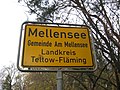 Ortseingang Mellensee - panoramio.jpg 2.592 × 1.944; 2,18 MB
-
 Paltrockmühle Saalow (29835628275).jpg 3.598 × 2.300; 3,06 MB
-
 Radweg Rehagen - Kummersdorf Ort - panoramio.jpg 3.264 × 2.448; 2,9 MB
-
 Radweg Sperenberg - Kummersdorf Gut - panoramio.jpg 2.592 × 1.944; 2,56 MB
-
 Rastplatz am Nottekanal - panoramio.jpg 2.592 × 1.944; 2,96 MB
-
 Rastplatz Kummersdorf-Alexanderdorf - panoramio.jpg 2.592 × 1.944; 3,17 MB
-
 Rastplatz Kummersdorf-Gut (Radfernweg Berlin-Leipzig) - panoramio.jpg 2.592 × 1.944; 3,33 MB
-
 Raststelle am 2.Tiefbau Sperenberg - panoramio.jpg 2.592 × 1.944; 3,41 MB
-
 Rauhreif - panoramio (1).jpg 2.592 × 1.944; 2,25 MB
-
 Rehagen - Angelgewässer-DAV - panoramio.jpg 2.592 × 1.944; 2,09 MB
-
 Rehagen - Bodengeopfad - panoramio.jpg 2.592 × 1.944; 3,23 MB
-
 Rehagen-Klausdorf - Bodengeopfad - panoramio (1).jpg 2.592 × 1.944; 3,42 MB
-
 Rehagen-Klausdorf - Bodengeopfad - panoramio.jpg 2.592 × 1.944; 3,53 MB
-
 Ruinen 2. Weltkrieg bei Rehagen - panoramio.jpg 2.592 × 1.944; 2,87 MB
-
 Ruinen 2.Weltkrieg bei Rehagen - panoramio (1).jpg 2.592 × 1.944; 3,22 MB
-
 Ruinen 2.Weltkrieg bei Rehagen - panoramio.jpg 2.592 × 1.944; 2,66 MB
-
 Rund im Heegesee - Waldlichtung - panoramio.jpg 3.264 × 2.448; 3,11 MB
-
 Rund um den Heegesee - Kiefern und Sand - panoramio.jpg 2.448 × 3.264; 3,07 MB
-
 Schleuse Mellensee - Nottekanal - panoramio.jpg 2.592 × 1.944; 2,39 MB
-
 Schornstein ehemaliges Gelände der sowjet.Steitkräfte-2 - panoramio.jpg 1.944 × 2.592; 1,7 MB
-
 Schornstein ehemaliges Gelände der sowjet.Streitkräfte-1 - panoramio.jpg 1.944 × 2.592; 1,61 MB
-
 Schumkesee Sperenberg - seit 1994 ungenutzt... - panoramio.jpg 2.592 × 1.944; 2,88 MB
-
 Sitzgruppe - Marke Eigenbau - panoramio.jpg 2.592 × 1.944; 2,75 MB
-
 Solide Ausführung - panoramio.jpg 2.592 × 1.944; 3,04 MB
-
 Sommerflieder 2013 mit Besucher... - panoramio.jpg 4.896 × 3.672; 6,32 MB
-
 Spargelfelder - (schwarz) - panoramio.jpg 2.592 × 1.944; 1,8 MB
-
 Spargelfelder - (weiss) - panoramio.jpg 2.592 × 1.944; 1,8 MB
-
 Spargelfelder mit schwarzer Folie - panoramio.jpg 3.264 × 2.448; 3,12 MB
-
 Spargelfelder mit weißer Folie - panoramio.jpg 3.264 × 2.448; 3,15 MB
-
 Sperenberg - am Torf (faules Luch) - panoramio (1).jpg 2.592 × 1.944; 2,41 MB
-
 Sperenberg - am Torf (faules Luch) - panoramio.jpg 2.592 × 1.944; 2,79 MB
-
 Sperenberg - am Torf - der Winter naht - panoramio.jpg 2.592 × 1.944; 2,39 MB
-
 Sperenberg - Barssee-1 - panoramio.jpg 2.592 × 1.944; 3,19 MB
-
 Sperenberg - Barssee-2 - panoramio.jpg 2.592 × 1.944; 2,4 MB
-
 Sperenberg - Faules Luch (Torf) - panoramio (1).jpg 2.592 × 1.944; 2,21 MB
-
 Sperenberg - Faules Luch (Torf) - panoramio.jpg 2.592 × 1.944; 1,41 MB
-
 Sperenberg - Faules Luch - panoramio (1).jpg 2.592 × 1.944; 2,16 MB
-
 Sperenberg - Faules Luch - panoramio.jpg 2.592 × 1.944; 1,64 MB
-
 Sperenberg - Gipsbrüche - Bodengeopfad - panoramio.jpg 2.592 × 1.944; 3,29 MB
-
 Sperenberg - zwischen den Jahren - panoramio.jpg 2.592 × 1.944; 2,01 MB
-
 Sperenberg- Bodengeopfad - Wanderweg Nr.7a - panoramio.jpg 2.592 × 1.944; 2,11 MB
-
 Spieglungen... - panoramio.jpg 2.592 × 1.944; 2,88 MB
-
 Start der Landebahn - panoramio.jpg 700 × 464; 232 KB
-
 Strom und Geometrie - panoramio.jpg 3.264 × 2.448; 2,79 MB


.jpg)
.jpg)
.JPG)
.JPG)
.JPG)
.JPG)
.JPG)
.JPG)
.JPG)
.JPG)


_-_panoramio.jpg)


.jpg)


.jpg)


_in_Sperenberg_-_panoramio.jpg)


.jpg)


.jpg)
.jpg)


_ca.100_Jahre_alt_-_seit_1994_ungenutzt_-_panoramio.jpg)
.jpg)


.jpg)
.jpg)


_-_panoramio.jpg)


.jpg)
.jpg)


.jpg)


_-_panoramio.jpg)

.jpg)


.jpg)


.jpg)


_-_panoramio.jpg)
_-_panoramio.jpg)


_-_panoramio_(1).jpg)
_-_panoramio.jpg)


_-_panoramio_(1).jpg)
_-_panoramio.jpg)
.jpg)


