Category:Ampthill
Vai alla navigazione
Vai alla ricerca
town in Central Bedfordshire, Bedfordshire, UK  | |||||
| Carica un file multimediale | |||||
| Istanza di | |||||
|---|---|---|---|---|---|
| Luogo | Central Bedfordshire, Bedfordshire, Est dell'Inghilterra, Inghilterra | ||||
| sito web ufficiale | |||||
 | |||||
Sottocategorie
Questa categoria contiene le 8 sottocategorie indicate di seguito, su un totale di 8.
A
- Ampthill railway station (1 F)
C
- Cooper's Hill, Bedfordshire (2 F)
- Cut-Throat Meadow (12 F)
H
- Houghton House (27 F)
T
Pagine nella categoria "Ampthill"
Questa categoria contiene un'unica pagina, indicata di seguito.
A
File nella categoria "Ampthill"
Questa categoria contiene 200 file, indicati di seguito, su un totale di 309.
(pagina precedente) (pagina successiva)-

-

-
 10 Bedford Street, Ampthill.jpg 4 128 × 3 096; 2,5 MB
-
 12 Dunstable Street, Ampthill (October 2023).jpg 2 957 × 2 218; 1,89 MB
-
 12 Dunstable Street, Ampthill.jpg 2 679 × 2 009; 1,34 MB
-
-
 A new roof - geograph.org.uk - 2757518.jpg 640 × 480; 76 KB
-
 A soon to be ex-field - geograph.org.uk - 5060265.jpg 2 304 × 1 728; 1,11 MB
-

-
 A whatsitsname - geograph.org.uk - 2757324.jpg 3 648 × 2 736; 2,25 MB
-
 A507 near Ampthill Grange - geograph.org.uk - 2522989.jpg 640 × 480; 70 KB
-
 A507 northbound - geograph.org.uk - 5187662.jpg 640 × 480; 64 KB
-
 A507 northbound - geograph.org.uk - 5187669.jpg 640 × 480; 53 KB
-
 A507 towards Ampthill - geograph.org.uk - 4629039.jpg 640 × 480; 68 KB
-
 A507 west of Ampthill - geograph.org.uk - 2522995.jpg 640 × 480; 65 KB
-
 A507-Woburn Road junction - geograph.org.uk - 2523011.jpg 640 × 480; 45 KB
-
 Abbey Lane mists - geograph.org.uk - 2166419.jpg 3 872 × 2 592; 3,19 MB
-
 Alameda Cottages Ampthill - geograph.org.uk - 632228.jpg 640 × 480; 94 KB
-
 Alameda Restaurant - geograph.org.uk - 972496.jpg 640 × 480; 111 KB
-
 Albion Ampthill.jpg 883 × 1 280; 360 KB
-
 Allotment Gardens - geograph.org.uk - 832255.jpg 640 × 480; 123 KB
-
 Ampthill - Bedfordshire dot.png 417 × 599; 122 KB
-
 Ampthill - panoramio.jpg 4 000 × 3 000; 3,25 MB
-

-
-
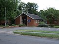
 Ampthill Baptist Church - geograph.org.uk - 5615167.jpg 1 024 × 755; 139 KB
-
 Ampthill Church - panoramio.jpg 3 000 × 4 000; 3,42 MB
-
 Ampthill Court House - geograph.org.uk - 5615073.jpg 1 024 × 768; 247 KB
-
 Ampthill fire station - geograph.org.uk - 584169.jpg 640 × 427; 219 KB
-

-
 Ampthill Heights - geograph.org.uk - 2420708.jpg 768 × 1 024; 114 KB
-
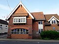
 Ampthill market place.jpg 900 × 675; 671 KB
-

-
 Ampthill Methodist Church - geograph.org.uk - 5615160.jpg 1 024 × 754; 152 KB
-
 Ampthill old fire station - geograph.org.uk - 1957328.jpg 640 × 427; 200 KB
-
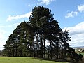
 Ampthill Park - geograph.org.uk - 5423100.jpg 4 608 × 3 456; 4,53 MB
-
 Ampthill Park - geograph.org.uk - 5440060.jpg 4 608 × 3 456; 4,35 MB
-
 Ampthill Park - geograph.org.uk - 6218944.jpg 4 608 × 3 456; 4,45 MB
-
 Ampthill Park House - geograph.org.uk - 4547694.jpg 4 214 × 3 094; 4,26 MB
-
 Ampthill Park House seen across the fields - geograph.org.uk - 3498686.jpg 1 600 × 1 200; 427 KB
-

-
 Ampthill Park, Bedfordshire - geograph.org.uk - 4897557.jpg 640 × 480; 81 KB
-
 Ampthill Police Station - geograph.org.uk - 4729246.jpg 640 × 480; 74 KB
-
 Ampthill Post Office - geograph.org.uk - 5615097.jpg 1 024 × 769; 152 KB
-
 Ampthill Pump - geograph.org.uk - 72684.jpg 531 × 640; 105 KB
-
 Ampthill rugby club - geograph.org.uk - 2757258.jpg 3 648 × 2 736; 2,18 MB
-
 Ampthill thatched cottages.jpg 900 × 661; 752 KB
-
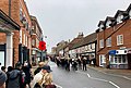
 Ampthill Town Centre - geograph.org.uk - 688411.jpg 640 × 480; 71 KB
-
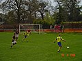
 Ampthill Town FC - geograph.org.uk - 2757241.jpg 3 648 × 2 736; 2,13 MB
-
 Ampthill Town Remembrance Day Parade 14 November 2021.jpg 3 671 × 2 468; 1,04 MB
-

-
 Ampthill Waitrose supermarket.jpg 4 032 × 2 268; 2,56 MB
-
 Ampthill, Albion - geograph.org.uk - 5615175.jpg 1 024 × 731; 149 KB
-
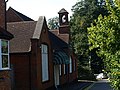
 Ampthill, almshouses - geograph.org.uk - 5615116.jpg 1 024 × 768; 161 KB
-
 Ampthill, CAB - geograph.org.uk - 5615145.jpg 1 024 × 768; 164 KB
-
 Ampthill, Cooper's Hill - geograph.org.uk - 5615183.jpg 1 024 × 768; 244 KB
-
 Ampthill, footpath - geograph.org.uk - 5615178.jpg 1 024 × 737; 259 KB
-
 Ampthill, gateway - geograph.org.uk - 5615066.jpg 1 024 × 762; 271 KB
-
 Ampthill, Georgian house with wrought-iron gates - geograph.org.uk - 1891342.jpg 1 024 × 768; 989 KB
-
 Ampthill, lychgate - geograph.org.uk - 1891322.jpg 800 × 603; 476 KB
-
 Ampthill, St Andrew's - geograph.org.uk - 5615122.jpg 1 024 × 768; 225 KB
-
 Ampthill, thatched cottages - geograph.org.uk - 5615081.jpg 1 024 × 768; 139 KB
-
 Ampthill, war memorial - geograph.org.uk - 5615181.jpg 1 024 × 751; 228 KB
-
 Ampthill, Wingfield Club - geograph.org.uk - 5615104.jpg 1 024 × 768; 132 KB
-
 Ampthill, Woburn Street - geograph.org.uk - 5615088.jpg 1 024 × 768; 134 KB
-
 Ampthill-temp-bannerjpg.jpg 4 015 × 572; 403 KB
-
 Approaching the One-O-One Roundabout - geograph.org.uk - 4408239.jpg 1 024 × 682; 211 KB
-
 ArsenalCelebrityCharityAmpthill.JPG 1 632 × 1 224; 496 KB
-
 Bedford Street Ampthill - geograph.org.uk - 688439.jpg 640 × 480; 79 KB
-
 Bedford Street, Ampthill - geograph.org.uk - 2453904.jpg 800 × 534; 478 KB
-
 Bedford Street, Ampthill - geograph.org.uk - 735724.jpg 640 × 480; 96 KB
-

-
 Bend in the A507, Ampthill - geograph.org.uk - 4729239.jpg 640 × 480; 53 KB
-
 Bridleway off Station Road, Ampthill - geograph.org.uk - 5722709.jpg 2 000 × 1 500; 1,42 MB
-
 Bridleway to and from Ampthill - geograph.org.uk - 6199611.jpg 2 000 × 1 500; 958 KB
-
 Cat Cottage, Alameda Road, Ampthill - geograph.org.uk - 2448962.jpg 800 × 533; 583 KB
-
 Charles May Receipt, 1828-9.jpg 769 × 1 200; 247 KB
-
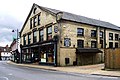
 Cheeseman and Son Chemist, Ampthill - geograph.org.uk - 688455.jpg 640 × 480; 102 KB
-
 Church Street, Ampthill - geograph.org.uk - 2446972.jpg 800 × 533; 541 KB
-
 Church Tower - Ampthill - geograph.org.uk - 522914.jpg 640 × 427; 82 KB
-
 Civil War mural, White Hart, Ampthill.JPG 2 048 × 1 536; 921 KB
-
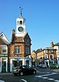 Clock tower, Ampthill.JPG 1 412 × 1 957; 586 KB
-
 Clubhouse - geograph.org.uk - 864872.jpg 640 × 480; 108 KB
-
 Clubhouses in Ampthill Park - geograph.org.uk - 2973834.jpg 640 × 427; 83 KB
-
 Cold - geograph.org.uk - 2267206.jpg 1 024 × 768; 295 KB
-
 Colonnade at the centre of the west front of Houghton House - geograph.org.uk - 6198374.jpg 2 000 × 1 500; 1,13 MB
-
 Corner of walled garden, Lodge Piece Farm - geograph.org.uk - 6199627.jpg 2 000 × 1 500; 889 KB
-
 Cottages Woburn Street Ampthill - geograph.org.uk - 632222.jpg 640 × 480; 115 KB
-
 Cottages, Alameda Road, Ampthill - geograph.org.uk - 2450469.jpg 800 × 533; 690 KB
-
 Cottages, Woburn Street, Ampthill - geograph.org.uk - 2450480.jpg 800 × 533; 464 KB
-
 Covered reservoir near Houghton House, Ampthill - geograph.org.uk - 6199635.jpg 2 000 × 1 500; 910 KB
-
 Cricket match in progress. - geograph.org.uk - 1318249.jpg 640 × 480; 102 KB
-
-
 Deer-proof fence - geograph.org.uk - 6184982.jpg 4 032 × 3 024; 2,85 MB
-
 Disused trailer - geograph.org.uk - 1922703.jpg 3 872 × 2 592; 1,2 MB
-
 Dunstable Street, Ampthill - geograph.org.uk - 2446904.jpg 800 × 533; 441 KB
-
 Dunstable Street, Ampthill - geograph.org.uk - 2446927.jpg 800 × 533; 541 KB
-
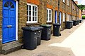 Dustbin Day, Bedford Street, Ampthill - geograph.org.uk - 2453909.jpg 800 × 533; 532 KB
-
 Early Morning - geograph.org.uk - 232700.jpg 640 × 480; 130 KB
-
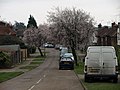 Early Spring Blossom - geograph.org.uk - 702264.jpg 640 × 480; 81 KB
-
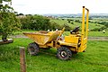 Earth mover - geograph.org.uk - 1922698.jpg 3 872 × 2 592; 1,26 MB
-
 Elizabeth II Postbox, Flitwick Road - geograph.org.uk - 3448690.jpg 682 × 1 024; 212 KB
-
 Engine and Tender Ampthill.jpg 1 783 × 1 238; 654 KB
-

-

-
 Entrance to Kingswood - geograph.org.uk - 1305136.jpg 640 × 480; 134 KB
-

-
 Farm Track - geograph.org.uk - 642665.jpg 640 × 480; 70 KB
-

-
 Field, Postern Piece, 1988 - geograph.org.uk - 5772305.jpg 1 024 × 683; 161 KB
-
 Fields near Ampthill - geograph.org.uk - 6184984.jpg 4 032 × 3 024; 2,77 MB
-
 Flitwick Road before the bypass - geograph.org.uk - 4661007.jpg 1 472 × 978; 262 KB
-
 Flitwick Road, Ampthill - geograph.org.uk - 3448696.jpg 1 024 × 682; 242 KB
-
 Flitwick Road, Ampthill - geograph.org.uk - 5060278.jpg 2 238 × 1 636; 1,09 MB
-
 Floral roundabout - geograph.org.uk - 1922714.jpg 3 872 × 2 592; 1,31 MB
-
 Flying - geograph.org.uk - 2267216.jpg 768 × 1 024; 76 KB
-
 Football Match, Ampthill Park, 1987 - geograph.org.uk - 5756043.jpg 1 024 × 683; 162 KB
-
 Footpath - geograph.org.uk - 522925.jpg 640 × 427; 83 KB
-
 Footpath - geograph.org.uk - 540696.jpg 640 × 427; 98 KB
-
 Footpath - geograph.org.uk - 972489.jpg 640 × 480; 133 KB
-
 Footpath ahead - geograph.org.uk - 1247099.jpg 640 × 480; 101 KB
-
 Footpath by the allotments - geograph.org.uk - 3455471.jpg 1 600 × 1 067; 680 KB
-
 Footpath by the stud farm - geograph.org.uk - 3455465.jpg 1 600 × 1 067; 370 KB
-
 Footpath junction at the entrance to King's Wood, Ampthill - geograph.org.uk - 6198501.jpg 2 000 × 1 500; 1,28 MB
-
 Footpath marker - geograph.org.uk - 1922729.jpg 3 872 × 2 592; 1,26 MB
-
 Footpath Marker. - geograph.org.uk - 1318262.jpg 640 × 480; 41 KB
-
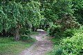
 Footpath near Houghton House, Ampthill - geograph.org.uk - 6199593.jpg 2 000 × 1 500; 1,25 MB
-
 Footpath near Wagstaff Way - geograph.org.uk - 3448714.jpg 1 024 × 682; 212 KB
-
 Footpath on the edge of a field of beans, Ampthill - geograph.org.uk - 6199602.jpg 2 000 × 1 500; 1,1 MB
-
 Footpath to Flitwick Road - geograph.org.uk - 3455478.jpg 1 600 × 1 067; 708 KB
-
 Footpath to Houghton House, Ampthill - geograph.org.uk - 6198351.jpg 2 000 × 1 500; 1,21 MB
-
 Footpath to the A507 - geograph.org.uk - 3455468.jpg 1 600 × 1 068; 671 KB
-
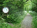
 Footpath, Ampthill - geograph.org.uk - 6198509.jpg 2 000 × 1 500; 1,03 MB
-
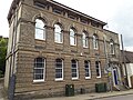
 Former Town Hall, Ampthill (geograph 6353286).jpg 1 024 × 683; 241 KB
-
 Front view of Houghton House, 1988 - geograph.org.uk - 5772142.jpg 1 024 × 683; 179 KB
-
 Georgian House Ampthill - geograph.org.uk - 632237.jpg 640 × 480; 131 KB
-
 Grange Farm Allotments - geograph.org.uk - 4695306.jpg 640 × 480; 58 KB
-
 Grazing and woodland, Ampthill - geograph.org.uk - 4629045.jpg 640 × 480; 73 KB
-

-
 Greensand Ridge walk - geograph.org.uk - 1285039.jpg 640 × 480; 94 KB
-
 Greensand Ridge Way - geograph.org.uk - 972463.jpg 640 × 480; 124 KB
-
-
 HGV's at Ampthill - geograph.org.uk - 4786206.jpg 640 × 426; 40 KB
-
 Holland Road, Ampthill - geograph.org.uk - 745853.jpg 640 × 480; 115 KB
-
 Holly walk - geograph.org.uk - 1285033.jpg 640 × 480; 143 KB
-
 Holly Walk, Ampthill - geograph.org.uk - 761564.jpg 640 × 480; 165 KB
-
 Houghton House from the Marston Vale Trail - geograph.org.uk - 6218943.jpg 4 608 × 3 456; 4,79 MB
-
 House on Dunstable Road, Ampthill - geograph.org.uk - 5060268.jpg 2 304 × 1 728; 821 KB
-
 Houses on Bedford Street, Ampthill - geograph.org.uk - 5060279.jpg 2 228 × 1 646; 1,11 MB
-
 Houses on Church St, Ampthill.JPG 1 963 × 1 471; 694 KB
-
 Houses on Dunstable Street, Ampthill - geograph.org.uk - 4629062.jpg 640 × 480; 69 KB
-
 Houses on Flitwick Road, Ampthill - geograph.org.uk - 5060267.jpg 2 304 × 1 728; 1 024 KB
-
 In need of modernisation - geograph.org.uk - 1247096.jpg 640 × 480; 80 KB
-
 Interesting Graffiti - geograph.org.uk - 1922722.jpg 1 600 × 1 071; 739 KB
-
 Its down here somewhere - geograph.org.uk - 1426035.jpg 640 × 480; 112 KB
-
 Katherine's Cross Inscription - geograph.org.uk - 154146.jpg 640 × 480; 165 KB
-
-
 Lake view, Ampthill Park - geograph.org.uk - 5423093.jpg 4 608 × 3 456; 5,72 MB
-
 Lane to Houghton House off the B530, Ampthill - geograph.org.uk - 6198319.jpg 2 000 × 1 500; 992 KB
-
 Leaning trees, Ampthill Park - geograph.org.uk - 5423107.jpg 4 608 × 3 456; 4,84 MB
-
 Loggia in the north front of Houghton House, Ampthill - geograph.org.uk - 6198379.jpg 2 000 × 1 460; 984 KB
-
 Love Shop, Woburn Street, Ampthill - geograph.org.uk - 2448922.jpg 800 × 533; 483 KB
-
 Market Stall - geograph.org.uk - 972481.jpg 640 × 480; 97 KB
-
 Marston Vale from Ampthill Park - geograph.org.uk - 6218951.jpg 4 608 × 3 456; 5,79 MB
-
 Marston Vale Timberland Trail sign, Ampthill Park - geograph.org.uk - 5423101.jpg 4 608 × 3 456; 5,28 MB
-
 Martin's, Church Street, Ampthill - geograph.org.uk - 2451636.jpg 800 × 534; 524 KB
-
 Message - Despair - geograph.org.uk - 1896456.jpg 1 024 × 685; 288 KB
-
 Mid Beds Link A Ride, Amphill, Central Bedforshire, 27th May 2010 (1) (13583831715).jpg 3 712 × 2 088; 3,65 MB
-
 Mid Beds Link A Ride, Amphill, Central Bedforshire, 27th May 2010 (2) (13583846945).jpg 3 712 × 2 088; 3,42 MB
-
 Moor Pond Piece, Ampthill - geograph.org.uk - 4573240.jpg 640 × 480; 243 KB
-
 New housing on Fliwick Road - geograph.org.uk - 3455492.jpg 1 600 × 1 067; 411 KB
-
 New Thatch in Ampthill - geograph.org.uk - 2872581.jpg 640 × 425; 56 KB
-
 No1 Market Place - geograph.org.uk - 2757360.jpg 2 736 × 3 648; 1,91 MB
-
 Obelisk Milestone by the B530, Church Street, Ampthill (geograph 5614574).jpg 1 200 × 1 600; 344 KB
-
 Old Court House, Ampthill.jpg 4 128 × 3 096; 2,88 MB
-
 Old House, Church Street, Ampthill - geograph.org.uk - 2453902.jpg 800 × 533; 516 KB
-

-
 Old trailer - geograph.org.uk - 1922680.jpg 3 872 × 2 592; 1,17 MB
-

-
 One of the Ossory Cottages in Ampthill - geograph.org.uk - 5746935.jpg 3 887 × 4 758; 4,92 MB
-
 Open door, expansive view – Houghton House - geograph.org.uk - 6218942.jpg 4 608 × 3 456; 4,71 MB
-
 Outbuilding - geograph.org.uk - 1247133.jpg 640 × 480; 67 KB
-
 Park Lodge, Ampthill.jpg 3 664 × 2 748; 2,11 MB
-

-
 Path in Kingswood, near Ampthill - geograph.org.uk - 2377906.jpg 1 280 × 960; 888 KB
-
 Path through Laurel Wood - geograph.org.uk - 2973827.jpg 480 × 640; 146 KB
-
 Path through the woods - geograph.org.uk - 3455480.jpg 1 600 × 1 069; 684 KB
-
 Path to the allotments by Farm Close - geograph.org.uk - 3455473.jpg 1 600 × 1 067; 515 KB
-
 Pedestrian crossing on Flitwick Road - geograph.org.uk - 3455493.jpg 1 600 × 1 067; 349 KB
-
 Permissive path - geograph.org.uk - 3455479.jpg 1 600 × 1 068; 703 KB
-
 Pillbox outside Ampthill - geograph.org.uk - 161407.jpg 640 × 480; 133 KB
-

-
 Play area by Wagstaff Way - geograph.org.uk - 3455469.jpg 1 600 × 1 069; 367 KB
-
 Play Area, Ampthill Heights - geograph.org.uk - 3448710.jpg 1 024 × 682; 224 KB
-
 Ploughed Field - geograph.org.uk - 1247127.jpg 640 × 480; 115 KB
-
 Post Office and stores, Ampthill - geograph.org.uk - 4629165.jpg 640 × 480; 73 KB
-
 Postcard from Ampthill (786057308).jpg 1 024 × 768; 165 KB
-
 Private road at the end of Ashburnham Road - geograph.org.uk - 3455487.jpg 1 600 × 1 067; 471 KB
-
 Protected Area^ - geograph.org.uk - 2215797.jpg 1 024 × 768; 290 KB
-
 Queens Head, Ampthill - geograph.org.uk - 972487.jpg 640 × 480; 96 KB


.jpg)


_Church_during_renovation,_1988_-_geograph.org.uk_-_5772295.jpg)


_-_geograph.org.uk_-_4729244.jpg)


.jpg)


_(13583831715).jpg)
_(13583846945).jpg)


.jpg)


.jpg)


