Category:Anticlines in the United States
Jump to navigation
Jump to search
Subcategories
This category has the following 5 subcategories, out of 5 total.
A
- Anticlines in Tennessee (1 F)
Media in category "Anticlines in the United States"
The following 27 files are in this category, out of 27 total.
-
 Anticline (Wills Creek Formation, Silurian; Round Top Hill, Maryland, USA).jpg 1,241 × 1,530; 2.15 MB
-
 Anticline Conococheague Holcim Quarry.jpg 1,234 × 720; 321 KB
-
 Anticline I-70 Fulton County PA.jpg 1,128 × 602; 279 KB
-
 BarstowFormationAnticlineMarch2010.jpg 3,941 × 2,712; 3.06 MB
-
 Bulletin 799 Plate 6A Anticline in Antietam Schist.jpg 686 × 403; 90 KB
-
 Bulletin of the Geological Society of America (1917) (20262833029).jpg 3,284 × 1,424; 912 KB
-
 Cave Mountain.jpg 2,301 × 1,529; 1.26 MB
-

-
 Coyote Canyon - (greg-willis.com) - panoramio.jpg 1,000 × 667; 282 KB
-
 Elk Basin MT WY.jpg 743 × 488; 160 KB
-

-
 Geologic map of Sanders quadrangle northern Arizona.jpg 6,042 × 11,567; 6.35 MB
-
 Kasatochi island bluffs Andreanof islands.jpg 3,000 × 2,000; 285 KB
-
 Meeker Dome.JPG 5,267 × 2,766; 8.09 MB
-
 Monterey-fold.jpg 568 × 388; 17 KB
-
 Mountains Albuquerque 2.jpg 3,264 × 2,448; 828 KB
-
 NJ Route 23 anticline.jpg 360 × 217; 43 KB
-
 North Limb Como Anticline.jpg 3,701 × 2,512; 7.12 MB
-
 NPS glen-canyon-geologic-map-central.jpg 3,143 × 1,859; 2.39 MB
-
 NPS glen-canyon-geologic-map-north.jpg 2,003 × 2,997; 2.24 MB
-
 NPS hot-springs-geologic-map.jpg 3,256 × 1,816; 1.79 MB
-
 Roundtop Hill outcrop2.jpg 1,175 × 773; 297 KB
-
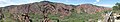 Roxborough Panorama.jpg 5,297 × 959; 1.69 MB
-
 SplitMountainAnticline.jpg 3,072 × 2,304; 3.37 MB
-
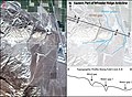 Wheeler ridge rivers-01-01.jpg 3,759 × 2,742; 4.92 MB
-
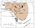 Williston Basin structure map.jpg 871 × 708; 86 KB
-
 Wills Creek Fm fold.jpg 464 × 586; 214 KB
.jpg)


_(20262833029).jpg)

_-_panoramio.jpg)

_7_(48632566143).jpg)


_3.jpg)