Category:Artillery Road, Pretoria
Jump to navigation
Jump to search
Afrikaans: Artilleriery, Salvokop, Pretoria
| Object location | | View all coordinates using: OpenStreetMap |
|---|
| NO WIKIDATA ID FOUND! Search for Artillery Road, Pretoria on Wikidata | |
| Upload media |
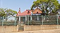
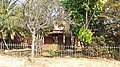
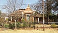
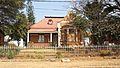
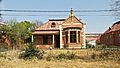
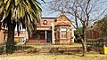
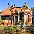
SAHRA assigns two numbers to the row of houses, as follows:
No. 1 to 13 Artillery Road, Pretoria
| This category shows a South African Protected Site with SAHRA file reference 9/2/258/0040. |
No. 14 and 15 Artillery Road, Pretoria
Media in category "Artillery Road, Pretoria"
The following 59 files are in this category, out of 59 total.
-
 1 - 15 Artillery Road, Pretoria 001.jpg 4,608 × 3,072; 5.74 MB
-
 1 - 15 Artillery Road, Pretoria 002.jpg 4,608 × 3,072; 7.54 MB
-
 1 - 15 Artillery Road, Pretoria 003.jpg 4,608 × 3,072; 7.37 MB
-
 1 - 15 Artillery Road, Pretoria 004.jpg 4,608 × 3,072; 8.07 MB
-
 1 - 15 Artillery Road, Pretoria 005.jpg 4,608 × 3,072; 4.73 MB
-
 1 - 15 Artillery Road, Pretoria 006.jpg 4,608 × 3,072; 7.57 MB
-
 1 - 15 Artillery Road, Pretoria 007.jpg 4,608 × 3,072; 6.57 MB
-
 1 - 15 Artillery Road, Pretoria 008.jpg 4,608 × 3,072; 6.06 MB
-
 1 - 15 Artillery Road, Pretoria 009.jpg 4,608 × 3,072; 5.1 MB
-
 1 - 15 Artillery Road, Pretoria 010.jpg 4,608 × 3,072; 4.77 MB
-
 1 - 15 Artillery Road, Pretoria 011.jpg 4,608 × 3,072; 7.39 MB
-
 1 - 15 Artillery Road, Pretoria 012.jpg 4,608 × 3,072; 6.23 MB
-
 1 - 15 Artillery Road, Pretoria 013.jpg 4,608 × 3,072; 5.6 MB
-
 1 - 15 Artillery Road, Pretoria 014.jpg 4,608 × 3,072; 4.51 MB
-
 1 - 15 Artillery Road, Pretoria 015.jpg 3,072 × 4,608; 4.43 MB
-
 1 - 15 Artillery Road, Pretoria 016.jpg 3,072 × 4,608; 4.51 MB
-
 1 - 15 Artillery Road, Pretoria 017.jpg 3,072 × 4,608; 4.56 MB
-
 1 - 15 Artillery Road, Pretoria 018.jpg 4,608 × 3,072; 6.68 MB
-
 1 - 15 Artillery Road, Pretoria 019.jpg 3,072 × 4,608; 5.36 MB
-
 1 - 15 Artillery Road, Pretoria 020.jpg 3,072 × 4,608; 6.38 MB
-
 1 - 15 Artillery Road, Pretoria 021.jpg 4,608 × 3,072; 4.58 MB
-
 1 - 15 Artillery Road, Pretoria 022.jpg 3,072 × 4,608; 4.62 MB
-
 1 - 15 Artillery Road, Pretoria 023.jpg 3,072 × 4,608; 4.6 MB
-
 1 - 15 Artillery Road, Pretoria 024.jpg 4,608 × 3,072; 4.93 MB
-
 1 - 15 Artillery Road, Pretoria 025.jpg 4,608 × 3,072; 5.03 MB
-
 1 - 15 Artillery Road, Pretoria 026.jpg 3,072 × 4,608; 4.68 MB
-
 1 - 15 Artillery Road, Pretoria 027.jpg 4,608 × 3,072; 4.9 MB
-
 1 - 15 Artillery Road, Pretoria 028.jpg 4,608 × 3,072; 5.87 MB
-
 1 Artillery Road-001.jpg 4,608 × 2,592; 5.08 MB
-
 10 Artillery Road-001.jpg 4,608 × 2,592; 5.9 MB
-
 11 Artillery Road-001.jpg 4,608 × 2,592; 5.57 MB
-
 12 Artillery Road-001.jpg 4,608 × 2,592; 5.68 MB
-
 13 Artillery Road-001.jpg 4,608 × 2,592; 6.43 MB
-
 14 Artillery Road-001.jpg 4,608 × 2,592; 6.32 MB
-
 15 Artillery Road-001.jpg 4,608 × 2,592; 5.42 MB
-
 2 Artillery Road-001.jpg 4,608 × 2,592; 4.67 MB
-
 3 Artillery Road-001.jpg 4,424 × 2,489; 5.44 MB
-
 4 Artillery Road-001.jpg 4,384 × 2,466; 4.85 MB
-
 5 Artillery Road-001.jpg 4,608 × 2,592; 6.1 MB
-
 6 Artillery Road-001.jpg 4,608 × 2,592; 5.21 MB
-
 7 Artillery Road-001.jpg 4,608 × 2,592; 5.95 MB
-
 8 Artillery Road-001.jpg 4,608 × 2,592; 5.92 MB
-
 9 2 258 -1 to 13 Artillery Rd-Pretoria-s.jpg 1,500 × 1,478; 1.2 MB
-
 9 Artillery Road-001.jpg 4,608 × 2,592; 6.54 MB
-
 Offisierswoning, 1 Artilleriery, a, Salvokop.jpg 4,000 × 3,000; 5.01 MB
-
 Offisierswoning, 1 Artilleriery, b, Salvokop.jpg 4,000 × 3,000; 4.15 MB
-
 Offisierswoning, 10 Artilleriery, Salvokop.jpg 4,000 × 3,000; 5.12 MB
-
 Offisierswoning, 11 Artilleriery, Salvokop.jpg 4,000 × 3,000; 4.82 MB
-
 Offisierswoning, 12 Artilleriery, Salvokop.jpg 4,000 × 3,000; 5.05 MB
-
 Offisierswoning, 13 Artilleriery, Salvokop.jpg 4,000 × 3,000; 5.02 MB
-
 Offisierswoning, 2 Artilleriery, Salvokop.jpg 4,000 × 3,000; 3.93 MB
-
 Offisierswoning, 3 Artilleriery, Salvokop.jpg 4,000 × 3,000; 5.13 MB
-
 Offisierswoning, 4 Artilleriery, Salvokop.jpg 4,000 × 3,000; 4.94 MB
-
 Offisierswoning, 5 Artilleriery, Salvokop.jpg 4,000 × 3,000; 4.91 MB
-
 Offisierswoning, 6 Artilleriery, Salvokop.jpg 4,000 × 3,000; 5.12 MB
-
 Offisierswoning, 7 Artilleriery, a, Salvokop.jpg 4,000 × 3,000; 4.92 MB
-
 Offisierswoning, 7 Artilleriery, b, Salvokop.jpg 4,000 × 3,000; 4.58 MB
-
 Offisierswoning, 8 Artilleriery, Salvokop.jpg 4,000 × 3,000; 4.76 MB
-
 Offisierswoning, 9 Artilleriery, Salvokop.jpg 4,000 × 3,000; 4.78 MB


