Category:Ashton Keynes
Jump to navigation
Jump to search
village in Wiltshire, England, UK  | |||||
| Upload media | |||||
| Instance of | |||||
|---|---|---|---|---|---|
| Location | Wiltshire, South West England, England | ||||
| Located in or next to body of water | |||||
| official website | |||||
 | |||||
English: Ashton Keynes is a village and civil parish in Wiltshire, England, near the border with Gloucestershire, about 6 miles south of Cirencester and 4 miles north of Cricklade. According to the 2001 census the parish had a population of 1,420. The village lies within the Cotswold Water Park and is situated on the River Thames about 7 miles from its source near Kemble (Thames Head). In the late 1980s a large Romano-British settlement was excavated on the edge of the village, in advance of extensive gravel extraction.
Nederlands: Ashton Keynes is een civil parish in de unitary authority Wiltshire, in het Engelse graafschap Wiltshire. De civil parish telt
Subcategories
This category has the following 3 subcategories, out of 3 total.
Media in category "Ashton Keynes"
The following 200 files are in this category, out of 255 total.
(previous page) (next page)-

-
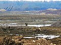
 A dirty ditch - geograph.org.uk - 309860.jpg 640 × 480; 117 KB
-
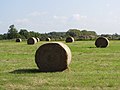
 A field with bales in it, near North End - geograph.org.uk - 2161882.jpg 1,440 × 1,080; 564 KB
-
 A quiet evening in the village - geograph.org.uk - 2497722.jpg 640 × 480; 134 KB
-
 A splendid show^ - geograph.org.uk - 5348689.jpg 2,592 × 1,944; 2.23 MB
-
 Aggregate Industries, North End Works, South Cerney (1) - geograph.org.uk - 1880317.jpg 1,600 × 1,200; 634 KB
-
 Aggregate Industries, North End Works, South Cerney (2) - geograph.org.uk - 1880318.jpg 1,600 × 1,200; 664 KB
-
 Aggregate Industries, North End Works, South Cerney (3) - geograph.org.uk - 1885389.jpg 1,600 × 1,199; 630 KB
-
 Aggregates factory beside flooded gravel pit - geograph.org.uk - 5749779.jpg 4,000 × 3,000; 4.76 MB
-
 Approaching the B4696 - geograph.org.uk - 5176871.jpg 2,592 × 1,944; 1.32 MB
-
 Ashton Keynes from the south - geograph.org.uk - 5176798.jpg 2,545 × 1,909; 1.05 MB
-
 Ashton Keynes Sports Ground - geograph.org.uk - 3902048.jpg 1,500 × 999; 226 KB
-
 Ashton Keynes Sports Ground Changing Rooms - geograph.org.uk - 3902052.jpg 1,500 × 999; 173 KB
-
 Ashton Keynes, Church Lane - geograph.org.uk - 1422312.jpg 640 × 480; 124 KB
-
 Ashton Keynes.jpg 3,648 × 2,736; 2.55 MB
-
 Aspen Lake Fishery, Lake 81, Cotswold Water Park, Ashton Keynes - geograph.org.uk - 2254863.jpg 1,440 × 1,080; 1,021 KB
-
 B4696 Ashton Keynes - geograph.org.uk - 2315944.jpg 1,440 × 1,080; 754 KB
-
 Bin day, near Fridays Ham Lane, east of Ashton Keynes - geograph.org.uk - 2254968.jpg 1,440 × 1,080; 744 KB
-
 Bird hide by the reedbeds - geograph.org.uk - 2905490.jpg 1,500 × 1,000; 363 KB
-
 Boarded-up houses near the Cotswold Community - geograph.org.uk - 4175469.jpg 4,000 × 3,000; 3.95 MB
-
 Bordering on farcical (27) - geograph.org.uk - 4085925.jpg 640 × 480; 69 KB
-
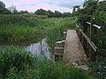
 Bridge over the Thames, Church Walk, Ashton Keynes - geograph.org.uk - 2314471.jpg 1,440 × 1,080; 900 KB
-
 Bridleway, Stoke Common - geograph.org.uk - 438543.jpg 640 × 480; 94 KB
-
 Catkins by the lake - geograph.org.uk - 2906465.jpg 983 × 1,500; 150 KB
-

-

-

-
 Cotswold Bruderhof.jpg 1,024 × 705; 89 KB
-
 Cotswold Stone Cottage, Ashton Keynes - geograph.org.uk - 1422305.jpg 640 × 480; 124 KB
-
 Cotswold Water Parks - geograph.org.uk - 4175460.jpg 4,000 × 2,184; 1.84 MB
-
 Cotswold Water Parks - geograph.org.uk - 4175477.jpg 4,000 × 2,400; 2.15 MB
-
 Cotswold Water Parks - geograph.org.uk - 4175487.jpg 4,000 × 2,140; 1.9 MB
-
 Cottage in Ashton Keynes - geograph.org.uk - 2390674.jpg 1,024 × 680; 229 KB
-

-
 Curious cattle - geograph.org.uk - 438564.jpg 640 × 469; 87 KB
-
 Dawn in Ashton Keynes - geograph.org.uk - 2497719.jpg 640 × 480; 72 KB
-
 Derelict quarrying machine, near Ashton Keynes - geograph.org.uk - 5749774.jpg 4,000 × 3,000; 4.69 MB
-
 Driveway to Cotswold Community - geograph.org.uk - 5763325.jpg 4,000 × 3,000; 4.69 MB
-

-
 Ducks by the River Thames - geograph.org.uk - 2906518.jpg 1,500 × 1,000; 278 KB
-
 Early Morning English Countryside.jpg 4,032 × 1,960; 1.71 MB
-

-

-

-

-
 Entering Ashton Keynes - geograph.org.uk - 5324056.jpg 640 × 480; 193 KB
-
 Entrance to gravel pit, east of Ashton Keynes (2) - geograph.org.uk - 2255006.jpg 1,440 × 1,080; 718 KB
-
 Entrance to gravel pit, east of Ashton Keynes - geograph.org.uk - 2254997.jpg 1,440 × 1,080; 826 KB
-
 Entrance to Stoke Common Farm - geograph.org.uk - 438538.jpg 640 × 480; 113 KB
-
 Field corner, Stoke Common - geograph.org.uk - 438546.jpg 640 × 480; 126 KB
-
 Field entrance near Pike Corner - geograph.org.uk - 4175308.jpg 4,000 × 3,000; 4.94 MB
-
 Field of maize at Happy Land, Ashton Keynes - geograph.org.uk - 4178047.jpg 4,000 × 2,152; 2.28 MB
-
 Filling in a gravel pit - geograph.org.uk - 5324063.jpg 640 × 480; 112 KB
-
 Flooded old gravel pit - geograph.org.uk - 5324070.jpg 640 × 480; 134 KB
-
 Footbridge across the Thames near Ashton Keynes - geograph.org.uk - 4175360.jpg 4,000 × 3,000; 5.52 MB
-
 Footbridge and ford across the Thames (geograph 4031809).jpg 4,000 × 3,000; 2.81 MB
-
 Footbridge and the River Thames, near Ashton Keynes - geograph.org.uk - 2315911.jpg 1,440 × 1,080; 883 KB
-
 Footbridge beside the Thames across a drain - geograph.org.uk - 4175364.jpg 4,000 × 3,000; 5.43 MB
-
 Footbridge by the River Thames, near Ashton Keynes - geograph.org.uk - 2315925.jpg 1,440 × 1,080; 964 KB
-

-
 Footpath entrance, near North End - geograph.org.uk - 2161900.jpg 1,440 × 1,080; 1.07 MB
-
 Ford at Ashton Keynes - geograph.org.uk - 4872409.jpg 1,600 × 1,067; 2.2 MB
-
 Gate pier of Manor House, Ashton Keynes - geograph.org.uk - 4175378.jpg 3,000 × 4,000; 6.24 MB
-
 Gravel pit near Ashton Keynes - geograph.org.uk - 4938956.jpg 4,000 × 3,000; 4.84 MB
-
 Gravel pit near Cleveland Farm - geograph.org.uk - 5431347.jpg 4,000 × 3,000; 4.96 MB
-
 Gravel pit, east of Ashton Keynes (1) - geograph.org.uk - 2254954.jpg 1,440 × 1,080; 731 KB
-
 Gravel pit, east of Ashton Keynes (2) - geograph.org.uk - 2254958.jpg 1,440 × 1,080; 761 KB
-
 Gravel pit, west of Ashton Keynes - geograph.org.uk - 2315834.jpg 1,440 × 1,080; 937 KB
-

-
 Hay bales near Ashton Keynes - geograph.org.uk - 4175457.jpg 4,000 × 3,000; 3.82 MB
-
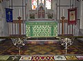
 Holy Cross, Ashton Keynes, banner - geograph.org.uk - 4099156.jpg 480 × 640; 59 KB
-

-

-

-

-

-

-

-

-

-

-
 Holy Cross, Ashton Keynes, font - geograph.org.uk - 4099216.jpg 480 × 640; 46 KB
-

-
-

-

-

-

-

-

-

-

-

-

-

-
 Holy Cross, Ashton Keynes, organ - geograph.org.uk - 4099241.jpg 480 × 640; 68 KB
-
 Holy Cross, Ashton Keynes, pulpit - geograph.org.uk - 4099240.jpg 467 × 640; 62 KB
-

-

-

-

-

-

-

-

-

-

-
 Holy Cross, Ashton Keynes, tower - geograph.org.uk - 4099127.jpg 480 × 640; 92 KB
-
 HorseandJockeyPub.jpg 1,923 × 2,575; 961 KB
-
 House by the Thames, Ashton Keynes - geograph.org.uk - 5393487.jpg 1,024 × 684; 337 KB
-
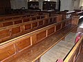
 Inside Holy Cross, Ashton Keynes (1) - geograph.org.uk - 4099220.jpg 640 × 462; 54 KB
-
 Inside Holy Cross, Ashton Keynes (2) - geograph.org.uk - 4099222.jpg 480 × 640; 48 KB
-
 Inside Holy Cross, Ashton Keynes (3) - geograph.org.uk - 4099233.jpg 640 × 480; 53 KB
-
 Inside Holy Cross, Ashton Keynes (4) - geograph.org.uk - 4099237.jpg 640 × 480; 65 KB
-
 Inside Holy Cross, Ashton Keynes (5) - geograph.org.uk - 4099238.jpg 640 × 480; 83 KB
-
 Inside Holy Cross, Ashton Keynes (6) - geograph.org.uk - 4099247.jpg 480 × 640; 56 KB
-
 Inside Holy Cross, Ashton Keynes (7) - geograph.org.uk - 4099249.jpg 640 × 480; 58 KB
-
 Inside Holy Cross, Ashton Keynes (8) - geograph.org.uk - 4099248.jpg 640 × 480; 55 KB
-
 Inside Holy Cross, Ashton Keynes (8) - geograph.org.uk - 4099253.jpg 640 × 480; 81 KB
-
 Inside Holy Cross, Ashton Keynes (9) - geograph.org.uk - 4099254.jpg 640 × 480; 55 KB
-
 Interior of Ashton Keynes church - geograph.org.uk - 2390951.jpg 680 × 1,024; 145 KB
-
 Island in Manorbrook Lake - geograph.org.uk - 2390980.jpg 1,024 × 680; 141 KB
-
 Kentend Farm, Ashton Keynes - geograph.org.uk - 4175419.jpg 4,000 × 2,400; 2.64 MB
-
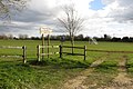
 Kissing gate on the Thames Path - geograph.org.uk - 2498153.jpg 640 × 480; 117 KB
-
 Lake at Cotswold Water Park - geograph.org.uk - 3964170.jpg 1,024 × 680; 153 KB
-
 Lake near Ashton Keynes - geograph.org.uk - 2315807.jpg 1,440 × 1,080; 447 KB
-
 Lake near the Thames west of Ashton Keynes - geograph.org.uk - 2314555.jpg 1,440 × 1,080; 1 MB
-
 Lane looking towards High Bridge - geograph.org.uk - 4031803.jpg 4,000 × 3,000; 2.73 MB
-
 Looking over a field towards the River Thames - geograph.org.uk - 2892743.jpg 1,500 × 1,000; 211 KB
-
-
 Manor House, disused, near Ashton Keynes - geograph.org.uk - 4175368.jpg 4,000 × 3,000; 3.36 MB
-
 Manor House, disused, near Ashton Keynes - geograph.org.uk - 4175373.jpg 4,000 × 3,000; 3.75 MB
-
 Manorbrook Lake - geograph.org.uk - 2390976.jpg 1,024 × 680; 145 KB
-
 Manorbrook Lake - geograph.org.uk - 2905482.jpg 1,500 × 992; 168 KB
-
 Manorbrook Lake - geograph.org.uk - 2905484.jpg 1,500 × 998; 177 KB
-
 Manorbrook Lake - geograph.org.uk - 2906454.jpg 1,500 × 994; 201 KB
-
 Manorbrook Lake in the early hours - geograph.org.uk - 2498159.jpg 640 × 480; 138 KB
-

-
 Minor road from Ashton Keynes - geograph.org.uk - 1880319.jpg 1,600 × 1,200; 918 KB
-
 Moat between the Manor House and Parish Church - geograph.org.uk - 4165615.jpg 1,024 × 768; 223 KB
-

-
 Not the Thames, near Ashton Keynes - geograph.org.uk - 2315893.jpg 1,080 × 1,440; 831 KB
-
 Not the Thames, near Ashton Keynes - geograph.org.uk - 2682490.jpg 600 × 800; 279 KB
-
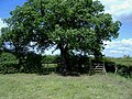
 Oak trees, Stoke Common - geograph.org.uk - 438556.jpg 640 × 480; 119 KB
-
 Old Cross by Church Lane - geograph.org.uk - 1422350.jpg 640 × 480; 125 KB
-
 Old quarry equipment near Ashton Keynes - geograph.org.uk - 4175429.jpg 4,000 × 3,000; 3.36 MB
-
 Old quarry equipment near Ashton Keynes - geograph.org.uk - 4175436.jpg 3,676 × 2,757; 2.13 MB
-
 Old quarry equipment near Ashton Keynes - geograph.org.uk - 4175439.jpg 4,000 × 3,000; 3.4 MB
-
 Old quarry equipment near Ashton Keynes - geograph.org.uk - 4175446.jpg 3,794 × 2,846; 2.38 MB
-
 Old quarry equipment near Ashton Keynes - geograph.org.uk - 4175450.jpg 4,000 × 3,000; 3.41 MB
-
 Old quarry equipment near Ashton Keynes - geograph.org.uk - 4175452.jpg 4,000 × 3,000; 3.5 MB
-
 Park End, Ashton Keynes - geograph.org.uk - 1422297.jpg 640 × 480; 106 KB
-
 Path through the maize in Ashton Keynes - geograph.org.uk - 4175414.jpg 3,000 × 4,000; 3.01 MB
-
 Playing field at Ashton Keynes - geograph.org.uk - 2390963.jpg 1,024 × 680; 224 KB
-
 Preaching cross in Ashton Keynes - geograph.org.uk - 2390955.jpg 680 × 1,024; 242 KB
-
 Preaching cross, Ashton Keynes - geograph.org.uk - 2390945.jpg 680 × 1,024; 306 KB
-

-
 Reedbeds by the Thames Path - geograph.org.uk - 2906479.jpg 1,500 × 1,000; 261 KB
-
 Reedmace by a lake near Ashton Keynes - geograph.org.uk - 2315815.jpg 1,080 × 1,440; 805 KB
-
 Reedmace head by a lake near Ashton Keynes - geograph.org.uk - 2315819.jpg 1,080 × 1,440; 355 KB
-
 River Thames - geograph.org.uk - 2200884.jpg 640 × 480; 88 KB
-

-
 River Thames and Thames Path in Ashton Keynes - geograph.org.uk - 4175403.jpg 4,000 × 3,000; 3.03 MB
-
 River Thames and the Thames Path - geograph.org.uk - 4068457.jpg 1,280 × 853; 1.44 MB
-
 River Thames at Ashton Keynes - geograph.org.uk - 2388116.jpg 1,024 × 680; 296 KB
-
 River Thames at Ashton Keynes - geograph.org.uk - 2390658.jpg 1,024 × 680; 283 KB
-
 River Thames at Ashton Keynes - geograph.org.uk - 2390666.jpg 1,024 × 680; 255 KB
-
 River Thames at Ashton Keynes - geograph.org.uk - 4068454.jpg 1,280 × 853; 1.25 MB
-
 River Thames in Ashton Keynes - geograph.org.uk - 4175411.jpg 2,893 × 3,857; 4.39 MB
-
 River Thames near Ashton Keynes - geograph.org.uk - 2390654.jpg 1,024 × 680; 328 KB
-
 River Thames, west of Ashton Keynes - geograph.org.uk - 2315245.jpg 1,440 × 1,080; 1.01 MB
-
 Rixon Gate, east of Ashton Keynes - geograph.org.uk - 2254867.jpg 1,440 × 1,080; 917 KB
-
 Rixon Gate, east of Ashton Keynes - geograph.org.uk - 2254871.jpg 1,440 × 1,080; 862 KB
-
 Road over Ashton Down - geograph.org.uk - 1587423.jpg 640 × 480; 67 KB
-
 Sailing Club in the Cotswold Water Parks - geograph.org.uk - 4175464.jpg 4,000 × 2,016; 1.63 MB
-
 Signpost on the Thames Path - geograph.org.uk - 2906491.jpg 1,000 × 1,500; 312 KB
-
 South Cerney Telephone Exchange - geograph.org.uk - 6207899.jpg 2,592 × 1,944; 1.37 MB
-
 Stream by Ashton House - geograph.org.uk - 1422275.jpg 640 × 480; 114 KB
-

-
 Sunset over village of Ashton Keynes (44417800300).jpg 4,575 × 2,921; 2.12 MB
-
 Sunset over village of Ashton Keynes (45322134005).jpg 4,608 × 3,072; 2.51 MB
-

-
 Thames Path - geograph.org.uk - 2200893.jpg 640 × 480; 87 KB
-
 Thames Path - geograph.org.uk - 2200915.jpg 640 × 480; 107 KB
-
 Thames Path - geograph.org.uk - 2200940.jpg 640 × 480; 91 KB
-
 Thames Path - geograph.org.uk - 2200963.jpg 640 × 480; 87 KB
-

-
 Thames Path at Ashton Keynes - geograph.org.uk - 2388132.jpg 680 × 1,024; 335 KB
-
 Thames Path in Ashton Keynes - geograph.org.uk - 4175383.jpg 4,000 × 3,000; 4.62 MB
-
 Thames Path in the Water Parks - geograph.org.uk - 4175353.jpg 4,000 × 3,000; 6.08 MB
-
 The infant River Thames - geograph.org.uk - 5176769.jpg 2,592 × 1,944; 1.87 MB
-
 The Old Horse and Jockey, 15 Gosditch - geograph.org.uk - 4937562.jpg 3,924 × 2,512; 2.88 MB
-
 The River Thames - geograph.org.uk - 5348661.jpg 2,592 × 1,944; 2.05 MB
-
 The River Thames and the Thames Path, west of Ashton Keynes - geograph.org.uk - 2314544.jpg 1,440 × 1,080; 1.08 MB
-
 The River Thames at Ashton Keynes - geograph.org.uk - 2906501.jpg 1,500 × 988; 238 KB
-
 The River Thames at Ashton Keynes - geograph.org.uk - 2906505.jpg 1,000 × 1,500; 180 KB
-
 The River Thames at Ashton Keynes - geograph.org.uk - 2906509.jpg 1,500 × 1,000; 209 KB
-
 The River Thames at Ashton Keynes - geograph.org.uk - 2906516.jpg 1,500 × 1,000; 276 KB
-
 The River Thames flows alongside High Road - geograph.org.uk - 1776021.jpg 1,500 × 1,000; 247 KB
-
 The River Thames in Ashton Keynes - geograph.org.uk - 1776022.jpg 1,500 × 964; 272 KB


_-_geograph.org.uk_-_1880317.jpg)
_-_geograph.org.uk_-_1880318.jpg)
_-_geograph.org.uk_-_1885389.jpg)


_-_geograph.org.uk_-_4085925.jpg)


.jpg)


_-_geograph.org.uk_-_2255006.jpg)


.jpg)


_-_geograph.org.uk_-_2254954.jpg)
_-_geograph.org.uk_-_2254958.jpg)


_-_geograph.org.uk_-_4099133.jpg)
_-_geograph.org.uk_-_4099134.jpg)
_-_geograph.org.uk_-_4099136.jpg)
_-_geograph.org.uk_-_4099139.jpg)
_-_geograph.org.uk_-_4099140.jpg)
_-_geograph.org.uk_-_4099142.jpg)


_-_geograph.org.uk_-_4099157.jpg)
_-_geograph.org.uk_-_4099169.jpg)
_-_geograph.org.uk_-_4099175.jpg)
_-_geograph.org.uk_-_4099176.jpg)
_-_geograph.org.uk_-_4099179.jpg)
_-_geograph.org.uk_-_4099181.jpg)
_-_geograph.org.uk_-_4099183.jpg)
_-_geograph.org.uk_-_4099185.jpg)
_-_geograph.org.uk_-_4099224.jpg)
_-_geograph.org.uk_-_4099229.jpg)


_-_geograph.org.uk_-_4099143.jpg)
_-_geograph.org.uk_-_4099147.jpg)
_-_geograph.org.uk_-_4099148.jpg)
_-_geograph.org.uk_-_4099149.jpg)
_-_geograph.org.uk_-_4099150.jpg)
_-_geograph.org.uk_-_4099151.jpg)
_-_geograph.org.uk_-_4099153.jpg)


_-_geograph.org.uk_-_4099220.jpg)
_-_geograph.org.uk_-_4099222.jpg)
_-_geograph.org.uk_-_4099233.jpg)
_-_geograph.org.uk_-_4099237.jpg)
_-_geograph.org.uk_-_4099238.jpg)
_-_geograph.org.uk_-_4099247.jpg)
_-_geograph.org.uk_-_4099249.jpg)
_-_geograph.org.uk_-_4099248.jpg)
_-_geograph.org.uk_-_4099253.jpg)
_-_geograph.org.uk_-_4099254.jpg)


.jpg)
.jpg)


