Category:Aston, Cote, Shifford and Chimney
Jump to navigation
Jump to search
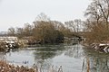
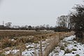
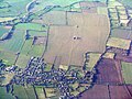
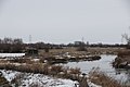
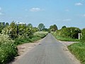
English: Aston, Cote, Shifford and Chimney is a civil parish in the West Oxfordshire district of Oxfordshire in England. According to the 2001 census the parish had a population of 1,264. As the name suggests, the parish includes the villages of Aston and Cote, and the hamlets of Shifford and Chimney. The southern border of the parish is the River Thames.
Svenska: Aston, Cote, Shifford and Chimney är ett civil parish i West Oxfordshire-distriktet i Oxfordshire i England. 2001 fanns det 1 264 folkbokförda. Som namnet antyder innehåller detta civil parish fyra byar: Aston, Cote, Shifford och Chimney. Söder om byarna rinner Themsen.
civil parish in West Oxfordshire, England | |||||
| Upload media | |||||
| Instance of | |||||
|---|---|---|---|---|---|
| Location | West Oxfordshire, Oxfordshire, South East England, England | ||||
 | |||||
Subcategories
This category has the following 4 subcategories, out of 4 total.
A
C
S
Media in category "Aston, Cote, Shifford and Chimney"
The following 161 files are in this category, out of 161 total.
-
 A Brand New Farm - geograph.org.uk - 4447695.jpg 3,792 × 2,500; 1.24 MB
-
 A look through the loophole - geograph.org.uk - 2199051.jpg 1,024 × 768; 124 KB
-
 A second information display - geograph.org.uk - 2233450.jpg 1,024 × 683; 162 KB
-
 Another bend - geograph.org.uk - 2231089.jpg 1,024 × 683; 179 KB
-
 Approaching Shifford Lock - geograph.org.uk - 5073806.jpg 2,592 × 1,944; 1.69 MB
-

-
 At North Street Farm - geograph.org.uk - 4098275.jpg 4,000 × 3,000; 3.2 MB
-
 Back round the bend - geograph.org.uk - 2231084.jpg 1,024 × 683; 206 KB
-
 Back through the fence - geograph.org.uk - 2199038.jpg 1,024 × 683; 298 KB
-
 Back with a staircase - geograph.org.uk - 2234614.jpg 1,024 × 683; 183 KB
-
 Bend in the road - geograph.org.uk - 1535419.jpg 640 × 427; 109 KB
-
 Beside the Great Brook - geograph.org.uk - 4486978.jpg 3,876 × 2,824; 1.95 MB
-
 Big Thistle - geograph.org.uk - 4098027.jpg 4,000 × 3,000; 3.14 MB
-
 Block in a loophole - geograph.org.uk - 2231062.jpg 1,024 × 683; 302 KB
-
 Blocked up entrance - geograph.org.uk - 2228487.jpg 1,024 × 683; 277 KB
-
 Blue Flowers and Barns - geograph.org.uk - 4091518.jpg 2,538 × 3,300; 3.26 MB
-
 Boundary hedgerow - geograph.org.uk - 3985351.jpg 640 × 480; 109 KB
-
 Bridge in the distance - geograph.org.uk - 2232291.jpg 1,024 × 683; 179 KB
-
 Bridge on a ditch - geograph.org.uk - 2228475.jpg 1,024 × 683; 291 KB
-

-

-
 Chimney Farm - geograph.org.uk - 2429104.jpg 1,024 × 680; 197 KB
-
 Chimney Meadows - geograph.org.uk - 2427961.jpg 1,024 × 680; 256 KB
-
 Chimney meadows - geograph.org.uk - 5371493.jpg 640 × 480; 61 KB
-
 Chimney meadows - geograph.org.uk - 5371495.jpg 640 × 480; 133 KB
-
 Chimney through the trees - geograph.org.uk - 2235942.jpg 1,024 × 683; 179 KB
-
 Clanfield from the air - geograph.org.uk - 5612630.jpg 3,264 × 2,448; 5.12 MB
-
 Clean inside - geograph.org.uk - 2234634.jpg 533 × 800; 76 KB
-
 Closer view - geograph.org.uk - 2233355.jpg 1,024 × 683; 135 KB
-
 Concrete partly underground structure - geograph.org.uk - 3985235.jpg 640 × 480; 145 KB
-
 Corner of Shifford Churchyard - geograph.org.uk - 4090513.jpg 1,600 × 1,177; 574 KB
-
 Bridge over The Great Brook - geograph.org.uk - 1590656.jpg 640 × 427; 110 KB
-
 Disappearing away - geograph.org.uk - 2227564.jpg 1,024 × 683; 120 KB
-
 Down the other side - geograph.org.uk - 2233361.jpg 533 × 800; 194 KB
-
 Eroding away - geograph.org.uk - 2231066.jpg 1,024 × 683; 233 KB
-
 Fields at Shifford - geograph.org.uk - 4091552.jpg 1,600 × 1,257; 536 KB
-
 First one in sight - geograph.org.uk - 2227639.jpg 1,024 × 683; 279 KB
-
 Flat Landscape - geograph.org.uk - 4097950.jpg 1,600 × 1,185; 496 KB
-
 Flooded and frozen fields, upper Thames valley - geograph.org.uk - 2786167.jpg 1,600 × 1,066; 251 KB
-
 Flooded and frozen fields, upper Thames valley - geograph.org.uk - 2786168.jpg 1,600 × 1,066; 248 KB
-
 Footpath in a flat landscape - geograph.org.uk - 4486845.jpg 3,828 × 2,848; 2.91 MB
-
 Footpath to Standlake - geograph.org.uk - 4486988.jpg 3,772 × 2,800; 2.45 MB
-
 Gate in the entrance - geograph.org.uk - 2228495.jpg 1,024 × 683; 241 KB
-
-
 Graves by the Church - geograph.org.uk - 2199969.jpg 1,024 × 683; 251 KB
-
 Grazing on Chimney Meadows - geograph.org.uk - 4503833.jpg 3,864 × 2,648; 3.08 MB
-
 Great Brook and Bridge - geograph.org.uk - 4486969.jpg 4,000 × 3,000; 3.76 MB
-
 Great Brook with dog - geograph.org.uk - 3985258.jpg 640 × 480; 118 KB
-
 Grebe on the Thames - geograph.org.uk - 2239801.jpg 1,024 × 768; 131 KB
-
 Head on - geograph.org.uk - 2234674.jpg 1,024 × 683; 178 KB
-
 Heading into the distance - geograph.org.uk - 2227557.jpg 533 × 800; 75 KB
-
 Heading towards Chimney - geograph.org.uk - 1534064.jpg 640 × 427; 89 KB
-
 Houses by the crossroads - geograph.org.uk - 4098019.jpg 4,000 × 3,000; 2.52 MB
-
 In Chimney Meadows - geograph.org.uk - 5073844.jpg 1,944 × 2,592; 2.09 MB
-
 In the Elephant Grass - geograph.org.uk - 4486837.jpg 4,000 × 3,000; 3.53 MB
-
 It's over a ditch - geograph.org.uk - 2234598.jpg 1,024 × 683; 151 KB
-
 Just on the bend - geograph.org.uk - 2228484.jpg 1,024 × 683; 241 KB
-
 Lane junction in the Thames valley - geograph.org.uk - 3985274.jpg 640 × 480; 93 KB
-
 Line of pylons near Chimney - geograph.org.uk - 1535360.jpg 640 × 427; 34 KB
-

-

-
 Looking at the bend - geograph.org.uk - 2231079.jpg 1,024 × 683; 236 KB
-
 Looking at the front - geograph.org.uk - 2231072.jpg 1,024 × 683; 293 KB
-
 Looking at the front - geograph.org.uk - 2234590.jpg 1,024 × 683; 209 KB
-
 Looking back to the Bridge - geograph.org.uk - 2227652.jpg 1,024 × 683; 91 KB
-
 Meadow near the bridge - geograph.org.uk - 2232292.jpg 1,024 × 683; 154 KB
-
 Meadows past the notice - geograph.org.uk - 2234649.jpg 1,024 × 683; 184 KB
-
 More bends - geograph.org.uk - 2227604.jpg 1,024 × 683; 246 KB
-
 More ice on the bend - geograph.org.uk - 2227587.jpg 1,024 × 683; 237 KB
-
 Near the end of the road at Chimney - geograph.org.uk - 4487003.jpg 4,000 × 3,000; 3.09 MB
-
 Next one across the field - geograph.org.uk - 2232287.jpg 1,024 × 683; 146 KB
-
 Next pillbox in the meadow - geograph.org.uk - 2232295.jpg 1,024 × 683; 128 KB
-
 No loopholes in the front - geograph.org.uk - 2228502.jpg 1,024 × 683; 256 KB
-
 North Street Farm Barns - geograph.org.uk - 4098278.jpg 1,600 × 1,200; 550 KB
-
 Old Shifford church - geograph.org.uk - 2199959.jpg 1,024 × 683; 108 KB
-
 Old Shifford Farm from south of the Thames - geograph.org.uk - 6239190.jpg 4,000 × 3,000; 4.99 MB
-
 One across the ditch - geograph.org.uk - 2199064.jpg 1,024 × 683; 313 KB
-
 Other direction - geograph.org.uk - 2235938.jpg 1,024 × 683; 188 KB
-
 Path by the bends - geograph.org.uk - 2231091.jpg 1,024 × 683; 274 KB
-
 Path by the pillbox - geograph.org.uk - 2231053.jpg 1,024 × 683; 236 KB
-
 Pillbox and base - geograph.org.uk - 2234604.jpg 1,024 × 683; 192 KB
-
 Pillbox at the farm - geograph.org.uk - 2199007.jpg 1,024 × 683; 286 KB
-
 Pillbox beside the River Thames - geograph.org.uk - 2427968.jpg 1,024 × 680; 236 KB
-

-
 Pillbox in Chimney Meadows - geograph.org.uk - 2427987.jpg 1,024 × 680; 243 KB
-
 Pillbox, Chimney - geograph.org.uk - 910296.jpg 640 × 436; 73 KB
-
 Pillboxes in Chimney Meadows - geograph.org.uk - 2427992.jpg 1,024 × 680; 214 KB
-
 Pots at the Pottery - geograph.org.uk - 4063329.jpg 3,000 × 4,000; 2.95 MB
-
 Purpose of the fence line - geograph.org.uk - 2234645.jpg 1,024 × 683; 110 KB
-
 Pylon by the river - geograph.org.uk - 2227544.jpg 533 × 800; 90 KB
-
 Pylons and power lines - geograph.org.uk - 2427929.jpg 680 × 1,024; 146 KB
-
 Rebar in the concrete - geograph.org.uk - 2231057.jpg 1,024 × 683; 284 KB
-
 Recently mown meadow - geograph.org.uk - 3985211.jpg 640 × 480; 107 KB
-
 River Thames - geograph.org.uk - 3269802.jpg 1,024 × 768; 267 KB
-
 River Thames - geograph.org.uk - 3269823.jpg 1,024 × 768; 169 KB
-
 River Thames - geograph.org.uk - 3269838.jpg 1,024 × 768; 164 KB
-
 River Thames - geograph.org.uk - 3269879.jpg 1,024 × 768; 141 KB
-
 River Thames at Shifford - geograph.org.uk - 4494214.jpg 4,000 × 3,000; 2.68 MB
-
 River Thames at Shifford lock cut - geograph.org.uk - 5371504.jpg 640 × 360; 105 KB
-
 River Thames near Chimney Meadows - geograph.org.uk - 2427945.jpg 1,024 × 680; 303 KB
-
 River Thames near Chimney Meadows - geograph.org.uk - 2427956.jpg 1,024 × 680; 251 KB
-
 River Thames near Shifford - geograph.org.uk - 2425437.jpg 1,024 × 680; 216 KB
-
 River Thames near Shifford Lock - geograph.org.uk - 2429107.jpg 1,024 × 680; 297 KB
-
 River Thames near Shifford Lock Cut - geograph.org.uk - 2429103.jpg 1,024 × 680; 208 KB
-
 River Thames nr Buckland - geograph.org.uk - 3623708.jpg 640 × 438; 79 KB
-
 Road from Shifford to Cote - geograph.org.uk - 1569565.jpg 640 × 480; 81 KB
-

-
 Road to Chimney - geograph.org.uk - 1534030.jpg 640 × 427; 70 KB
-
 Road to Cote and Old Shifford - geograph.org.uk - 1535400.jpg 640 × 427; 50 KB
-
 Road to Old Shifford - geograph.org.uk - 1430796.jpg 640 × 427; 73 KB
-
 Seat on the corner - geograph.org.uk - 4030990.jpg 640 × 377; 103 KB
-
 Semi-detached in Shifford - geograph.org.uk - 4080893.jpg 640 × 444; 70 KB
-

-
 Set of steps on this one - geograph.org.uk - 2234682.jpg 1,024 × 683; 184 KB
-
 Shifford farm pillbox - geograph.org.uk - 2199034.jpg 1,024 × 683; 265 KB
-
 Shifford Lock Cut - geograph.org.uk - 2428779.jpg 1,024 × 680; 266 KB
-
 Shifford Lock Cut - geograph.org.uk - 4494197.jpg 4,000 × 3,000; 3.95 MB
-
 Shifford Lock Cut Bridge - geograph.org.uk - 2428769.jpg 1,024 × 680; 252 KB
-
 Shifford Lock Cut Footbridge - geograph.org.uk - 910265.jpg 640 × 426; 87 KB
-
 Shifford Lock House - geograph.org.uk - 4487013.jpg 3,000 × 4,000; 2.57 MB
-
 Side and back - geograph.org.uk - 2234686.jpg 1,024 × 683; 157 KB
-
 Sideways on - geograph.org.uk - 2234639.jpg 1,024 × 683; 148 KB
-
 Sign and information board - geograph.org.uk - 2233446.jpg 533 × 800; 104 KB
-
 Signpost at the bridge - geograph.org.uk - 2232298.jpg 1,024 × 683; 218 KB
-
 Signs of erosion - geograph.org.uk - 2228498.jpg 533 × 800; 131 KB
-
 Sitting on a plinth - geograph.org.uk - 2234588.jpg 1,024 × 683; 188 KB
-
 Sluice beside the river. - geograph.org.uk - 2231108.jpg 1,024 × 683; 258 KB
-
 Sluice by the bridge - geograph.org.uk - 2228481.jpg 1,024 × 683; 286 KB
-
 Snow on the bridge - geograph.org.uk - 2232301.jpg 533 × 800; 129 KB
-
 Stairs to the entrance - geograph.org.uk - 2234630.jpg 533 × 800; 150 KB
-
 Strictly no Mooring - geograph.org.uk - 2234664.jpg 1,024 × 683; 205 KB
-
 Stump of a cross - geograph.org.uk - 2203426.jpg 533 × 800; 161 KB
-
 Sunk in the ground - geograph.org.uk - 2199985.jpg 1,024 × 683; 281 KB
-
 Thames Path near Shifford Lock - geograph.org.uk - 2429106.jpg 1,024 × 680; 297 KB
-
 Thames path past the Pillbox - geograph.org.uk - 2234656.jpg 1,024 × 683; 173 KB
-
 The Great Brook - geograph.org.uk - 1534079.jpg 640 × 427; 105 KB
-
 The Great Brook - geograph.org.uk - 1534107.jpg 640 × 427; 122 KB
-
 The Great Brook - geograph.org.uk - 4486965.jpg 4,000 × 3,000; 5.24 MB
-
 The next bend - geograph.org.uk - 2231083.jpg 1,024 × 683; 207 KB
-
 The next Kissing gate - geograph.org.uk - 2227573.jpg 1,024 × 683; 177 KB
-
 The River Thames - geograph.org.uk - 2045446.jpg 640 × 480; 116 KB
-
 The River Thames near Tenfoot Bridge - geograph.org.uk - 5073883.jpg 2,592 × 1,944; 1.8 MB
-
 The River Thames, near Chimney - geograph.org.uk - 5073858.jpg 2,592 × 1,944; 1.37 MB
-
 The road to Chimney - geograph.org.uk - 1590664.jpg 640 × 427; 95 KB
-
 The road to Old Shifford - geograph.org.uk - 1569547.jpg 640 × 480; 48 KB
-
 The second Pillbox - geograph.org.uk - 2233455.jpg 1,024 × 683; 152 KB
-
 The Thames at Tenfoot Bridge - geograph.org.uk - 4179917.jpg 4,000 × 3,000; 3.04 MB
-
 The Thames Path from Chimney - geograph.org.uk - 2236025.jpg 1,024 × 683; 155 KB
-
 The Thames Path National Trail near Chimney - geograph.org.uk - 5887786.jpg 4,608 × 3,456; 5.45 MB
-
 The Thames Path National Trail near Shifford Lock - geograph.org.uk - 5887795.jpg 4,608 × 3,456; 5.11 MB
-
 The Thames Path National Trail near Tenfoot Bridge - geograph.org.uk - 5887778.jpg 4,608 × 3,456; 5.23 MB
-
 The Thames viewed from Tenfoot Bridge - geograph.org.uk - 2427974.jpg 1,024 × 680; 195 KB
-
 Towards Tenfoot bridge - geograph.org.uk - 2232289.jpg 1,024 × 683; 198 KB
-
 Turning to Cote and Old Shifford - geograph.org.uk - 1535380.jpg 640 × 427; 51 KB
-
 View across the square - geograph.org.uk - 4063314.jpg 3,560 × 2,808; 1.8 MB
-
 View from the Meadow - geograph.org.uk - 2234635.jpg 1,024 × 683; 128 KB
-
 View past the Pillbox - geograph.org.uk - 2235946.jpg 1,024 × 683; 177 KB
-
 Where the bridge narrows - geograph.org.uk - 2232304.jpg 533 × 800; 117 KB
-
 Wood on the ice - geograph.org.uk - 2227614.jpg 1,024 × 683; 266 KB
-
 Woolies in the snow - geograph.org.uk - 2228482.jpg 1,024 × 683; 184 KB
-
 You Get The Picture - geograph.org.uk - 4953797.jpg 4,000 × 3,000; 2.57 MB


