Category:Atlantic Way, Liverpool
Jump to navigation
Jump to search

Atlantic Way is a roadway, with adjacent promenade along Liverpool Waterfront, running north from the former entrance to Herculaneum Dock to the south end of Brunswick Dock.
Media in category "Atlantic Way, Liverpool"
The following 12 files are in this category, out of 12 total.
-
 Benchmark at Toxteth Dock.jpg 4,068 × 3,036; 6.9 MB
-
 Benchmark at Harrington Dock sea wall.jpg 5,152 × 3,864; 8.38 MB
-
 Anchor on Atlantic Way.jpg 4,757 × 3,292; 10.97 MB
-
 Brunswick Dock - geograph.org.uk - 71011.jpg 640 × 480; 59 KB
-
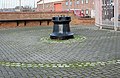 Capstan on Atlantic Way.jpg 4,756 × 3,082; 10.43 MB
-
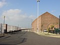
 Entrance to Herculaneum Dock.jpg 4,497 × 3,225; 9.4 MB
-
 Footpath beside the Mersey - geograph.org.uk - 1368093.jpg 640 × 425; 81 KB
-
 Lucy box at Harrison Way.jpg 4,554 × 3,240; 8.77 MB
-
 Lucy box on Atlantic Way.jpg 4,265 × 3,145; 8.3 MB
-
 Marker stone, Atlantic Way 1.jpg 5,184 × 3,456; 15.67 MB
-
 Marker stone, Atlantic Way 2.jpg 4,230 × 3,318; 12.91 MB
-
 Open Lucy box on Atlantic Way.jpg 4,814 × 3,131; 8.76 MB


