Category:Atlas des anciens plans de Paris by Imprimerie nationale, 1900 from the David Rumsey Historical Map Collection
Jump to navigation
Jump to search
Media in category "Atlas des anciens plans de Paris by Imprimerie nationale, 1900 from the David Rumsey Historical Map Collection"
The following 140 files are in this category, out of 140 total.
-
 Atlas des anciens plans de Paris - 001. Covers - David Rumsey.jpg 8,904 × 12,469; 55.03 MB
-
 Atlas des anciens plans de Paris - 002. Half title - David Rumsey.jpg 10,678 × 14,474; 16.99 MB
-
 Atlas des anciens plans de Paris - 003. Half title page verso - David Rumsey.jpg 10,662 × 14,474; 13.8 MB
-
 Atlas des anciens plans de Paris - 004. Title page - David Rumsey.jpg 10,680 × 14,604; 23.78 MB
-
 Atlas des anciens plans de Paris - 005. Text, Page 5 - David Rumsey.jpg 10,918 × 14,763; 22.05 MB
-
 Atlas des anciens plans de Paris - 006. Text, Page 6-7 - David Rumsey.jpg 21,676 × 14,763; 44.09 MB
-
 Atlas des anciens plans de Paris - 007. Text, Page 8-9 - David Rumsey.jpg 21,676 × 14,763; 45.21 MB
-
 Atlas des anciens plans de Paris - 008. Text, Page 10-11 - David Rumsey.jpg 21,676 × 14,763; 45.89 MB
-
 Atlas des anciens plans de Paris - 009. Text, Page 12-13 - David Rumsey.jpg 21,676 × 14,763; 45.51 MB
-
 Atlas des anciens plans de Paris - 010. Text, Page 14-15 - David Rumsey.jpg 21,676 × 14,763; 44.79 MB
-
 Atlas des anciens plans de Paris - 011. Text, Page 16-17 - David Rumsey.jpg 21,676 × 14,763; 36.18 MB
-
 Atlas des anciens plans de Paris - 012. Text, Page 18-19 - David Rumsey.jpg 21,676 × 14,763; 45.19 MB
-
 Atlas des anciens plans de Paris - 013. Text, Page 20-21 - David Rumsey.jpg 21,676 × 14,763; 53.68 MB
-
 Atlas des anciens plans de Paris - 014. Text, Page 22-23 - David Rumsey.jpg 21,676 × 14,763; 48.99 MB
-
 Atlas des anciens plans de Paris - 015. Text, Page 24-25 - David Rumsey.jpg 21,676 × 14,763; 41.9 MB
-
 Atlas des anciens plans de Paris - 016. Text, Page 26-27 - David Rumsey.jpg 21,676 × 14,763; 43.65 MB
-
 Atlas des anciens plans de Paris - 017. Text, Page 28-29 - David Rumsey.jpg 21,676 × 14,763; 42.9 MB
-
 Atlas des anciens plans de Paris - 018. Text, Page 30-31 - David Rumsey.jpg 21,676 × 14,763; 43.46 MB
-
 Atlas des anciens plans de Paris - 019. Text, Page 32-33 - David Rumsey.jpg 21,676 × 14,763; 44.47 MB
-
 Atlas des anciens plans de Paris - 020. Text, Page 34-35 - David Rumsey.jpg 21,676 × 14,763; 47.17 MB
-
 Atlas des anciens plans de Paris - 021. Text, Page 36-37 - David Rumsey.jpg 21,676 × 14,763; 49.4 MB
-
 Atlas des anciens plans de Paris - 022. Text, Page 38-39 - David Rumsey.jpg 21,676 × 14,763; 47.84 MB
-
 Atlas des anciens plans de Paris - 023. Text, Page 40-41 - David Rumsey.jpg 21,676 × 14,763; 45.37 MB
-
 Atlas des anciens plans de Paris - 024. Text, Page 42-43 - David Rumsey.jpg 21,676 × 14,763; 45.88 MB
-
 Atlas des anciens plans de Paris - 025. Text, Page 44-45 - David Rumsey.jpg 21,676 × 14,763; 44.62 MB
-
 Atlas des anciens plans de Paris - 026. Text, Page 46-47 - David Rumsey.jpg 21,676 × 14,763; 44.25 MB
-
 Atlas des anciens plans de Paris - 027. Text, Page 48-49 - David Rumsey.jpg 21,676 × 14,763; 44.51 MB
-
 Atlas des anciens plans de Paris - 028. Text, Page 50-51 - David Rumsey.jpg 21,676 × 14,763; 45.25 MB
-
 Atlas des anciens plans de Paris - 029. Text, Page 52-53 - David Rumsey.jpg 21,676 × 14,763; 50 MB
-
 Atlas des anciens plans de Paris - 030. Text, Page 54-55 - David Rumsey.jpg 21,676 × 14,763; 50.03 MB
-
 Atlas des anciens plans de Paris - 031. Text, Page 56-57 - David Rumsey.jpg 21,676 × 14,763; 50.93 MB
-
 Atlas des anciens plans de Paris - 032. Text, Page 58-59 - David Rumsey.jpg 21,676 × 14,763; 52.31 MB
-
 Atlas des anciens plans de Paris - 033. Text, Page 60 - David Rumsey.jpg 10,646 × 14,640; 27.25 MB
-
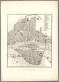
 Atlas des anciens plans de Paris - 034. Plan de la cité gauloise - David Rumsey.jpg 17,468 × 12,726; 55.3 MB
-
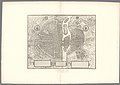
 Atlas des anciens plans de Paris - 035. Plan de Lutèce - David Rumsey.jpg 17,236 × 12,572; 41.48 MB
-
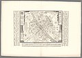
 Atlas des anciens plans de Paris - 036. Paris de 1180 à 1223 - David Rumsey.jpg 17,736 × 12,676; 41.77 MB
-
 Atlas des anciens plans de Paris - 037. Paris de 1285 à 1314 - David Rumsey.jpg 12,502 × 17,552; 54.82 MB
-
 Atlas des anciens plans de Paris - 038. Paris in 1380 - David Rumsey.jpg 24,674 × 17,304; 112.61 MB
-

-

-
 Atlas des anciens plans de Paris - 041. Paris in 1530 - David Rumsey.jpg 17,222 × 12,250; 38.51 MB
-
 Atlas des anciens plans de Paris - 042. Paris in 1530 - David Rumsey.jpg 17,300 × 12,548; 48.99 MB
-
 Atlas des anciens plans de Paris - 043. Paris de 1512 à 1547 - David Rumsey.jpg 17,736 × 24,854; 105.71 MB
-
 Atlas des anciens plans de Paris - 044. Paris de 1512 à 1547 - David Rumsey.jpg 17,642 × 24,758; 118.1 MB
-
 Atlas des anciens plans de Paris - 045. Paris de 1512 à 1547 - David Rumsey.jpg 28,630 × 24,932; 200.41 MB
-
 Atlas des anciens plans de Paris - 046. Paris vers 1540 - David Rumsey.jpg 24,749 × 17,447; 93.82 MB
-
 Atlas des anciens plans de Paris - 047. Paris en 1552 - David Rumsey.jpg 25,644 × 18,055; 148.56 MB
-
 Atlas des anciens plans de Paris - 048. Paris en 1555 - David Rumsey.jpg 18,137 × 24,932; 96.22 MB
-
 Atlas des anciens plans de Paris - 049. Paris en 1555 - David Rumsey.jpg 18,184 × 24,886; 93.71 MB
-
 Atlas des anciens plans de Paris - 050. Paris en 1555 - David Rumsey.jpg 27,544 × 24,699; 156.54 MB
-
 Atlas des anciens plans de Paris - 051. Paris en 1575 - David Rumsey.jpg 17,555 × 12,904; 58 MB
-
 Atlas des anciens plans de Paris - 052. Paris en 1609 - David Rumsey.jpg 17,689 × 24,930; 109.89 MB
-
 Atlas des anciens plans de Paris - 053. Paris en 1609 - David Rumsey.jpg 17,591 × 24,851; 113.66 MB
-
 Atlas des anciens plans de Paris - 054. Paris en 1609 - David Rumsey.jpg 28,717 × 25,000; 193.8 MB
-
 Atlas des anciens plans de Paris - 055. Paris en 1609 - David Rumsey.jpg 25,016 × 17,648; 129.4 MB
-
 Atlas des anciens plans de Paris - 056. Paris en 1615 - David Rumsey.jpg 24,757 × 17,385; 117.75 MB
-
 Atlas des anciens plans de Paris - 057. Paris in 1630 - David Rumsey.jpg 24,841 × 17,600; 122.53 MB
-
 Atlas des anciens plans de Paris - 058. Paris de 1649 à 1652 - David Rumsey.jpg 24,868 × 17,633; 91.96 MB
-
 Atlas des anciens plans de Paris - 059. Paris en 1654 - David Rumsey.jpg 24,649 × 17,994; 90.33 MB
-
 Atlas des anciens plans de Paris - 060. Paris en 1654 - David Rumsey.jpg 24,877 × 18,017; 88.6 MB
-
 Atlas des anciens plans de Paris - 061. Paris en 1654 - David Rumsey.jpg 25,000 × 27,176; 142.76 MB
-
 Atlas des anciens plans de Paris - 062. Paris en 1652 - David Rumsey.jpg 24,977 × 17,990; 118.79 MB
-
 Atlas des anciens plans de Paris - 063. Paris en 1652 - David Rumsey.jpg 24,798 × 17,894; 116.45 MB
-
 Atlas des anciens plans de Paris - 064. Paris en 1652 - David Rumsey.jpg 24,727 × 17,893; 111.03 MB
-
 Atlas des anciens plans de Paris - 065. Paris en 1652 - David Rumsey.jpg 25,123 × 17,978; 112.29 MB
-
 Atlas des anciens plans de Paris - 066. Paris en 1652 - David Rumsey.jpg 41,136 × 31,573; 373.6 MB
-
 Atlas des anciens plans de Paris - 067. Paris de 1670 à 1676 - David Rumsey.jpg 17,983 × 25,139; 113.81 MB
-
 Atlas des anciens plans de Paris - 068. Paris de 1670 à 1676 - David Rumsey.jpg 17,892 × 25,022; 109.52 MB
-
 Atlas des anciens plans de Paris - 069. Paris de 1670 à 1676 - David Rumsey.jpg 28,268 × 25,116; 184.91 MB
-
 Atlas des anciens plans de Paris - 070. Paris in 1672 - David Rumsey.jpg 24,867 × 17,821; 104.96 MB
-
 Atlas des anciens plans de Paris - 071. Paris in 1672 - David Rumsey.jpg 25,070 × 18,004; 110.54 MB
-
 Atlas des anciens plans de Paris - 072. Paris in 1672 - David Rumsey.jpg 24,871 × 17,979; 96.87 MB
-
 Atlas des anciens plans de Paris - 073. Paris in 1672 - David Rumsey.jpg 25,104 × 17,766; 91.91 MB
-
 Atlas des anciens plans de Paris - 074. Paris in 1672 - David Rumsey.jpg 41,351 × 31,331; 333.96 MB
-
 Atlas des anciens plans de Paris - 075. Paris en 1676 - David Rumsey.jpg 25,064 × 17,536; 106.69 MB
-
 Atlas des anciens plans de Paris - 076. Paris en 1697 - David Rumsey.jpg 25,168 × 18,100; 128.05 MB
-
 Atlas des anciens plans de Paris - 077. Paris en 1713 - David Rumsey.jpg 25,062 × 17,392; 123.73 MB
-
 Atlas des anciens plans de Paris - 078. Paris en 1714 - David Rumsey.jpg 24,600 × 17,204; 87.24 MB
-
 Atlas des anciens plans de Paris - 079. Paris en 1714 - David Rumsey.jpg 24,651 × 17,239; 91.36 MB
-
 Atlas des anciens plans de Paris - 080. Paris en 1714 - David Rumsey.jpg 24,780 × 17,370; 92.06 MB
-
 Atlas des anciens plans de Paris - 081. Paris en 1714 - David Rumsey.jpg 24,630 × 17,222; 83.37 MB
-
 Atlas des anciens plans de Paris - 082. Paris en 1728 - David Rumsey.jpg 17,726 × 12,543; 67.22 MB
-
 Atlas des anciens plans de Paris - 083. Paris en 1728 - David Rumsey.jpg 17,769 × 12,721; 70.39 MB
-
 Atlas des anciens plans de Paris - 084. Paris en 1728 - David Rumsey.jpg 18,098 × 25,339; 123.29 MB
-
 Atlas des anciens plans de Paris - 085. Paris en 1728 - David Rumsey.jpg 17,760 × 24,740; 116.57 MB
-
 Atlas des anciens plans de Paris - 086. Paris en 1728 - David Rumsey.jpg 32,933 × 32,039; 319.92 MB
-
 Atlas des anciens plans de Paris - 087. Paris en 1731 - David Rumsey.jpg 17,988 × 25,134; 133.24 MB
-
 Atlas des anciens plans de Paris - 088. Paris en 1731 - David Rumsey.jpg 18,089 × 25,106; 135.63 MB
-
 Atlas des anciens plans de Paris - 089. Paris en 1731 - David Rumsey.jpg 30,895 × 25,198; 246.03 MB
-
 Atlas des anciens plans de Paris - 090. Paris de 1734 à 1739 - David Rumsey.jpg 24,664 × 17,740; 105.47 MB
-
 Atlas des anciens plans de Paris - 091. Paris de 1734 à 1739 - David Rumsey.jpg 25,129 × 17,884; 116.53 MB
-
 Atlas des anciens plans de Paris - 092. Paris de 1734 à 1739 - David Rumsey.jpg 25,039 × 17,929; 112.29 MB
-
 Atlas des anciens plans de Paris - 093. Paris de 1734 à 1739 - David Rumsey.jpg 24,666 × 17,226; 104.89 MB
-
 Atlas des anciens plans de Paris - 094. Paris de 1734 à 1739 - David Rumsey.jpg 39,604 × 29,433; 348.14 MB
-
 Atlas des anciens plans de Paris - 095. Paris en 1760 - David Rumsey.jpg 24,827 × 17,328; 122.07 MB
-
 Atlas des anciens plans de Paris - 096. Paris en 1763 - David Rumsey.jpg 17,900 × 25,022; 126.52 MB
-
 Atlas des anciens plans de Paris - 097. Paris en 1763 - David Rumsey.jpg 17,712 × 24,696; 118.01 MB
-
 Atlas des anciens plans de Paris - 098. Paris en 1763 - David Rumsey.jpg 32,151 × 25,000; 230.98 MB
-
 Atlas des anciens plans de Paris - 099. Paris en 1775 - David Rumsey.jpg 12,668 × 17,391; 66.62 MB
-
 Atlas des anciens plans de Paris - 100. Paris en 1775 - David Rumsey.jpg 24,670 × 17,200; 100.66 MB
-
 Atlas des anciens plans de Paris - 101. Paris en 1775 - David Rumsey.jpg 24,789 × 17,325; 109.42 MB
-
 Atlas des anciens plans de Paris - 102. Paris en 1775 - David Rumsey.jpg 12,557 × 17,206; 66.57 MB
-
 Atlas des anciens plans de Paris - 103. Paris en 1775 - David Rumsey.jpg 32,400 × 28,700; 280.13 MB
-
 Atlas des anciens plans de Paris - 104. Paris de 1789 à 1798 - David Rumsey.jpg 17,432 × 24,778; 86.84 MB
-
 Atlas des anciens plans de Paris - 105. Paris de 1789 à 1798 - David Rumsey.jpg 17,574 × 25,000; 87.73 MB
-
 Atlas des anciens plans de Paris - 106. Paris de 1789 à 1798 - David Rumsey.jpg 17,370 × 24,766; 75.87 MB
-
 Atlas des anciens plans de Paris - 107. Paris de 1789 à 1798 - David Rumsey.jpg 17,587 × 24,844; 80.65 MB
-
 Atlas des anciens plans de Paris - 108. Paris de 1789 à 1798 - David Rumsey.jpg 17,587 × 24,969; 81.57 MB
-
 Atlas des anciens plans de Paris - 109. Paris de 1789 à 1798 - David Rumsey.jpg 17,702 × 25,200; 94.9 MB
-
 Atlas des anciens plans de Paris - 110. Paris de 1789 à 1798 - David Rumsey.jpg 46,539 × 41,990; 417.14 MB
-
 Atlas des anciens plans de Paris - François Quesnel, Paris en 1609 - David Rumsey.jpg 22,200 × 21,700; 322.16 MB
-
 Atlas des anciens plans de Paris - Georges Braun, Paris en 1530 - David Rumsey.jpg 11,900 × 9,400; 67.84 MB
-
 Atlas des anciens plans de Paris - Paris de 1180 à 1223 - David Rumsey.jpg 9,780 × 7,620; 48.23 MB
-
 Atlas des anciens plans de Paris - Paris de 1285 à 1314 - David Rumsey.jpg 9,930 × 12,670; 78.27 MB
-
 Atlas des anciens plans de Paris - Paris de 1512 à 1547 - David Rumsey.jpg 23,000 × 19,700; 328.15 MB
-
 Atlas des anciens plans de Paris - Paris de 1649 à 1652 - David Rumsey.jpg 17,250 × 11,400; 111.74 MB
-
 Atlas des anciens plans de Paris - Paris de 1670 à 1676 - David Rumsey.jpg 22,000 × 22,000; 275.53 MB
-
 Atlas des anciens plans de Paris - Paris en 1380 - David Rumsey.jpg 17,100 × 15,000; 190.89 MB
-
 Atlas des anciens plans de Paris - Paris en 1552 - David Rumsey.jpg 21,800 × 16,170; 240.76 MB
-
 Atlas des anciens plans de Paris - Paris en 1555 - David Rumsey.jpg 19,300 × 16,850; 135.35 MB
-
 Atlas des anciens plans de Paris - Paris en 1575 - David Rumsey.jpg 13,400 × 10,200; 84.8 MB
-
 Atlas des anciens plans de Paris - Paris en 1615 - David Rumsey.jpg 18,400 × 12,700; 168.15 MB
-
 Atlas des anciens plans de Paris - Paris en 1630 - David Rumsey.jpg 18,200 × 14,000; 169.97 MB
-
 Atlas des anciens plans de Paris - Paris en 1652 - David Rumsey 2.jpg 24,006 × 21,867; 255.69 MB
-
 Atlas des anciens plans de Paris - Paris en 1652 - David Rumsey.jpg 30,000 × 24,850; 353.42 MB
-
 Atlas des anciens plans de Paris - Paris en 1654 - David Rumsey.jpg 18,500 × 19,260; 191.75 MB
-
 Atlas des anciens plans de Paris - Paris en 1672 - David Rumsey.jpg 30,000 × 25,100; 323.08 MB
-
 Atlas des anciens plans de Paris - Paris en 1676 - David Rumsey.jpg 16,900 × 13,600; 128.2 MB
-
 Atlas des anciens plans de Paris - Paris en 1697 - David Rumsey.jpg 19,500 × 15,300; 194.94 MB
-
 Atlas des anciens plans de Paris - Paris en 1713 - David Rumsey.jpg 20,000 × 15,000; 187.89 MB
-
 Atlas des anciens plans de Paris - Paris en 1728 - David Rumsey.jpg 30,000 × 25,500; 338.68 MB
-
 Atlas des anciens plans de Paris - Paris en 1760 - David Rumsey.jpg 20,600 × 14,000; 182.99 MB
-
 Atlas des anciens plans de Paris - Paris en 1763 - David Rumsey.jpg 30,000 × 18,500; 338.14 MB
-
 Atlas des anciens plans de Paris - Paris en 1775 - David Rumsey.jpg 28,512 × 24,065; 476.81 MB
-
 Atlas des anciens plans de Paris - Paris vers 1540 - David Rumsey.jpg 14,700 × 12,300; 103.88 MB
-
 Atlas des anciens plans de Paris - Plan de la cité gauloise - David Rumsey.jpg 9,960 × 8,610; 44.78 MB
-
 Atlas des anciens plans de Paris - Plan de Lutèce - David Rumsey.jpg 9,850 × 7,400; 40.26 MB
-
 Atlas des anciens plans de Paris - Sebastian Münster, Paris en 1530 - David Rumsey.jpg 9,000 × 6,950; 42.91 MB
-
 Atlas des anciens plans de Paris - Vassalieu dit Nicolay, Paris en 1609 - David Rumsey.jpg 19,200 × 15,320; 202.11 MB
-
 Quartier Saint-Eustache par Gomboust (1652).jpg 3,108 × 2,312; 4.05 MB


.jpg)