Category:Atmospheric carbon dioxide maps
Jump to navigation
Jump to search
Subcategories
This category has only the following subcategory.
Media in category "Atmospheric carbon dioxide maps"
The following 9 files are in this category, out of 9 total.
-
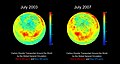
 Arctic Carbon Dioxide, March 23, 2010 (8270694102).jpg 1,920 × 1,080; 95 KB
-
Assimilation of OCO-2 Carbon Dioxide into the GEOS Simulation.webm 3 min 26 s, 3,840 × 2,160; 39.82 MB
-
 Carbon Dioxide in Earth's Mid-Troposphere, April 2013 Monthly Average (8787526939).jpg 1,960 × 1,482; 256 KB
-
 Global Atmospheric Carbon Dioxide (CO₂) (SVS5115).png 1,920 × 1,920; 3.67 MB
-
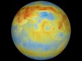
 Global Carbon Dioxide Transport from AIRS Data, July 2009 (8252801031).jpg 1,460 × 1,179; 180 KB
-
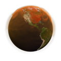
 Global Carbon Dioxide, July 2003 (8269718477).jpg 2,560 × 1,920; 156 KB
-
 Global Carbon Dioxide, July 2003 (8269718635).jpg 2,560 × 1,920; 122 KB
-
 Global Map of Carbon Dioxide 2003 (8262894854).jpg 1,200 × 900; 492 KB
-
.jpg)
.jpg)
_(SVS5115).png)
.jpg)
.jpg)
.jpg)
.jpg)
.jpg)