Category:Austria photographs taken on 2010-08-08
Jump to navigation
Jump to search
Countries of Europe: Armenia‡ · Austria · Belarus · Belgium · Bosnia and Herzegovina · Bulgaria · Croatia · Czech Republic · Estonia · Finland · France‡ · Georgia‡ · Germany · Greece · Hungary · Italy · Kazakhstan‡ · Latvia · Lithuania · Malta · Netherlands‡ · Norway · Poland · Portugal‡ · Romania · Russia‡ · Slovakia · Slovenia · Spain‡ · Sweden · Switzerland · Turkey‡ · Ukraine · United Kingdom
‡: partly located in Europe
‡: partly located in Europe
| ← | 8 August 2010 | → | ||
| ← | August 2010 | → | ||

Austria photographs taken on 8 August 2010.
Image files should be categorized here automatically using {{taken on}} template. Direct categorisation is also possible, if automatic is impossible.
Media in category "Austria photographs taken on 2010-08-08"
The following 142 files are in this category, out of 142 total.
-
 08.08.2010. Pyhrn-Autobahn - panoramio (1).jpg 3,072 × 1,373; 496 KB
-
 393 Raupe des Schwalbenschwanz.jpg 1,574 × 1,181; 1.22 MB
-
 Alkuser Rotspitze a.JPG 3,008 × 2,000; 2.91 MB
-
 Alkuser Rotspitze b.JPG 3,008 × 2,000; 2.77 MB
-
 Alkuser Rotspitze c.JPG 3,008 × 2,000; 2.6 MB
-
 Alkuser Rotspitze d.JPG 3,008 × 2,000; 2.72 MB
-
 Alkuser Rotspitze, Prijakte.JPG 3,008 × 2,000; 2.68 MB
-
 Alkuser Rotspitze, Schleinitz, Prijakte.JPG 3,008 × 2,000; 2.53 MB
-
 Anglerparadies Hessendorf-Bf-01.jpg 2,000 × 1,500; 2.01 MB
-
 Anker uhr detail.JPG 994 × 2,321; 1.07 MB
-
 Austria august2010 0214.jpg 2,272 × 1,704; 1.05 MB
-
 Bezirkspolizeikommando Schärding und Polizeiinspektion Schärding (Eingang).jpg 2,304 × 3,072; 2.77 MB
-
 Brauerei Baumgartner (Schärding) 2.jpg 3,032 × 2,259; 2.14 MB
-
 Bulli am Hochgurgel.jpg 4,000 × 3,000; 2.32 MB
-
 Dacia Duster - dark copper.JPG 3,072 × 2,304; 2.42 MB
-
 Debantgrad - Nordgipfel mit Ganot a.JPG 3,008 × 2,000; 2.27 MB
-
 Debantgrad - Nordgipfel mit Ganot b.JPG 3,008 × 2,000; 2.49 MB
-
 Debantgrad - Nordgipfel mit Ganot und Ralfkopf.JPG 3,008 × 2,000; 2.87 MB
-
 Debantgrat - Nordgipfel.JPG 3,008 × 2,000; 2.81 MB
-
 Debantgrat Gipfelkreuz.JPG 2,000 × 3,008; 1.79 MB
-
 Debantgrat mit Gartlsee a.JPG 3,008 × 2,000; 3.08 MB
-
 Debantgrat mit Gartlsee b.JPG 3,008 × 2,000; 2.89 MB
-
 Debantgrat mit Gartlsee c.JPG 3,008 × 2,000; 2.66 MB
-
 Debantgrat von Süden a.JPG 3,008 × 2,000; 3.04 MB
-
 Debantgrat von Süden b.JPG 3,008 × 2,000; 2.86 MB
-
 Debantgrat von Süden c.JPG 3,008 × 2,000; 2.94 MB
-
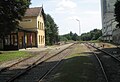 Drosendorf-Bf-01.jpg 2,000 × 1,365; 1.2 MB
-
 Drosendorf-Bf-02.jpg 2,000 × 1,390; 1.5 MB
-
 Drosendorf-Bf-03.jpg 1,800 × 1,311; 1.11 MB
-
 Drosendorf-Bf-04.jpg 2,000 × 1,500; 1.49 MB
-
 Drosendorf-Bf-05.jpg 2,000 × 1,500; 1.08 MB
-
 Drosendorf-Bf-06.jpg 1,800 × 1,350; 1.29 MB
-
 Drosendorf-Bf-07.jpg 1,800 × 1,350; 1.42 MB
-
 Dürnstein an der Donau, Kirchturm - panoramio.jpg 1,712 × 2,288; 1.34 MB
-
 Gamskarkogelhütte (2.467m).jpg 5,184 × 3,456; 7.17 MB
-
 Geras-Kottaun-Bf-01.jpg 2,000 × 1,290; 1.09 MB
-
 Geras-Kottaun-Bf-02.jpg 2,000 × 1,271; 986 KB
-
 Glödis vom Debantgrat.JPG 2,000 × 3,008; 2.34 MB
-
 Granatspitzgruppe vom Debantgrat a.JPG 3,008 × 2,000; 2.58 MB
-
 Granatspitzgruppe vom Schobertörl a.JPG 3,008 × 2,000; 2.11 MB
-
 Granatspitzgruppe vom Schobertörl b.JPG 3,008 × 2,000; 2.88 MB
-
 Großvenediger vom Debantgrat a.JPG 3,008 × 2,000; 2.29 MB
-
 Großvenediger vom Debantgrat b.JPG 3,008 × 2,000; 2.26 MB
-
 Gubach- und Simonyspitzen vom Debantgrat.JPG 3,008 × 2,000; 2.26 MB
-
 Gymnostomum aeruginosum (a, 145144-474909) 8390.JPG 2,816 × 1,880; 1.33 MB
-
 Gymnostomum aeruginosum (a, 145144-474909) 8392.JPG 2,816 × 1,880; 1.74 MB
-
 Hessendorf-Bf-01.jpg 1,900 × 1,268; 1.06 MB
-
 Hochschober vom Debantgrat a.JPG 3,008 × 2,000; 2.72 MB
-
 Hochschober vom Debantgrat b.JPG 3,008 × 2,000; 2.68 MB
-
 Hochschober vom Debantgrat c.JPG 3,008 × 2,000; 2.66 MB
-
 Hochschober vom Debantgrat d.JPG 3,008 × 2,000; 2.37 MB
-
 Hochschober vom Debantgrat e.JPG 3,008 × 2,000; 2.73 MB
-
 Hochschober vom Debantgrat f.JPG 3,008 × 2,000; 2.69 MB
-
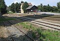
 Hofern-Bf-01.jpg 2,000 × 1,442; 1.36 MB
-
 Hofern-Bf-02.jpg 1,988 × 1,329; 1.28 MB
-
 Hoher Eichham vom Debantgrat.JPG 3,008 × 2,000; 2.45 MB
-
 Kleiner und Großer Muntanitz vom Debantgrad.JPG 1,147 × 546; 422 KB
-
 Košenjak - pogled na Golico - panoramio.jpg 2,592 × 1,944; 1.5 MB
-
 KurtEyesOpen.jpg 2,489 × 2,043; 1.87 MB
-
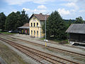
 Langau-Bf-01.jpg 2,000 × 1,550; 1.51 MB
-
 Langau-Bf-03.jpg 2,000 × 1,347; 1.13 MB
-
 Leibnitzer Rotspitzen f.JPG 3,008 × 2,000; 2.59 MB
-
 Leibnitzer Rotspitzen g.JPG 3,008 × 2,000; 3.23 MB
-
 Leibnitzer Rotspitzen h.JPG 2,883 × 1,830; 1.74 MB
-
 Leibnitzer Rotspitzen i.JPG 3,008 × 2,000; 2.8 MB
-
 Leibnitzer Rotspitzen j.JPG 2,922 × 1,854; 3.57 MB
-
 Leibnitzer Rotspitzen k.JPG 3,008 × 2,000; 3.07 MB
-
 Leibnitzer Rotspitzen l.JPG 3,008 × 2,000; 2.54 MB
-
 Luckenkogel vom Debantgrat a.JPG 3,008 × 2,000; 2.31 MB
-
 Luckenkogel vom Debantgrat b.JPG 3,008 × 2,000; 2.48 MB
-
 Malham-, Gubach- und Simonyspitzen vom Debantgrat.JPG 3,008 × 2,000; 2.47 MB
-
 Muntanitz vom Debantgrat a.JPG 3,008 × 2,000; 2.52 MB
-
 Muntanitz vom Debantgrat b (cropped).JPG 996 × 621; 427 KB
-
 Muntanitz vom Debantgrat b.JPG 3,008 × 2,000; 2.53 MB
-
 Muntanitz, Luckenkogel vom Debantgrat a.JPG 3,008 × 2,000; 2.37 MB
-
 Muntanitz, Luckenkogel vom Debantgrat b.JPG 3,008 × 2,000; 2.48 MB
-
 Muntanitz, Luckenkogel vom Debantgrat c.JPG 3,008 × 2,000; 2.32 MB
-
 Muntanitz, Luckenkogel vom Debantgrat e (cropped).JPG 1,048 × 697; 456 KB
-
 Muntanitz, Luckenkogel vom Debantgrat e.JPG 3,008 × 2,000; 2.32 MB
-
 Nieder Fladnitz-Bf-01.jpg 2,000 × 1,500; 1.32 MB
-
 Nieder Fladnitz-Bf-02.jpg 2,000 × 1,500; 1.38 MB
-
 Panorama Kühkranz und Kallbrunnalm.jpg 9,090 × 2,326; 2.62 MB
-
 Plattenkogel - Ansicht vom Salzachtal (Sommer).jpg 4,000 × 3,000; 4.69 MB
-
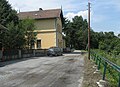
 Pleißing-Waschbach-Bf-01.jpg 2,000 × 1,500; 1.63 MB
-
 Pylaisia polyantha (a, 145050-474913) 8393.JPG 2,816 × 1,880; 933 KB
-
 Pylaisia polyantha (a, 145050-474913) 8397.JPG 2,816 × 1,880; 990 KB
-
 Restaurant Bräustüberl, Schärding, Upper Austria - 20100808.jpg 2,988 × 2,154; 3.35 MB
-
 Retz-Bf-01.jpg 2,000 × 1,487; 1.11 MB
-
 Retz-Bf-02.jpg 2,000 × 1,477; 1.21 MB
-
 Retz-Bf-03.jpg 2,000 × 1,500; 1.07 MB
-
 Roter Knopf, Glödis, Südliche Talleitenspitze, Gößnitzkopf vom Debantgrat.JPG 3,008 × 2,000; 2.37 MB
-
 Roter Knopf, Glödis, Talleitenspitze vom Debantgrat a.JPG 3,008 × 2,000; 2.5 MB
-
 Roter Knopf, Glödis, Talleitenspitze vom Debantgrat b.JPG 3,008 × 2,000; 2.27 MB
-
 Roter Knopf, Glödis, Talleitenspitze vom Debantgrat c.JPG 3,008 × 2,000; 2.33 MB
-
 Röt- und Daberspitze vom Debantgrat.JPG 3,008 × 2,000; 2.44 MB
-
 Rötspitze vom Debantgrat.JPG 3,008 × 2,000; 2.31 MB
-
 Rötspitze, Quirl und Malhamspitzen vom Debantgrat.JPG 3,008 × 2,000; 2.43 MB
-
 Rötspitze, Quirl, Malham-, Gubach- und Simonyspitzen vom Debantgrat.JPG 3,008 × 2,000; 2.15 MB
-
 Schwaz-8574.jpg 2,631 × 1,838; 4.33 MB
-
 Schwaz-8591.jpg 3,000 × 2,008; 3.41 MB
-
 Schwaz-8597.jpg 3,000 × 2,008; 2.67 MB
-
 Schwaz-8601.jpg 3,000 × 2,008; 3.44 MB
-
 Schwaz-8602.jpg 3,000 × 2,040; 4.25 MB
-
 Schwaz-Palais Tannenberg-Enzenberg-8576.jpg 2,500 × 1,674; 3.13 MB
-
 Schärding - Apothekenschild.JPG 3,072 × 2,304; 2.68 MB
-
 Schärding - Bierapotheke, altes Schild.JPG 3,072 × 2,304; 2.89 MB
-
 Schärding - Blick auf die Burganlage von der alten Innbrücke.JPG 3,072 × 2,304; 2.75 MB
-
 Schärding - Brauerei Baumgartner - 1.jpg 3,072 × 2,304; 2.71 MB
-
 Schärding - Bräuhaus (Schild).JPG 3,072 × 2,304; 2.76 MB
-
 Schärding - Bunte Häuser.JPG 2,304 × 3,072; 2.89 MB
-
 Schärding - Colossus of Rhodes.JPG 2,304 × 3,072; 2.73 MB
-
 Schärding - Eduscho Ladengeschäft.jpg 3,072 × 2,304; 2.67 MB
-
 Schärding - Ehem. Wachturm mit Durchfahrt.jpg 3,072 × 2,304; 2.72 MB
-
 Schärding - Hofstall, Schild.JPG 3,072 × 2,304; 2.78 MB
-
 Schärding - Kirchenturmuhr St.Georg16-31.JPG 2,304 × 3,072; 2.16 MB
-
 Schärding - Orangerie, Gebäude (westlich).JPG 3,072 × 2,304; 2.8 MB
-
 Schärding - Orangerie, Hauptgebäude.JPG 2,304 × 3,072; 2.64 MB
-
 Schärding - Rathaus.JPG 2,304 × 3,072; 2.53 MB
-
 Schärding - Silberzeile.jpg 3,072 × 2,304; 2.81 MB
-
 Schärding - Touristeninformation.JPG 3,072 × 2,304; 2.25 MB
-
 Schärding - Trafik-Schild.jpg 3,072 × 2,304; 2.59 MB
-
 Schärding - Unterer Stadtplatz mit St.-Georgs-Brunnen.JPG 3,072 × 2,304; 2.55 MB
-
 Schärding - Wassertor innen.JPG 2,304 × 3,072; 2.55 MB
-
 Schärding - Wegweiserschilder Bahnhofstr.JPG 2,304 × 3,072; 2.65 MB
-
 Schärding - Zeichen an einem Haus (1574 und Initialen).JPG 3,072 × 2,304; 2.94 MB
-
 Schärding - Zwinger (Schild).JPG 2,557 × 1,998; 1.6 MB
-
 Schärding - Zwinger.JPG 2,304 × 3,072; 2.75 MB
-
 Simonyspitzen vom Debantgrat.JPG 3,008 × 2,000; 2.41 MB
-
 Törlkopf, Leibnitzkopf, Mirnitzspitzen, Alkuser Rotspitze a.JPG 3,008 × 2,000; 2.29 MB
-
 Törlkopf, Leibnitzkopf, Mirnitzspitzen, Alkuser Rotspitze b.JPG 3,008 × 2,000; 2.29 MB
-
 Törlkopf, Leibnitzkopf, Mirnitzspitzen, Alkuser Rotspitze c.JPG 3,008 × 2,000; 2.74 MB
-
 UNESCO, AUSTRIA-SALZBURG - panoramio (1).jpg 1,600 × 1,200; 418 KB
-
 UNESCO, AUSTRIA-SALZBURG - panoramio.jpg 1,600 × 1,200; 1.12 MB
-
 Unter Retzbach-Bf-01.jpg 2,000 × 1,353; 1.21 MB
-

-
 Weitersfeld NÖ-Bf-01.jpg 2,000 × 1,500; 1.51 MB
-
 Weitersfeld NÖ-Bf-02.jpg 2,000 × 1,500; 1.31 MB
-
 Weitersfeld NÖ-Bf-03.jpg 2,000 × 1,500; 1.31 MB
-
 Weißspitze vom Debantgrat.JPG 3,008 × 2,000; 2.4 MB
-
 Wellachköpfe, Kleiner Muntanitz vom Debantgrat.JPG 3,008 × 2,000; 2.61 MB
-
 Zissersdorf-Bf-03.jpg 2,000 × 1,500; 1.41 MB
-
 Zissersdorf-Bf-06.jpg 2,000 × 1,178; 802 KB
.jpg)


.jpg)
_2.jpg)


.jpg)


_8390.JPG)
_8392.JPG)


.JPG)


.JPG)


.jpg)

_8393.JPG)
_8397.JPG)


.JPG)


.JPG)


.JPG)
.JPG)


.jpg)


